Category:1780s maps of France
Appearance
Subcategories
This category has the following 11 subcategories, out of 11 total.
- 1787 maps of France (6 F)
'
Media in category "1780s maps of France"
The following 30 files are in this category, out of 30 total.
-
054 Carte de Penmarc'h vers 1780.JPG 2,199 × 2,709; 4.2 MB
-
Carte Mineralogique de France (BM 1914,0520.673).jpg 2,500 × 1,962; 1,016 KB
-
The engagement off Belle-Isle Novr 20, 1759 (BM 1871,1209.96).jpg 2,500 × 1,996; 1,015 KB
-
The Road of Toulon with the adjacent Country (BM 1871,1209.134).jpg 2,500 × 2,011; 1.1 MB
-
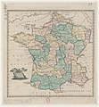
Present France - btv1b53076035x.jpg 4,933 × 5,348; 3.41 MB
-
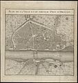
1783-Plan de la ville et du nouveau pont d'Orléans.JPG 282 × 300; 20 KB
-
A chart of the Coast of France from l'Orient to St Gilles (BM 1871,1209.91).jpg 2,500 × 2,029; 1.11 MB
-
A map of France from the best Authorities (BM 1871,1209.100).jpg 2,500 × 1,993; 1.2 MB
-
Carte de France de Mathias Robert de Hesseln de 1780 (haute résolution).jpg 6,642 × 6,618; 44.22 MB
-
Carte de France de Mathias Robert de Hesseln de 1780.jpg 546 × 546; 93 KB
-
Carte des gabelles, 1788.jpg 4,297 × 5,673; 4.55 MB
-
Détail Paris et région de la carte de France de Mathias Robert de Hesseln de 1780.jpg 1,052 × 1,040; 391 KB
-
Fontenoy Battle (BM 1871,1209.113).jpg 2,130 × 1,680; 786 KB
-
Goulien carte.jpg 619 × 528; 156 KB
-
Guissény carte 1780.jpg 988 × 722; 507 KB
-
Lombards Library 009.jpg 1,829 × 2,447; 1.05 MB
-
Machine de Marly- carte de la Seine.jpg 3,638 × 3,130; 1.12 MB
-
SieurMichel-01.png 904 × 610; 591 KB
-
SieurMichel-02.png 905 × 648; 1,023 KB
-
SieurMichel-05.png 927 × 636; 1.19 MB
-
SieurMichel-06.png 927 × 636; 1.05 MB
-
SieurMichel-20.png 1,000 × 1,413; 2.31 MB
-
SieurMichel-21.png 926 × 641; 971 KB
-
William Faden. Composite Mediterranean. 1785.L.jpg 1,470 × 914; 539 KB


