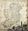
Category:1780s maps of Ireland
Jump to navigation
Jump to search
Media in category "1780s maps of Ireland"
The following 8 files are in this category, out of 8 total.
-
Wilson's Map of Irish roads 1786.jpg 2,419 × 2,668; 3 MB
-
Cork Harbour RMG K0967.jpg 1,280 × 730; 614 KB
-
Ireland Leinster Hogg 1784 700x1030.jpg 700 × 1,030; 177 KB
-
Ireland, divided into its four provinces; subdivided into counties (NYPL b13919861-5207402).jpg 6,679 × 8,024; 43.08 MB


