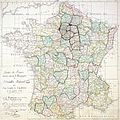
Category:1789 maps of France
Jump to navigation
Jump to search
Media in category "1789 maps of France"
The following 10 files are in this category, out of 10 total.
-
775 of 'Histoire de l'unité politique et territoriale de la France' (11129881164).jpg 1,336 × 1,890; 613 KB
-
Carte de France 1789 Bretagne.jpg 300 × 299; 88 KB
-
CarteComiteConstitution1789.jpg 1,399 × 1,400; 919 KB
-
France location map-Provinces 1789.svg 2,000 × 1,922; 557 KB
-
Map of Versailles in 1789 by William R Shepherd (died 1934).jpg 1,572 × 1,154; 864 KB
-
Plan Lyon 1789.jpg 7,164 × 8,192; 26.15 MB


