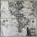
Category:1770s maps of the Americas
Jump to navigation
Jump to search
Subcategories
This category has the following 3 subcategories, out of 3 total.
Media in category "1770s maps of the Americas"
The following 24 files are in this category, out of 24 total.
-
Mapa de America sujeto à las observaciones astronomicas - por D. Tomàs Lopez... - btv1b8469136g.jpg 10,836 × 8,508; 12.64 MB
-
CartedAmerique.jpeg 514 × 404; 59 KB
-
A map of North and Central America Wellcome V0049921.jpg 3,307 × 2,110; 2.87 MB
-
A new general map of America (4071868775).jpg 2,000 × 1,633; 3.33 MB
-
Amérique ou Indes occidentales - par le Sr Robert de Vaugondy... - btv1b8469418k.jpg 8,544 × 8,136; 10.92 MB
-
Amérique, sans titre, avec car touche aux armes de Sartine - btv1b8469817j.jpg 10,188 × 8,316; 10.12 MB
-
Carte dAmerique divisées en ses principales parties (4072632530).jpg 2,000 × 1,634; 3.42 MB
-
Chodowiecki Basedow Tafel 43.jpg 1,734 × 2,047; 330 KB
-
L'Amérique divisée en ses principaux états (1775).jpg 12,460 × 9,033; 18.73 MB
-
MapaAméricaJonghe.JPG 1,800 × 1,809; 1.55 MB
-
Robert - Amérique ou Indes Occidentales.jpg 1,941 × 1,539; 1,002 KB


