Category:1740s maps of the Americas
Jump to navigation
Jump to search
Subcategories
This category has the following 3 subcategories, out of 3 total.
Media in category "1740s maps of the Americas"
The following 34 files are in this category, out of 34 total.
-
 America cum Supplementis Poly-Glottis by Gottfried Hensel.jpg 5,078 × 4,061; 4.06 MB
-

-

-
 1741 linguistic maps of Europe, Asia, Africa and the Americas by Gottfried Hensel.jpg 3,397 × 2,806; 12.35 MB
-

-
 1741 maps of Europe, Asia, Africa and America showing the distribution of languages.jpg 3,910 × 3,507; 2.16 MB
-
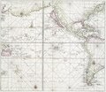 Pacific Ocean showing part of North and South America.) NYPL478199.tiff 4,108 × 3,563; 41.88 MB
-

-
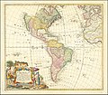
 1746 Homann Heirs Map of South ^ North America - Geographicus - Americae-hmhr-1746.jpg 4,000 × 3,494; 3.91 MB
-
 Emanual Bowen, "A complete system of geography" Wellcome L0017516.jpg 1,528 × 1,252; 697 KB
-

-

-

-
 America Map 1745 (rus).jpg 2,247 × 1,845; 2.64 MB
-

-
 Americae Mappa generalis, Homann Heirs & Johann Matthaus Haas (1746).jpg 6,386 × 5,528; 18.83 MB
-
 Americae Mappa generalis, Homann Heirs, Johann Matthaus Haas (1746).jpg 1,600 × 1,394; 2.65 MB
-

-

-

-

-
 Carte d'Amérique - dressée... par N. Bellin... - btv1b8468997m.jpg 10,258 × 8,184; 11.65 MB
-
 Carte d'Amérique dressée pour l'usage du Roy - par Guillaume Delisle... - btv1b8469815q.jpg 10,090 × 8,100; 12.81 MB
-
 Cartes et plans de l'Amerique. LOC 2003623376-22.jpg 10,324 × 6,853; 8.61 MB
-
 Cartes et plans de l'Amerique. LOC 2003623376-22.tif 10,324 × 6,853; 202.42 MB
-

-
 Gottfried Hensel's linguistic map of the world, 1741.jpg 1,600 × 1,322; 894 KB
-
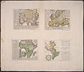
 Hensel 1741 4maps.jpg 1,744 × 1,400; 2.41 MB
-
 Hensel Polyglot, Maps of the Continents 1741 Cornell CUL PJM 1022 01.jpg 6,333 × 5,440; 4.29 MB
-

-

-
 Nieuwe kaart van America uitgegeven te Amsterdam (4071869817).jpg 2,000 × 1,588; 2.99 MB
-
 Polyglot Maps of Asia, Europe, Africa and the Americas by Gottfried Hensel.jpg 6,333 × 5,440; 5.86 MB
-
 Terra polyglotta.jpg 7,952 × 7,210; 9.91 MB

.jpg)


.jpg)


_-_Geographicus_-_America-bowen-1747.jpg)


.jpg)
.jpg)
.jpg)
.jpg)


.jpg)

