Category:1730s maps of the Americas
Jump to navigation
Jump to search
Subcategories
This category has the following 2 subcategories, out of 2 total.
N
S
Media in category "1730s maps of the Americas"
The following 13 files are in this category, out of 13 total.
-
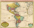
1739 America Covens & Mortier.jpg 2,250 × 1,885; 4.39 MB
-
America (13783482204).jpg 1,526 × 2,000; 1.61 MB
-
America (4072637822).jpg 1,369 × 2,000; 2.77 MB
-
America - by H. Moll, geographer. NYPL464991.tiff 4,248 × 4,819; 58.57 MB
-
America cum Supplementis Poly-Glottis.jpg 2,947 × 2,441; 1.92 MB
-
Carte d'Amérique dressée pour l'usage du Roy - par Guillaume Delisle... - btv1b84685658.jpg 10,450 × 8,784; 13.4 MB
-
Carte dAmerique (4072635240).jpg 2,000 × 1,653; 3.64 MB
-
Remarks in support of the new chart of North and South America (microform) - in six sheets (IA cihm 16764).pdf 1,166 × 1,383, 124 pages; 10.28 MB
-
Kungsboken-karta-amerika.jpg 3,232 × 2,230; 817 KB
-
LAmérique (4072636864).jpg 2,000 × 1,502; 3.39 MB
-
The colonies of the Europeans in America (12325995375).jpg 1,180 × 2,000; 851 KB


