Category:1729 maps
Jump to navigation
Jump to search
| ← · 1720 · 1721 · 1722 · 1723 · 1724 · 1725 · 1726 · 1727 · 1728 · 1729 · → |
Deutsch: Karten mit Bezug zum Jahr 1729
English: Maps related to the year 1729
Español: Mapas relativos al año 1729
Français : Cartes concernant l’an 1729
Русский: Карты 1729 года
Subcategories
This category has the following 8 subcategories, out of 8 total.
Media in category "1729 maps"
The following 79 files are in this category, out of 79 total.
-
 A map of Palestine (FL36012293 3898185).jpg 8,163 × 5,990; 57.72 MB
-
 A map of the East Indies.png 3,436 × 1,884; 11.58 MB
-

-

-
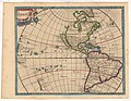 America (FL13728025 2510740).jpg 4,831 × 3,742; 26.98 MB
-

-
 Capt. Dampiers new voyage to New Holland etc in 1699 etc.png 3,384 × 2,021; 12.44 MB
-
 Carel Allard, Ierusalem (FL4542251 3512354).jpg 4,443 × 3,462; 23.26 MB
-

-
 Carta 10ª da costa do Brasil.jpg 800 × 477; 314 KB
-
 Carta 6ª da costa do Brasil.jpg 800 × 469; 278 KB
-
 Carta 9ª da costa do Brasil.jpg 800 × 470; 255 KB
-
 Carte de la forêt de Fontainebleau (H. Matis, 1729).jpg 13,711 × 15,885; 47.68 MB
-

-

-

-

-

-

-
 Henri Liébaux. Carte de la Albanie 1729.jpg 855 × 1,138; 231 KB
-
 Ignaz Schwartz, Peregrinatio filiorum Israel (FL45611915 3950757).jpg 2,103 × 1,935; 1.79 MB
-
 Ignaz Schwartz, Prima orbis division, et populorum origo (FL45611849 3950727).jpg 2,115 × 1,981; 1.95 MB
-
 Ignaz Schwartz, Situs Paradisi Terrestris (FL45611868 3950725).jpg 2,186 × 1,947; 1.78 MB
-

-

-
 Imperii Sinarum Nova Descriptio (FL25570040 2467955).jpg 7,221 × 5,626; 53.41 MB
-
 Jacques Bonfrère, Tabula geographica Terrae Sanctae (FL200878667 2368382).jpg 16,545 × 6,229; 151.53 MB
-
 Kiang-Si - par Jean-Baptiste d'Anville - btv1b53009256t.jpg 3,390 × 4,148; 2.6 MB
-
 Land-Charte ueber die Reysen der H.Apostel sonderlich des H.Pauli (FL200037472 2369211).jpg 7,800 × 5,256; 59.9 MB
-
 Landtaffel der 12 Israelytischen Stamme nach der Eintheilung Ezechiels (FL13733974 3532286).jpg 4,195 × 6,612; 42.07 MB
-
-
 Philipp Clüver, Siciliae Antiquae Descriptio (FL37476910 2589920).jpg 7,735 × 6,664; 76.81 MB
-

-

-
 Pieter de Coup, Achaia quae et Hellas hodie Livadia (FL35071038 2529644).jpg 7,408 × 5,669; 59.06 MB
-
 Pieter de Coup, Asia antiqua et nova (FL27958391 2480864).jpg 6,918 × 5,439; 50.41 MB
-
 Pieter de Coup, Epirus hodie Canina (FL35071076 2529651).jpg 7,286 × 5,665; 47.05 MB
-
 Pieter de Coup, Gallia Antiqua et Nova (FL33133751 2584893).jpg 8,118 × 6,861; 74.15 MB
-
 Pieter de Coup, Hellas Seu Graecia Universa (FL35071025 2529647).jpg 7,269 × 5,841; 45.09 MB
-
 Pieter de Coup, Hispaniae Veteris et Novae Descriptio (FL37099206 2588139).jpg 7,830 × 6,729; 81.08 MB
-
 Pieter de Coup, Italiae Gallicae sive Galliae Cisalpinae (FL83240451 2589075).jpg 7,095 × 5,670; 47.52 MB
-
 Pieter de Coup, Macedoniae et Thessaliae Regiones (FL35071026 2529643).jpg 7,145 × 5,569; 48.15 MB
-
 Pieter de Coup, Peloponnesus nunc Morea (FL35071073 2529649).jpg 7,300 × 5,633; 58.29 MB
-

-
 Pieter de Coup, Sarmatia et Scythia, Russia et Tartaria Europaea (FL155328959 2608415).jpg 7,038 × 6,059; 56.26 MB
-
 Pieter de Coup, Scythia et Tartaria Asiatica (FL36380691 2622405).jpg 7,081 × 5,448; 55.53 MB
-
 Pieter van der Aa, Archipel Septentrional ou Mer Egée (FL35069326 2528179).jpg 9,913 × 8,360; 115.65 MB
-
 Pieter van der Aa, Canaan (FL199397986 2368244).jpg 3,656 × 5,344; 30.32 MB
-
 Pieter van der Aa, Corfou ou Corcyre Ile de la Mer Ionienne (FL35069307 2528404).jpg 10,149 × 8,655; 104.09 MB
-

-

-

-

-
 Pieter van der Aa, Dijon capitale du Duché de Bourgogne (FL147409516 2630902).jpg 7,649 × 2,470; 21.31 MB
-
-
 Pieter van der Aa, Greece (FL35069289 2528380).jpg 10,421 × 8,591; 87.92 MB
-
 Pieter van der Aa, Ierusalem (FL6878984 2366852).jpg 5,300 × 1,158; 3.43 MB
-
 Pieter van der Aa, L'Archipel Meridional ou les Iles Cyclades (FL35069339 2528181).jpg 10,177 × 8,376; 120.56 MB
-
 Pieter van der Aa, Les Isles Britanniques (FL35475094 2582151).jpg 9,933 × 8,437; 110.74 MB
-
 Pieter van der Aa, Nouvelle carte de d'Andalousie Grenade (FL37476717 2589041).jpg 10,674 × 8,650; 142.93 MB
-

-
 Pieter van der Aa, Rouen, capitale de Normandie (FL147394700 2631142).jpg 7,841 × 2,880; 28.62 MB
-
 Pieter van der Aa, Saumur, dans l'Anjou (FL147394708 2630913).jpg 7,987 × 2,920; 25.46 MB
-
 Pieter van der Aa, Terre Sainte (FL200878554 2366851).jpg 6,808 × 5,489; 58.62 MB
-
 Pieter van der Aa, Tours, Capitale de la Touraine (FL147394630 2630912).jpg 7,927 × 2,932; 26.09 MB
-
 Province de Kiang-nan - (par Jean-Baptiste d'Anville) - btv1b53009098m.jpg 4,192 × 4,388; 3.39 MB
-
 Pé-tchi-li - par Jean-Baptiste d'Anville - btv1b530089994.jpg 3,570 × 4,579; 2.83 MB
-
 Royaume de Corée - (d'Anville) - btv1b59631188.jpg 2,072 × 3,104; 1,011 KB
-
 Scythia et Tartaria Asiatica.png 2,974 × 2,433; 13.18 MB
-
 Syriæ sive Soriæ descriptio (FL13729636 2516125).jpg 4,835 × 3,729; 25.06 MB
-
 The Gallapagos Islands - (Hermann Moll) - btv1b8596522z.jpg 1,560 × 844; 248 KB
-
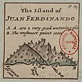 The Island of Juan Ferdinando - (Hermann Moll) - btv1b8596521j.jpg 775 × 784; 120 KB
-
 The Scots settlement in America called New Caledonia, A.D. 1699 (4579404788).jpg 3,744 × 5,244; 9.61 MB
-
 UBBasel Map 1729 Kartenslg Schw Cl 10.tif 10,778 × 8,981, 2 pages; 276.97 MB
-
 UBBasel Map 1729 Kartenslg Schw Cl 11.tif 10,119 × 9,076, 2 pages; 262.78 MB
-
 UBBasel Map 1729 Kartenslg Schw Cl 9.tif 8,810 × 10,421, 2 pages; 262.7 MB
-
 UBBasel Map 1729 VB A2-2-18.tif 6,630 × 7,244, 2 pages; 137.43 MB
-
 Weissenau Plan 1729.jpg 2,216 × 4,457; 7.15 MB
-
 Ægyptus et Cyrene (FL25570323 2512343).jpg 6,017 × 5,228; 38.99 MB
.jpg)


.jpg)


.jpg)
.jpg)


.jpg)

.jpg)
.jpg)
.jpg)
.jpg)

.jpg)
.jpg)
.jpg)
.jpg)
.jpg)

.jpg)
.jpg)
.jpg)
.jpg)


.jpg)
.jpg)
.jpg)
.jpg)
.jpg)
.jpg)
.jpg)
.jpg)
.jpg)
.jpg)
.jpg)
.jpg)
.jpg)
.jpg)
.jpg)
.jpg)
.jpg)
.jpg)
.jpg)
.jpg)
.jpg)
.jpg)
.jpg)
.jpg)
.jpg)
.jpg)
_-_btv1b53009098m.jpg)

_-_btv1b59631188.jpg)

.jpg)
_-_btv1b8596522z.jpg)
_-_btv1b8596521j.jpg)
.jpg)

.jpg)
.jpg)
.jpg)
.jpg)
.jpg)
.jpg)
.jpg)
.jpg)