Category:1728 maps
Jump to navigation
Jump to search
| ← · 1720 · 1721 · 1722 · 1723 · 1724 · 1725 · 1726 · 1727 · 1728 · 1729 · → |
Deutsch: Karten mit Bezug zum Jahr 1728
English: Maps related to the year 1728
Español: Mapas relativos al año 1728
Français : Cartes concernant l’an 1728
Русский: Карты 1728 года
Subcategories
This category has the following 5 subcategories, out of 5 total.
Media in category "1728 maps"
The following 48 files are in this category, out of 48 total.
-
1728 Homann Map of Bavaria, Germany - Geographicus - Bavariae-homann-1728.jpg 4,301 × 5,000; 8.6 MB
-
(King1893NYC) pg015 BRADFORD'S PLAN OF THE CITY OF NEW YORK, 1728.jpg 1,630 × 1,283; 1.45 MB
-
Bifeche.jpg 1,524 × 1,024; 375 KB
-
Cap Français - Gravure ancienne - 1728.jpg 1,299 × 1,015; 1.34 MB
-
D'Reyse des Apostels Pauli na roomen etc (FL37116826 3895149).jpg 13,205 × 10,114; 184.04 MB
-
De werelt caart.png 6,235 × 4,414; 35.12 MB
-
Engelbert Kaempfer, Imperium Iaponicum In Sexaginta Et Octo Provincias Divisum (FL37098963 2469349).jpg 14,494 × 11,766; 230.49 MB
-
Engelbert Kaempfer, Mappa Iteneris ab Urbe Simonoseki Osaccam (FL37098956 2469879).jpg 8,174 × 9,873; 114.97 MB
-
Homann - Marocca - 1726.jpg 640 × 558; 121 KB
-
Hotel-de-Blossac---1728.svg 311 × 320; 235 KB
-
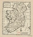
Ireland Divided into Its Provinces and Counties &c (btv1b53056672w).jpg 3,458 × 3,820; 1.95 MB
-
Jacques François Bénard, Carta de la Terre Promise (FL200878573 2368353).jpg 6,778 × 3,938; 15.6 MB
-
John Gaspar Scheuchzer, Ichonographia Urbis Jedo (FL37476871 2401304).jpg 12,535 × 9,935; 169.17 MB
-
Map of Copenhagen by J.F. Arnoldt, January 1728.jpg 5,000 × 4,020; 1.67 MB
-
Map of the Indian Ocean and the China Sea was engraved in 1728 by Ibrahim Müteferrika.jpg 2,552 × 1,914; 5.24 MB
-
Pieter van der Aa Asia 1728.jpg 575 × 438; 110 KB
-
Plan de Sedan 1728 349.JPG 2,831 × 1,905; 878 KB
-
The Counties of Antrim, Ardmagh and Down - By H. Moll Geographer - btv1b530565786.jpg 2,816 × 3,520; 1.6 MB
-
The Counties of Clare and Limerick - By H. Moll Geographer - btv1b53056962m.jpg 3,624 × 2,704; 1.55 MB
-
The Counties of Dublin and Louth - By H. Moll Geographer - btv1b53056651m.jpg 2,696 × 3,536; 1.51 MB
-
The Counties of Gallway - By H. Moll Geographer - btv1b53056434c.jpg 3,480 × 2,768; 1.68 MB
-
The Counties of Sligoe and Mayo - By H. Moll Geographer - btv1b530561688.jpg 3,424 × 2,768; 1.65 MB
-
The County of Rosscommon - By H. Moll Geographer - btv1b53056423h.jpg 2,728 × 3,424; 1.33 MB


