Category:1721 maps
Jump to navigation
Jump to search
| ← · 1720 · 1721 · 1722 · 1723 · 1724 · 1725 · 1726 · 1727 · 1728 · 1729 · → |
Deutsch: Karten mit Bezug zum Jahr 1721
English: Maps related to the year 1721
Español: Mapas relativos al año 1721
Français : Cartes concernant l’an 1721
Русский: Карты 1721 года
Subcategories
This category has the following 8 subcategories, out of 8 total.
Media in category "1721 maps"
The following 32 files are in this category, out of 32 total.
-
1721 Chatelain Plan or Map of Rome, Italy - Geographicus - Rome-chatelain-1720.jpg 3,500 × 2,687; 3.37 MB
-
1721 John Senex Map of Rome - Geographicus - Rome-sennex-1721.jpg 3,500 × 2,999; 3.77 MB
-
A new map of America from the latest observations (4072635516).jpg 2,000 × 1,707; 3.76 MB
-
A new map of the World from the latest observations.png 6,435 × 5,048; 60.1 MB
-
America Osidental RMG K1011.jpg 1,280 × 860; 944 KB
-
Bernard Renau D'Elicagaray, Plan de la ville et baye de Gibraltar (FL13722350 2471425).jpg 12,048 × 9,050; 148.32 MB
-
Donaustrudel 1721.jpg 650 × 450; 135 KB
-
Erlangen Hohmann Schloss und Schlossgarten Plan 1721 001.jpg 1,000 × 844; 293 KB
-
Erlangen Hohmann Stadtplan 1721 001.jpg 1,000 × 847; 349 KB
-
Hausstein 1721.jpg 650 × 450; 132 KB
-
Hotel-de-Blossac---1721.svg 311 × 320; 235 KB
-
Karlsruhe 1721.jpg 1,600 × 1,252; 526 KB
-
Lake Borgne de la Tour map 1720.jpg 1,158 × 966; 398 KB
-
Les Indes Orientales.jpg 6,644 × 8,980; 20.76 MB
-
Map of Turkey, Persia, Mecran (Balochistan).jpg 1,756 × 1,480; 899 KB
-
North Asia (1721).png 1,438 × 646; 1.79 MB
-
Persarum imperium. LOC 2003627036.jpg 6,887 × 4,967; 6.74 MB
-
Plan du fort projetteʾ au nouveau Bilocxy. LOC 2001628147.jpg 7,271 × 5,333; 5.14 MB
-
Plan du fort projetteʾ au nouveau Bilocxy. LOC 2001628147.tif 7,271 × 5,333; 110.94 MB
-
PLAN EIN STICK VON DER DANAW.jpg 2,880 × 1,043; 440 KB
-
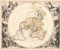
Planisphere terrestre, suivant les nouvelles observations des astronomes LOC 2017585819.jpg 8,212 × 6,801; 8.95 MB
-
Planisphere terrestre, suivant les nouvelles observations des astronomes LOC 2017585819.tif 8,212 × 6,801; 159.79 MB
-
Romeyn de Hooghe, Biblical map (FL51331400 2369881).jpg 12,288 × 9,369; 157.76 MB
-
中山传信录往琉球2.jpg 929 × 844; 436 KB
-
中山传信录往琉球A.jpg 911 × 845; 464 KB


