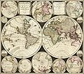
Category:1690s maps of the world
Jump to navigation
Jump to search
| 17th-century maps of the world: ← 1600s 1610s 1620s 1630s 1640s 1650s 1660s 1670s 1680s 1690s → |
English: This category is supposed to hold world maps created in the 1690s.
Subcategories
This category has only the following subcategory.
Media in category "1690s maps of the world"
The following 23 files are in this category, out of 23 total.
-
Ca. 1690 world map - Orbis Terrarum Nova et Accurata Tabula.jpg 7,225 × 6,225; 40.55 MB
-
New and Accurate Map of the World WDL179.png 1,212 × 1,024; 2.79 MB
-
Nova orbis tabula, ad usum serenissimi Burgundiae Ducis LOC 2006627251.jpg 7,774 × 6,252; 9.48 MB
-
Nova orbis tabula, ad usum serenissimi Burgundiae Ducis LOC 2006627251.tif 7,774 × 6,252; 139.05 MB
-
1672 95 Novus Planiglobii Valck'.jpg 8,500 × 6,487; 17.74 MB
-
1695 Armenian map of the world.jpg 14,002 × 11,207; 31.5 MB
-
Askharhatsuits.jpg 1,420 × 1,139; 932 KB
-
Matenadaran (021).jpg 7,152 × 5,368; 5.01 MB
-
1696 map of the world by Carolus Allard.jpg 14,267 × 12,499; 44.11 MB
-
1696 Zahn Map of the World in Two Hemispheres - Geographicus - World-zahn-1696.jpg 6,000 × 2,433; 4.98 MB
-
Hamadaradz Asharhatsuyts = Extensive world map (8540503506).jpg 800 × 569; 123 KB
-
Cowley's Circumnavigation 1699.jpg 6,387 × 3,699; 5.24 MB
-
Le Globe Terrestre Represente En Deux Plans-Hemispheres et en Diverses Autres Figures.jpg 15,314 × 11,841; 37.97 MB
-
Map of the heavens and the earth (NYPL b15511388-478196).jpg 6,192 × 4,367; 8.97 MB
-
Map of the heavens and the earth (NYPL b15511388-478196).tiff 10,328 × 7,760, 2 pages; 229.57 MB
-
Orbis terrarum nova et accuratissima tabula LOC 2006627252.jpg 6,897 × 5,824; 7.78 MB
-
Orbis terrarum nova et accuratissima tabula LOC 2006627252.tif 6,897 × 5,824; 114.92 MB
-
Planisphaerium terrestre sive terrarum orbis RMG F0431.tiff 6,571 × 5,561; 104.55 MB
-
System of global gores.jpg 1,284 × 903; 214 KB


