Category:1700s maps of the world
Jump to navigation
Jump to search
| 18th-century maps of the world: ← 1700s 1710s 1720s 1730s 1740s 1750s 1760s 1770s 1780s 1790s → |
English: This category is supposed to hold world maps created in the 1700s.
Subcategories
This category has the following 4 subcategories, out of 4 total.
Media in category "1700s maps of the world"
The following 70 files are in this category, out of 70 total.
-
Delisle Mappe-Monde 1700 UTA.jpg 3,450 × 2,259; 1.47 MB
-
1700 map of the world by Paolo Petrini.jpg 12,878 × 10,246; 37.96 MB
-
1700 Orbis Terrarum Visscher mr.jpg 2,250 × 1,918; 4.58 MB
-
Map of the world (NYPL b15373374-1505120).jpg 4,592 × 6,299; 6.27 MB
-
Nova delineatio totius orbis terrarum LOC 2017585646.jpg 4,341 × 3,322; 3.53 MB
-
Nova delineatio totius orbis terrarum LOC 2017585646.tif 4,341 × 3,322; 41.26 MB
-
Cumnecdum Stella Haec extorts suiset Olympo.jpg 5,111 × 6,238; 6.86 MB
-
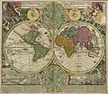
Double hemispherical map of the world (1705).jpg 5,590 × 4,225; 4.52 MB
-
Proietio Optica Hemisphaerii Polaris Arctici.jpg 4,601 × 5,899; 5.04 MB
-
Delisle - Mappe-Monde.png 1,978 × 1,300; 4.43 MB
-
Homann - Planiglobii Terrestris Cumutroq Hemisphaerio Caelesti.png 1,620 × 1,400; 4.8 MB
-
Peter karta1707.jpg 1,920 × 1,600; 1.15 MB
-
Haemisphaerium orbis antiqui cumzonis circulis et situ populorum diuerso - CBT 5870039.jpg 5,704 × 4,749; 7.87 MB
-
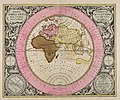
Orbis Terrarum, Cellarius, 1708.jpg 3,134 × 2,400; 2.04 MB
-
Orbis terrarum cognitus veteribus Graecis et Latinis. NYPL464974.tiff 2,943 × 1,858; 15.65 MB
-
A New and correct map of the world, laid down according to the latest discoveries.jpg 5,000 × 3,098; 18.31 MB
-
A new and correct Mapp of the WORLD NYPL1640712.tiff 7,230 × 5,428; 112.28 MB
-
A new map of the world according to Wrights alias Mercators projection &c. (8253082228).jpg 2,000 × 1,226; 2.14 MB
-
A new map of the world, 1703.jpg 5,946 × 3,719; 3.47 MB
-
A new map of ye world - by Robt. Morden. NYPL1261075.tiff 2,525 × 1,539; 11.12 MB
-
A new mapp of the world. NYPL1640711.tiff 5,904 × 4,770; 80.61 MB
-
Antique World Map of Continents and Oceans 1700.png 1,600 × 1,173; 4.3 MB
-
Bankoku Chikyu Saiken Zenzu 1700.jpg 24,193 × 12,681; 168.93 MB
-
Carta Hydrographica oder Algemeine Welt- und Commercien-Carte 1704.jpg 8,245 × 4,867; 17.35 MB
-
Carte Generale du Monde, ou Description du Monde Terrestre & Aquatique.jpg 12,257 × 10,532; 25.52 MB
-
Cartes marines a l'usage des armese du Roy.jpg 1,700 × 745; 372 KB
-
Diversa orbis Terrae visu incedente per coluros Tropicorum ambos ejus polos... - CBT 5870902.jpg 5,496 × 4,760; 10.04 MB
-
Drake 1706.jpg 1,650 × 1,130; 414 KB
-
EAMC 132 - a new and correct map of the world.png 1,423 × 826; 2.6 MB
-
Haemisphaeriorum tabula carthesiana (Nla.obj-232350895).tif 7,286 × 6,192; 129.08 MB
-
Haemisphaeriorum tabula Carthesiana - CBT 5870962.jpg 5,554 × 4,611; 9.34 MB
-
Jean-Baptiste Nolin - Le Globe Terreste.jpg 2,586 × 1,990; 2.91 MB
-
Large-scale-old-map-of-the-world-1702.jpg 7,800 × 5,315; 15.88 MB
-
Map - Special Collections University of Amsterdam - OTM- HB-KZL 31-02-41.tif 7,343 × 6,247; 131.24 MB
-
Map-pacific-cavendish.jpg 2,824 × 1,895; 1.38 MB
-
Mappe-monde 1702.jpg 2,000 × 1,388; 895 KB
-
Mappe-Monde ou Carte Universelle, 1702.jpg 2,487 × 1,680; 2 MB
-
Navigationes Praecipuae Europaeorum ad Exteras Nationes.jpg 2,500 × 1,636; 1.22 MB
-
A new mapp of the world (NYPL b13909432-1640711).jpg 5,964 × 4,823; 9.33 MB
-
A new mapp of the world (NYPL b13909432-1640711).tiff 7,230 × 5,428; 112.28 MB
-
A new and correct Mapp of the WORLD (NYPL b13909432-1640712).jpg 6,939 × 4,236; 8.53 MB
-
Companies Land.jpeg 770 × 873; 732 KB
-
A new map of ye world (NYPL b15366051-1261075).jpg 2,485 × 1,501; 1.08 MB
-
Orbis terrarum cognitus hodiernis Europaeis. NYPL464975.tiff 2,721 × 1,462; 11.39 MB
-
Zee-atlas LOC 2011586011-1.jpg 9,282 × 8,151; 11.66 MB
-
Zee-atlas LOC 2011586011-1.tif 9,282 × 8,151; 216.46 MB


