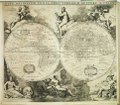
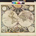
Category:1660s maps of the world
Jump to navigation
Jump to search
| 17th-century maps of the world: ← 1600s 1610s 1620s 1630s 1640s 1650s 1660s 1670s 1680s 1690s → |
English: This category is supposed to hold world maps created in the 1660s.
Subcategories
This category has only the following subcategory.
Media in category "1660s maps of the world"
The following 39 files are in this category, out of 39 total.
-
(Nova et accuratissima totius terrarum orbis tabula). LOC 98687202.jpg 6,782 × 5,130; 8.36 MB
-
(Nova et accuratissima totius terrarum orbis tabula). LOC 98687202.tif 6,782 × 5,130; 99.54 MB
-
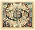
1660 celestial map - Scenographia Systematis Mundani Ptolemaici.jpg 13,701 × 11,756; 36.7 MB
-
1660 geocentric model chart - Scenographia Systematis Mundani Ptolemaici.jpg 13,036 × 11,158; 33.88 MB
-
1660 Nova Totius de Wit 12 bladige wandkaart.jpg 3,584 × 2,752; 2.09 MB
-
Continentem Dudum Notam Componebat (with) Continentem Noviter Detectam, 1660.jpg 5,087 × 3,164; 4.53 MB
-
Nova totius terrarum orbis tabula auctore F. de Wit RMG F8117.tiff 4,800 × 3,722; 51.11 MB
-
1660 engraving Scenographia Systematis Copernicani.jpg 783 × 700; 449 KB
-
Nova Orbis Tabula in Lucem Edita.jpg 2,172 × 1,820; 888 KB
-
Johannes Blaeu - World map 1664.jpg 877 × 650; 197 KB
-
Nova et Accuratissima Terrarum Orbis Tabula (J.Blaeu, 1664).jpg 7,686 × 6,751; 15.76 MB
-
Nuevo Atlas o Teatro Mundo - Nova et Accuratissima Totius.jpg 6,480 × 5,144; 5.43 MB
-
Nova totius terrarum orbis tabula (8429816765).jpg 800 × 678; 170 KB
-
1666 Orbis Terrarum Goos.jpg 4,782 × 3,702; 9.92 MB
-
Le Globe Terrestre - Par P. Du Val Geographe du Roy - btv1b550003804 (1 of 2).jpg 3,750 × 5,498; 1.98 MB
-
Le Globe Terrestre - Par P. Du Val Geographe du Roy - btv1b550003804 (2 of 2).jpg 3,664 × 5,488; 1.31 MB
-
Le globe terrestre - par P. Du Val... - btv1b8444042r (1 of 2).jpg 4,934 × 7,739; 5.03 MB
-
Le globe terrestre - par P. Du Val... - btv1b8444042r (2 of 2).jpg 5,185 × 8,024; 5.24 MB
-
Pierre Duval, Planisphere ou carte generale du monde (FL13730376 2718552).jpg 9,800 × 7,156; 102.68 MB
-
1669 map of the world by Pieter Goos.tif 6,927 × 5,900; 233.88 MB
-
1664 Nova et Accvrat Blaeu.jpg 874 × 659; 575 KB
-
De Grondt en Vloer vande Groote Burger Sael.jpg 17,972 × 10,455; 57.1 MB
-
Great Burgerzaal Map and Celestial Map.jpg 13,520 × 3,961; 19.4 MB
-
Great Burgerzaal Map.png 2,321 × 1,200; 7.63 MB
-
Les tables de geographie, reduites en un jeu de cartes (35015059592).jpg 2,000 × 1,558; 3.36 MB
-
Map - Special Collections University of Amsterdam - OTM- HB-KZL 31-01-11.tif 6,686 × 3,680; 70.39 MB
-
Nova delineatio totius orbis terrarum RMG F8090.tiff 4,741 × 4,168; 56.54 MB
-
Nieuwe Werelt kaert (NYPL b13647135-ps map cd7 081).jpg 4,072 × 4,072; 6.54 MB
-
Weltkarte Atlas Blaeuw.jpg 11,220 × 8,524; 42.03 MB


