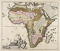
Category:1700s maps of Africa
Jump to navigation
Jump to search
Temperate regions: North America · South America · Africa · Europe · Asia · Oceania – Polar regions: – Other regions:
Subcategories
This category has the following 14 subcategories, out of 14 total.
- 1701 maps of Africa (16 F)
- 1702 maps of Africa (10 F)
- 1703 maps of Africa (7 F)
- 1704 maps of Africa (1 F)
- 1705 maps of Africa (11 F)
- 1706 maps of Africa (21 F)
- 1709 maps of Africa (2 F)
A
- 1700s maps of Algeria (3 F)
E
L
S
Media in category "1700s maps of Africa"
The following 18 files are in this category, out of 18 total.
-
Nicolas Sanson, Partie de la Haute Aethiopie (FL13721006 2370181).jpg 3,986 × 5,850; 31.45 MB
-
A chart of coast of BARBARY from C. Bajadore to the Golfe of St. Anne NYPL1640672.tiff 7,230 × 5,428; 112.28 MB
-
A chart of coasts of GABON, LOANGO and CONGO from C. St. Iohn to the River Ambris NYPL1640664.tiff 7,230 × 5,428; 112.28 MB
-
A chart of the BIGHT of BINNIN from Ningo Grande to R. Andoney NYPL1640666.tiff 7,230 × 5,428; 112.28 MB
-
A chart of the Canarie and Madera Islands (ca. 1702-1707).jpg 760 × 615; 97 KB
-
A chart of the coast of GUINEA from cape de Verd to cape Bona Esperanca NYPL1640669.tiff 7,230 × 5,428; 112.28 MB
-
A chart of the GOLD COAST in GUINEA from the River St. John to the River Volta NYPL1640667.tiff 7,230 × 5,428; 112.28 MB
-
A chart of THE ISLES off CAPE-VERD NYPL1640658.tiff 7,230 × 5,428; 112.28 MB
-
A chart of the shoulds and rivers of GAMBIA NYPL1640670.tiff 7,230 × 5,428; 112.28 MB
-
A draught of the coast of Africa from the streights mouth to Cape Bona Esprance NYPL1640674.tiff 5,428 × 7,230; 112.28 MB
-
A draught of the south part of AFRICA from cape Bona Esperance to Delagoa NYPL1640655.tiff 7,230 × 5,428; 112.28 MB
-
Africa (FL35470212 2496866).jpg 15,763 × 12,383; 255.76 MB
-
Africa elaboratissima - CBT 6625365.jpg 5,634 × 4,761; 8.39 MB
-
FortsGoldküste.JPG 1,200 × 783; 300 KB
-
Map - Special Collections University of Amsterdam - OTM- HB-KZL 33.17.69.tif 6,975 × 5,691; 113.57 MB
-
UBBasel Map 1690-1710 Kartenslg Mappe 252-43 Guinea.tiff 10,715 × 8,408, 2 pages; 257.78 MB


