Maps of Syria
Jump to navigation
Jump to search
| Maps of Syria on sister projects: | |||||||||
|---|---|---|---|---|---|---|---|---|---|
[[w:de:Portal:Syrien |
de:Portal:Syrien
]] |
en:Template:Syria categories | |||||||
- Maps are also available as part of the
 Wikimedia Atlas of the World project in the Atlas of Syria.
-
Map of Syria, Arab States.
(Location Syria) -
In red: Syria
(Location map) -
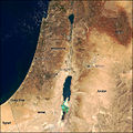
Air view of Middle East
(Syria on middle) -
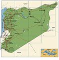
Map of Syria
(With principal cities) -
Map of Syria
(ONU Map) -
Syria 2004
(Very large map) -
Antiquity Syria
(Old cities) -
Map of Syria
(Syria location map) -
Map of Syria
(Transports in Syria) -
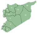
Administrative divisions of Syria
(The 14 Governorates) -
Governorates divisions of Syria (Name of Governorates)
-
Syria Ethnoreligious Map
(Ethnique and religious distribution) -
Syrian civil war 2011 - ...
(Closer to reality) -
2024 map, ...


