File:Vojvodina10.png
Jump to navigation
Jump to search
Size of this preview: 655 × 600 pixels. Other resolutions: 262 × 240 pixels | 524 × 480 pixels | 839 × 768 pixels | 1,035 × 948 pixels.
Original file (1,035 × 948 pixels, file size: 133 KB, MIME type: image/png)
Captions
Captions
Add a one-line explanation of what this file represents
Summary
[edit]
| Description |
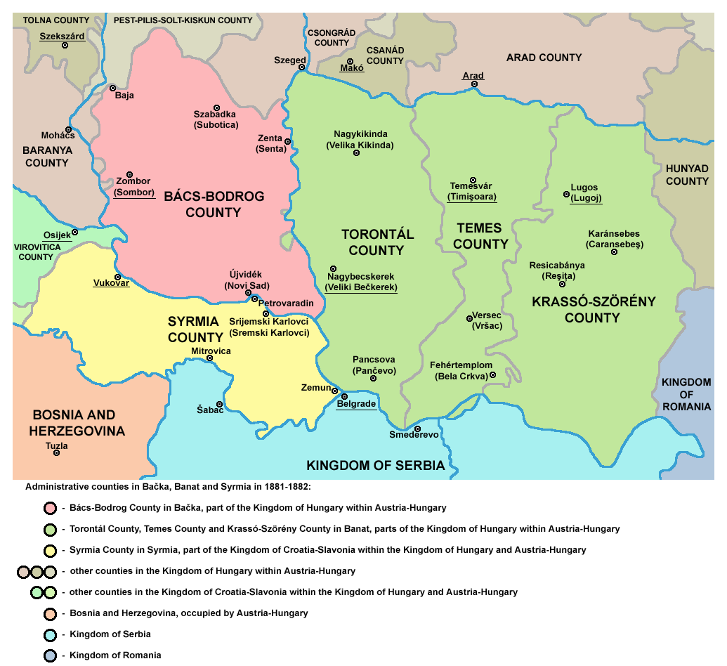
English: Historic map of counties in Bačka, Banat and Syrmia in 1881-1882. Српски / srpski: Историјска мапа жупанија у Бачкој, Банату и Срему 1881-1882. године. Magyar: Bácska, Szerémség és a Bánság vármegyéi (1881-1882). |
| Date | 6 December 2005 (original upload date) |
| Source | Transferred from en.wikipedia to Commons by Avemundi. |
| Author | Original uploader and author was PANONIAN at en.wikipedia |
| Other versions |
 , ,  |
Licensing
[edit]
self made map by user PANONIAN
| This work has been released into the public domain by its author, PANONIAN at English Wikipedia. This applies worldwide. In some countries this may not be legally possible; if so: PANONIAN grants anyone the right to use this work for any purpose, without any conditions, unless such conditions are required by law. |
References
[edit]
- Školski istorijski atlas, Zavod za izdavanje udžbenika SR Srbije, Beograd, 1970.
- Sve srpske mape - od šestog veka do Pariza, Specijalno izdanje BLICA, Decembar 1995
- Peter Rokai - Zoltan Đere - Tibor Pal - Aleksandar Kasaš, Istorija Mađara, Beograd, 2002.
- http://lazarus.elte.hu/~mihalyi/proba/Hungary%201881.jpg
- http://historicaltextarchive.com/hungary/map8.gif
- http://historicaltextarchive.com/hungary/map7.gif
- http://laszlorex.hu/sztlaszlo/terkep.jpg
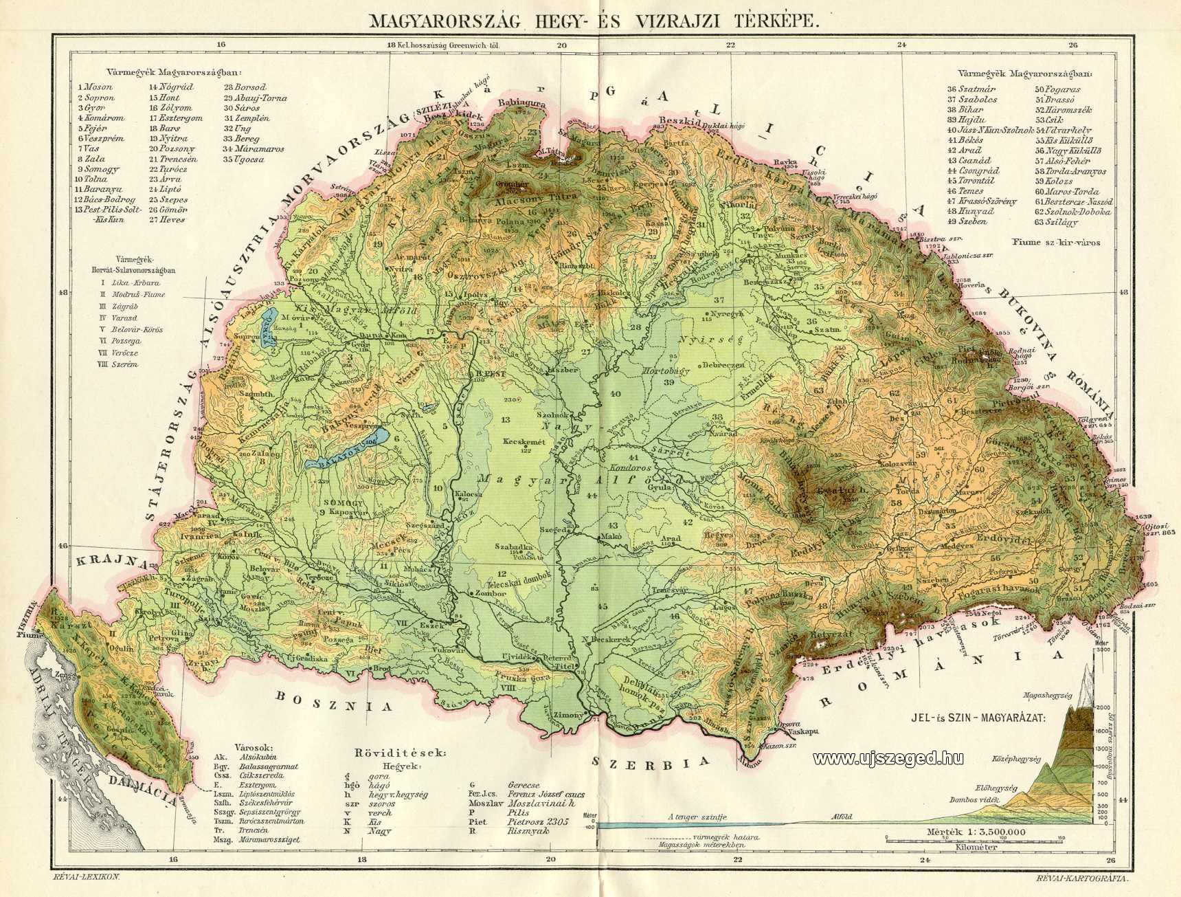
- http://www.ujszeged.hu/kepek/Magyar_Kiralysag_terkep.jpg
Original upload log
[edit]
The original description page was here. All following user names refer to en.wikipedia.
- 2005-12-06 14:21 PANONIAN 600×420×8 (120437 bytes)
File history
Click on a date/time to view the file as it appeared at that time.
| Date/Time | Thumbnail | Dimensions | User | Comment | |
|---|---|---|---|---|---|
| current | 16:12, 10 July 2014 | | 1,035 × 948 (133 KB) | WikiEditor2004 (talk | contribs) | minor change |
| 08:57, 24 October 2013 |  | 1,035 × 948 (133 KB) | WikiEditor2004 (talk | contribs) | aesthetics | |
| 08:26, 23 June 2011 |  | 1,038 × 948 (133 KB) | WikiEditor2004 (talk | contribs) | aesthetics | |
| 13:36, 11 June 2011 |  | 1,038 × 948 (126 KB) | WikiEditor2004 (talk | contribs) | improved version | |
| 15:08, 31 March 2009 |  | 940 × 968 (82 KB) | WikiEditor2004 (talk | contribs) | ||
| 10:09, 12 March 2009 |  | 980 × 869 (69 KB) | WikiEditor2004 (talk | contribs) | ||
| 17:15, 7 April 2008 |  | 600 × 420 (118 KB) | File Upload Bot (Magnus Manske) (talk | contribs) | {{BotMoveToCommons|en.wikipedia}} {{Information |Description={{en|historic map (self made) en:Category:Maps of the history of Vojvodina en:ja:??:Vojvodina10.jpg}} |Source=Transferred from [http://en.wikipedia.org en.wikipedia]; Transfer was s |
You cannot overwrite this file.
File usage on Commons
The following 5 pages use this file:
File usage on other wikis
The following other wikis use this file:
- Usage on ca.wikipedia.org
- Usage on de.wikipedia.org
- Usage on el.wikipedia.org
- Usage on en.wikipedia.org
- Usage on eo.wikipedia.org
- Usage on fr.wikipedia.org
- Usage on gl.wikipedia.org
- Usage on it.wikipedia.org
- Usage on ja.wikipedia.org
- Usage on lt.wikipedia.org
- Usage on mk.wikipedia.org
- Usage on ro.wikipedia.org
- Usage on sh.wikipedia.org
- Usage on uk.wikipedia.org