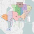
File:Seattle City Council District 4 neighborhoods.png
Jump to navigation
Jump to search

Size of this preview: 600 × 600 pixels. Other resolutions: 240 × 240 pixels | 480 × 480 pixels | 768 × 768 pixels | 1,024 × 1,024 pixels | 2,048 × 2,048 pixels | 3,203 × 3,203 pixels.
Original file (3,203 × 3,203 pixels, file size: 3.69 MB, MIME type: image/png)
Categories:
- Seattle City Council
- OpenStreetMap maps of Seattle
- Cascade, Seattle, Washington
- Fremont, Seattle, Washington
- Wallingford, Seattle, Washington
- Roosevelt, Seattle, Washington
- University District, Seattle, Washington
- Laurelhurst, Seattle, Washington
- Windermere, Seattle, Washington
- Bryant, Seattle, Washington
- Ravenna, Seattle, Washington
- Wedgwood, Seattle, Washington
- View Ridge, Seattle, Washington
- Sand Point, Seattle, Washington
- Tableau visualizations
