Category:Tableau visualizations
Jump to navigation
Jump to search
Media in category "Tableau visualizations"
The following 152 files are in this category, out of 152 total.
-
2015 Seattle City Council final results.gif 2,298 × 3,276; 1.06 MB
-
2017 Seattle Mayor Primary.png 1,900 × 1,182; 125 KB
-
2017 Washington train derailment detour routes.png 1,989 × 2,412; 2.03 MB
-
2017 Washington train derailment overview map.jpg 3,200 × 4,000; 851 KB
-
2020–21 United States Senate election in Georgia Ossoff-Perdue results by county pie map.png 2,027 × 2,347; 2.31 MB
-
A. W. Piper Seattle map.jpg 793 × 827; 129 KB
-
AIS map of MV ACX Crystal 2017-06-16 detail.png 1,936 × 1,182; 278 KB
-
AIS map of MV ACX Crystal 2017-06-16.png 1,947 × 1,127; 531 KB
-
Area chart of Washington brewery production 2010-2014.png 1,224 × 958; 336 KB
-
Arizona 2016 presidential results by county.png 1,337 × 1,324; 640 KB
-
Attorneys general filings against Executive Order 13769.png 1,948 × 1,452; 1,003 KB
-
Attorneys general filings over Executive Order 13769 table.png 1,404 × 989; 179 KB
-
August 2015 Seattle City Council Primary Results.png 2,306 × 3,276; 2.23 MB
-
Bar chart of languages in the United States.png 963 × 1,103; 32 KB
-
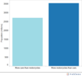
Bar of cars motorcycles population.png 895 × 463; 26 KB
-
Black River pre-1916 and 2013 map.png 1,224 × 943; 638 KB
-
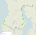
Burke-Gilman Trail.png 1,048 × 1,005; 723 KB
-
California 2016 presidential results by county.png 2,259 × 2,654; 1.66 MB
-
Case Statistics of COVID-19 and English Wikipedia Views.png 2,000 × 1,600; 159 KB
-
CB750 production.png 1,001 × 444; 67 KB
-
Cedar River Trail.gif 615 × 524; 49 KB
-
Cedar to Green River Trail.png 595 × 461; 42 KB
-
Color gradient example 1.png 1,068 × 1,286; 68 KB
-
Color gradient example 2.png 1,413 × 996; 56 KB
-
Colorado 2016 presidential results by county.png 2,714 × 2,343; 1.35 MB
-
Denny Way, Seattle.jpg 2,400 × 1,000; 191 KB
-
East Lake Sammamish Trail.gif 735 × 539; 56 KB
-
Eastside Rail Corridor.png 773 × 573; 204 KB
-
English views by category.png 1,654 × 1,200; 156 KB
-
English Wikipedia Views on Pandemic.png 1,800 × 1,400; 154 KB
-
Facebook users by age pie.jpg 1,023 × 943; 46 KB
-
Fastest production car.png 2,094 × 1,246; 107 KB
-
Fastest production motorcycle.png 1,284 × 984; 132 KB
-
Florida 2016 presidential results by county.png 3,514 × 3,365; 1.85 MB
-
Fremont cut map.png 1,360 × 765; 554 KB
-
Glacial erratic boulders in Island County.png 1,792 × 1,979; 1.02 MB
-
Green Lake with 1911 shoreline overlay.png 1,994 × 1,252; 983 KB
-
Honda Super Cub production 1958 to 2017.png 2,870 × 2,151; 407 KB
-
Idaho 2016 presidential results by county.png 1,680 × 2,692; 1.36 MB
-
Illinois 2016 presidential results by county.png 2,335 × 3,863; 3.04 MB
-
Initiative Measure No. 502 Concerns marijuana.png 3,038 × 1,921; 1.57 MB
-
Interurban Trail.gif 678 × 556; 61 KB
-
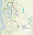
King County (Washington) rail trails.gif 896 × 950; 121 KB
-
King County Erratics.png 1,073 × 1,169; 488 KB
-
Lake Sammamish.png 1,496 × 1,678; 1.14 MB
-
Lake Washington Ship Canal and Black River map.png 1,224 × 937; 818 KB
-
Lake Washington Ship Canal map.png 2,651 × 1,458; 1.38 MB
-
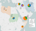
Large cities of the world with rent controls.png 2,400 × 1,093; 1.38 MB
-
Locator and inset map of Malta.png 834 × 1,084; 402 KB
-
Locator map of Malta 2.png 832 × 627; 249 KB
-
Map Motorcycles vs cars by population millions 2002.png 1,443 × 730; 502 KB
-
Map of Lake Washington and surrounding area.png 1,496 × 1,678; 1,023 KB
-
Map of licensed Washington breweries 2014.png 872 × 605; 256 KB
-
Map of Malta with locator.png 1,668 × 2,168; 838 KB
-
Map of Malta with scale.png 832 × 410; 79 KB
-
Map of Mercer Island.png 2,368 × 3,168; 1.71 MB
-
Map of Seattle Pronto stations.png 985 × 1,234; 621 KB
-
Map of Wedgwood Rock and Mount Erie.png 904 × 524; 225 KB
-
Massachusetts 2016 presidential results by county.png 3,933 × 2,498; 4.29 MB
-
Medina city limits.png 1,620 × 2,402; 1.12 MB
-
Mercer Street, Seattle map.jpg 2,400 × 1,000; 195 KB
-
Michigan 2016 presidential results by county.png 2,171 × 2,134; 1.58 MB
-
Minnesota 2016 presidential results by county.png 3,322 × 3,721; 4.08 MB
-
Montana 1992 presidential results by county.png 3,411 × 1,910; 2.27 MB
-
Montana 2016 presidential results by county.png 2,725 × 1,525; 1.52 MB
-
Montlake Cut map.png 1,179 × 908; 464 KB
-
Most Viewed English Wikipedia Pages.png 1,600 × 1,318; 204 KB
-
Motorcycle world land speed record.png 1,228 × 998; 23 KB
-
Nebraska 2016 presidential results by county.png 3,324 × 1,687; 1.3 MB
-
Nevada 2016 presidential results by county.png 1,073 × 1,507; 649 KB
-
New Mexico 2016 presidential results by county.png 2,298 × 2,709; 920 KB
-
North Carolina 2016 presidential results by county.png 3,310 × 1,364; 1.76 MB
-
North Dakota 2016 presidential results by county.png 2,820 × 2,068; 1.25 MB
-
Northern Cyprus Assembly of the Republic seats, 2013.png 1,882 × 1,164; 50 KB
-
Number of visas by country 2016, highlighting 7 excluded countries.png 2,652 × 1,316; 1.49 MB
-
Ohio 2016 presidential results by county.png 2,051 × 2,100; 1.45 MB
-
Oklahoma 2016 presidential results by county.png 4,044 × 2,088; 2.14 MB
-
Oregon 2016 presidential results by county.png 1,985 × 1,387; 906 KB
-
Pennsylvania 2016 presidential results by county.png 3,353 × 2,143; 2.88 MB
-
Pie chart of languages in the United States 01.png 345 × 321; 24 KB
-
Pike Street, Seattle map.jpg 1,945 × 1,551; 343 KB
-
Piper Creek and Carkeek Park.jpg 776 × 870; 65 KB
-
Pipers Creek and north Seattle.jpg 951 × 720; 108 KB
-
Pollinator Pathway Columbia Street.png 1,153 × 916; 572 KB
-
Population pyramid of Facebook users by age.png 1,584 × 1,092; 74 KB
-
Proposed Seattle canals.png 1,149 × 1,254; 603 KB
-
Queen Anne Boulevard map.jpg 3,101 × 1,807; 435 KB
-
Rhode Island 2016 presidential results by county.png 1,588 × 2,130; 1.23 MB
-
Route map of Alaskan Way Viaduct replacement tunnel.png 656 × 961; 300 KB
-
Salish feet without border.png 1,622 × 2,306; 1.17 MB
-
Salish feet.jpg 2,400 × 3,200; 2.6 MB
-
Salish feet.png 1,622 × 2,306; 1.51 MB
-
Sammamish River Trail.gif 671 × 561; 110 KB
-
Seattle City Council District 3 neighborhoods.png 3,564 × 3,564; 4.38 MB
-
Seattle City Council District 4 neighborhoods.png 3,203 × 3,203; 3.69 MB
-
Seattle City Council District 6 neighborhoods.png 3,591 × 3,591; 5.39 MB
-
Seattle City Council District 7 neighborhoods.png 2,422 × 2,422; 2.29 MB
-
Seattle City Council District map.png 3,968 × 5,968; 5.04 MB
-
Seattle crime, population and crime rate 1984-2016.png 1,968 × 1,568; 263 KB
-
Seattle mayoral election 2017 by precinct, candidate by color, votes cast by size.png 4,220 × 7,124; 11.92 MB
-
Seattle mayoral election 2017 by precinct, filled map.png 4,375 × 7,370; 8.2 MB
-
Seattle megaprojects volume moved.png 2,963 × 1,831; 304 KB
-
Snoqualmie Valley Trail.gif 991 × 891; 67 KB
-
South Dakota 2016 presidential results.png 2,538 × 1,649; 1.07 MB
-
SR 99 Tunnel Bertha stuck December 6, 2013.png 771 × 961; 361 KB
-
Tableau d'information de l'AMP de JOAL-FADIOUTH.jpg 4,027 × 2,702; 2.11 MB
-
Tableau Neila Gharbi Un Wiki.PNG 681 × 144; 14 KB
-
Tableau statistiques.png 537 × 423; 75 KB
-
Tamanowas Rock.png 2,128 × 1,284; 1.17 MB
-
Texas 2016 presidential results by county.png 4,092 × 4,038; 4.93 MB
-
Titanic passengers.png 5,600 × 5,200; 1.48 MB
-
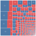
Tree map example 1.png 1,068 × 1,122; 80 KB
-
Tree map example 1a.png 1,068 × 1,164; 103 KB
-
Tree map example 2.png 1,345 × 831; 72 KB
-
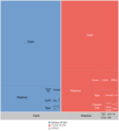
Tree map of languages in the United States.png 984 × 741; 31 KB
-
Tree map of Montana 1992 Presidential election by county.png 3,859 × 3,968; 1.11 MB
-
Tree map of Nevada 2016 Presidential election by county.png 2,685 × 2,968; 181 KB
-
Tree map of Utah 2016 Presidential election by county.png 3,866 × 3,968; 814 KB
-
Treemap of most-produced vehicles to date.png 8,000 × 8,000; 1.36 MB
-
United States presidential election in Washington, 2016, results by county.png 3,633 × 2,381; 2.52 MB
-
United States STD rates per 100,000 from 1941-2016.jpg 1,442 × 1,150; 81 KB
-
US law enforcement deaths in the line of duty 1791-2016.png 2,585 × 1,953; 197 KB
-
US military enlisted accessions 1975-2001.png 2,126 × 1,248; 175 KB
-
US Motorcycle Deaths by Year.png 1,300 × 1,720; 90 KB
-
US traffic deaths per VMT, VMT, per capita, and total annual deaths.png 2,300 × 1,400; 330 KB
-
USA annual VMT vs deaths per VMT.png 1,764 × 1,234; 113 KB
-
Utah 2016 presidential results by county.png 1,383 × 1,482; 784 KB
-
Visas to 7 countries in immigration ban by type and number 2016.png 2,557 × 2,177; 1.91 MB
-
VW adjusted close 2015-09-14 through 2015-09-30 with volume.png 1,670 × 1,139; 166 KB
-
VW percent of 2015-09-17 to 2015-09-30.png 1,808 × 1,278; 119 KB
-
VW stock price after emissions violations.png 1,808 × 1,298; 193 KB
-
Washington Hispanic origin and race by county.png 3,566 × 2,083; 2.55 MB
-
Washington I-502 results by county color variant modified colors.png 1,788 × 1,169; 600 KB
-
Washington I-502 results by county.png 1,788 × 1,169; 866 KB
-
Washington I-594 results.png 1,775 × 1,139; 852 KB
-
Washington Initiative 1639 results by county.png 2,021 × 1,528; 1.3 MB
-
Washington Initiative 692 pie map.jpg 2,045 × 1,205; 196 KB
-
Washington race and ethnic origin by county.png 3,971 × 2,444; 3.2 MB
-
Washington Referendum 71 results by county pie chart.png 1,806 × 1,180; 825 KB
-
Washington Referendum 74 results by county.png 1,987 × 1,205; 958 KB
-
Washington State Route 523.jpg 1,622 × 1,622; 212 KB
-
Washington State Route 99 map.jpg 1,101 × 1,858; 154 KB
-
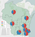
Wisconsin 2016 presidential results by congressional district.png 990 × 1,049; 460 KB
-
Wisconsin 2016 presidential results by county.png 1,907 × 2,034; 1.14 MB
-
Wyoming 2016 presidential results by county.png 3,182 × 2,768; 1.86 MB
-
Yesler Way, Seattle map.jpg 2,175 × 948; 168 KB


