File:Plunketts Creek Relief Map.PNG

Original file (886 × 800 pixels, file size: 107 KB, MIME type: image/png)
Captions
Captions
Summary
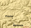
[edit]| DescriptionPlunketts Creek Relief Map.PNG | Relief Map of Plunketts Creek Watershed in Lycoming and Sullivan Counties, Pennsylvania, United States |
| Date | |
| Source | This is a section of a map taken from the planiglobe website [1] and enlarged by User:Ruhrfisch. |
| Author | Planiglobe |
| Permission (Reusing this file) |
According to the planiglobe website, "This work is licensed under a Creative Commons Attribution 2.5 License." |
Licensing
[edit]| This image is from Planiglobe. All maps hosted on Planiglobe are licensed under the Creative Commons Attribution 2.5 License, but Planiglobe suggests that they not be used for navigational purposes. For the purposes of this license, this clause is considered a disclaimer and not a license restriction. This file is licensed under the Creative Commons Attribution 2.5 Generic license.
|

|
Textual information (e.g. timestamp) once visible in the image itself has been moved into the image metadata and/or image description page. This makes the image easier to reuse and more language-neutral, and makes the text easier to process and search for. Commons discourages placing visible textual information in images. All licenses accepted on Commons permit this type of modification as a derivative work.
If attribution information were removed and the image is not public domain, replace this tag with {{Attribution metadata from licensed image}}.
беларуская (тарашкевіца) | català | Deutsch | English | español | فارسی | français | galego | magyar | italiano | македонски | മലയാളം | português | русский | sicilianu | slovenščina | svenska | Indonesia | 中文 | +/− |
File history
Click on a date/time to view the file as it appeared at that time.
| Date/Time | Thumbnail | Dimensions | User | Comment | |
|---|---|---|---|---|---|
| current | 00:07, 5 April 2013 |  | 886 × 800 (107 KB) | Ruhrfisch (talk | contribs) | Add labels for Barbours and Proctor, all other info the same |
| 00:02, 5 April 2013 |  | 886 × 800 (107 KB) | Ruhrfisch (talk | contribs) | Add labels for Barbours and Proctor, all other info the same | |
| 00:01, 5 April 2013 |  | 886 × 800 (107 KB) | Ruhrfisch (talk | contribs) | Add labels for Barbours and Proctor, all other info the same | |
| 05:07, 15 July 2008 |  | 885 × 800 (134 KB) | Jarekt (talk | contribs) | {{Information |Description=Cropped watermark |Source= |Date= |Author= |Permission= |other_versions= }} | |
| 02:31, 13 August 2007 |  | 905 × 800 (141 KB) | Ruhrfisch (talk | contribs) | {{Information| |Description= Relief Map of Plunketts Creek Watershed in Lycoming and Sullivan Counties, Pennsylvania, United States |Source= This is a section of a map taken from the planiglobe website [http://www.planiglobe.com/omc_set.html] and enlarge |
You cannot overwrite this file.
File usage on Commons
There are no pages that use this file.
File usage on other wikis
The following other wikis use this file:
- Usage on en.wikipedia.org
- Usage on ha.wikipedia.org
- Usage on te.wikipedia.org
- Usage on zh.wikipedia.org
Metadata
This file contains additional information such as Exif metadata which may have been added by the digital camera, scanner, or software program used to create or digitize it. If the file has been modified from its original state, some details such as the timestamp may not fully reflect those of the original file. The timestamp is only as accurate as the clock in the camera, and it may be completely wrong.
| Horizontal resolution | 37.8 dpc |
|---|---|
| Vertical resolution | 37.8 dpc |