File:O'Sullivan 1965 USGS Bulletin 1186 plate-1.pdf
Jump to navigation
Jump to search

Size of this JPG preview of this PDF file: 800 × 549 pixels. Other resolutions: 320 × 220 pixels | 640 × 439 pixels | 1,024 × 703 pixels | 1,280 × 878 pixels | 2,560 × 1,756 pixels | 6,450 × 4,425 pixels.
Original file (6,450 × 4,425 pixels, file size: 9.19 MB, MIME type: application/pdf)
Captions
Captions
Add a one-line explanation of what this file represents
Summary
[edit]| Description |
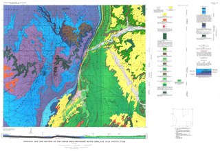
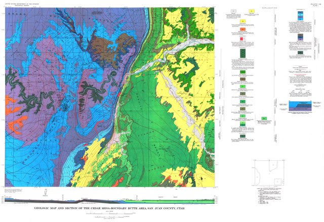
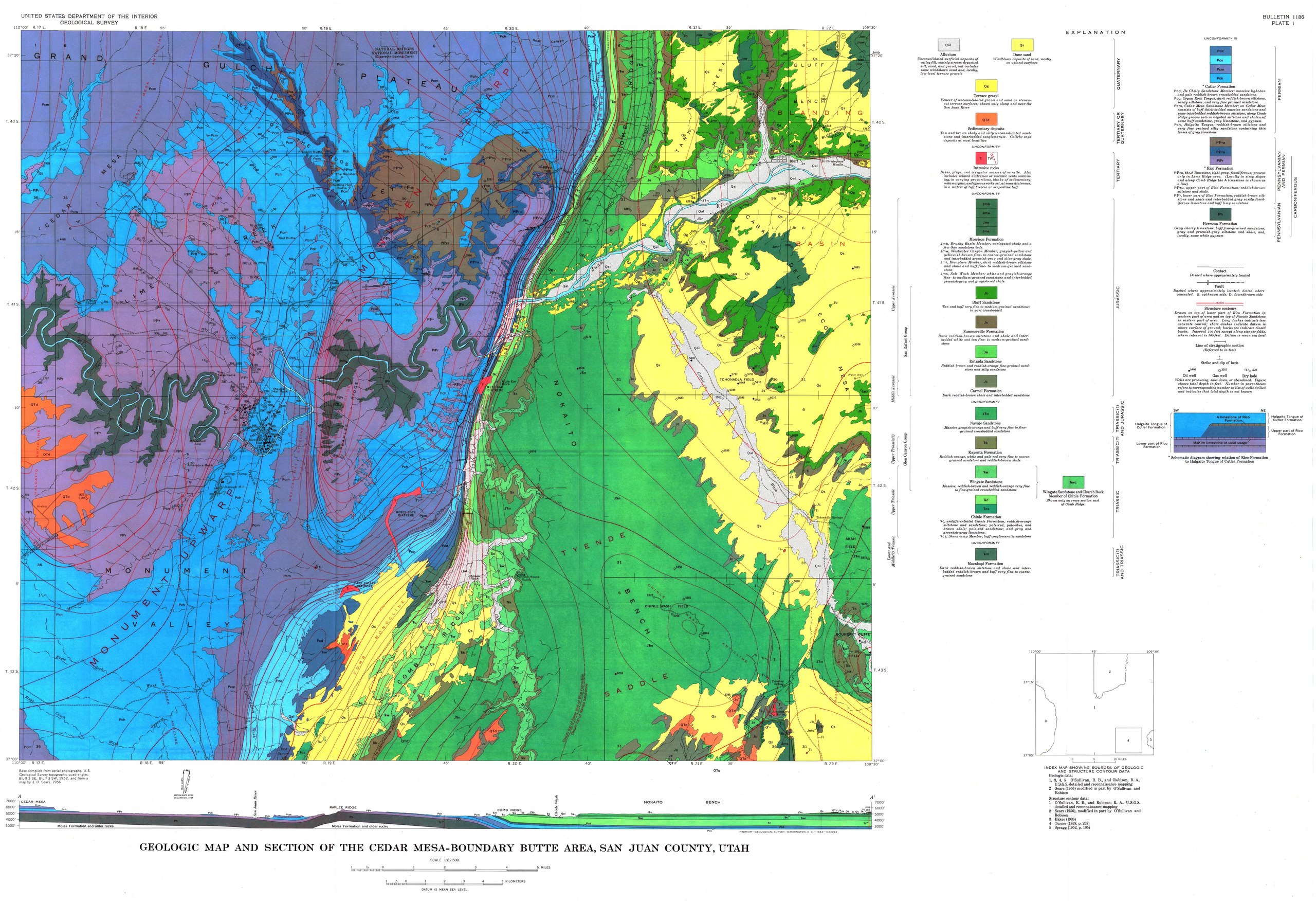
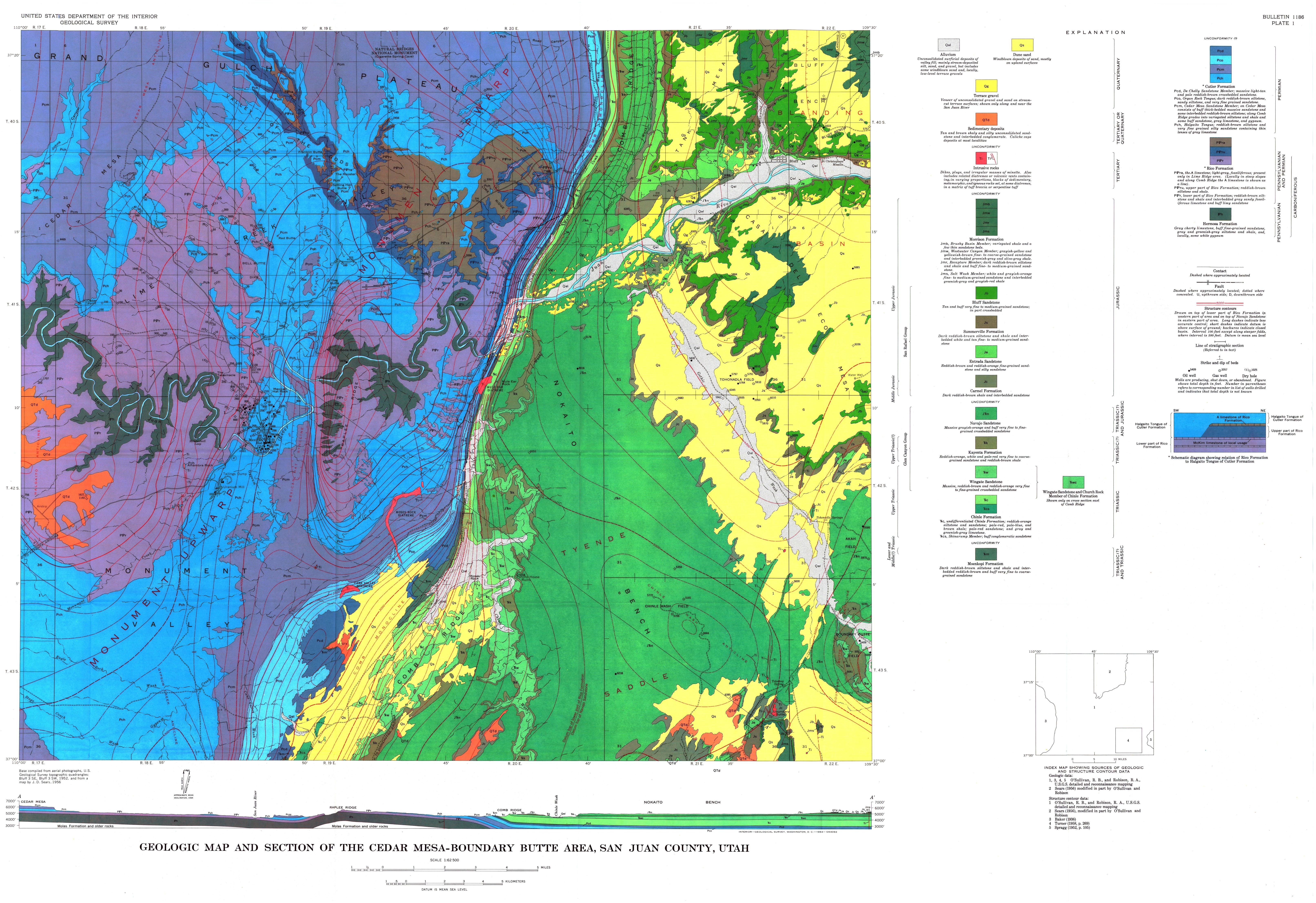
English: Geologic map and section of the Cedar Mesa - Boundary Butte area, San Juan County, Utah. From US Geological Survey Bulletin 1186 |
| Date | |
| Source | https://pubs.er.usgs.gov/publication/b1186 |
| Author | O'Sullivan,Robert Brett |
Licensing
[edit]This image is in the public domain in the United States because it only contains materials that originally came from the United States Geological Survey, an agency of the United States Department of the Interior. For more information, see the official USGS copyright policy.
|
File history
Click on a date/time to view the file as it appeared at that time.
| Date/Time | Thumbnail | Dimensions | User | Comment | |
|---|---|---|---|---|---|
| current | 05:49, 17 December 2018 |  | 6,450 × 4,425 (9.19 MB) | Kognos (talk | contribs) | User created page with UploadWizard |
You cannot overwrite this file.
File usage on Commons
There are no pages that use this file.
File usage on other wikis
The following other wikis use this file:
- Usage on fr.wikipedia.org
Metadata
Categories:
- Old geological maps of Utah
- San Juan River (Colorado River tributary)
- United States Geological Survey maps
- Valley of the Gods
- Comb Ridge
- Moki Dugway
- Geological cross sections of Utah
- Quaternary gravel in Utah
- Quaternary dune sand in Utah
- Igneous intrusions in Utah
- Morrison Formation in Utah
- Morrison Formation maps
- Brushy Basin Member
- Westwater Canyon Member, Morrison Formation
- Recapture Member, Morrison Formation
- Salt Wash Member, Morrison Formation
- Bluff Formation
- Summerville Formation - maps
- Entrada Sandstone maps
- Chinle Formation in Utah
- Chinle Formation maps
- Church Rock Member - maps
- Carmel Formation - maps
- Navajo Sandstone maps
- Kayenta Formation - maps
- Wingate Sandstone maps
- Shinarump Conglomerate - maps
- Moenkopi Formation maps
- Organ Rock Tongue, Cutler Formation
- Cedar Mesa Sandstone - maps
- De Chelly Sandstone - maps
- Halgaito Tongue, Cutler Formation
- Rico Formation (U.S. geology)
- Hermosa Group
- Oil wells in the United States
- Faults in Utah
- Cutler Formation - maps
- Navajo Sandstone in Utah