Category:PD USGS
Jump to navigation
Jump to search
Subcategories
This category has the following 4 subcategories, out of 4 total.
Pages in category "PD USGS"
This category contains only the following page.
Media in category "PD USGS"
The following 200 files are in this category, out of 22,480 total.
(previous page) (next page)-
"In My Day!" (18518488309).jpg 3,895 × 3,101; 6.28 MB
-
"Lot's Wife" (15232457247).jpg 1,400 × 989; 1.03 MB
-
"Quill" satellite radar image of flooded Eel River outflow current.JPG 1,000 × 719; 123 KB
-
"This means something. This is important" (19967592275).jpg 3,264 × 2,448; 2.32 MB
-
(beetle), Back, Judelot Farm, Maryland 2014-10-20-14.30 (22640942662).jpg 5,347 × 3,361; 6.77 MB
-
(Bright) Bees in Cars Front 2019-03-28-15.51.48 ZS PMax UDR (40548291263).jpg 3,606 × 2,755; 5.64 MB
-
(Bright) Car Full of Bees Overhead 2019-03-28-16.01.37 ZS PMax UDR (33637501448).jpg 5,760 × 3,840; 11.64 MB
-
(Fixed) Bees in Cars, Yellow, Overhead 2019-03-27-15.13.13 ZS PMax UDR (46598763235).jpg 5,782 × 3,696; 18.61 MB
-
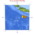
+7 earthquakes around Van 1900-2011.jpg 410 × 568; 64 KB
-
-174 -20 globe.jpg 146 × 146; 11 KB
-
-Agapostemon Male ID Copy (30340711068).jpg 1,080 × 1,080; 1,009 KB
-
-TBT - Cape Cod, Massachusetts (12220561204).jpg 1,400 × 965; 764 KB
-
-TBT- Cheyenne, WY (10853524504).jpg 1,325 × 1,400; 1.04 MB
-
-ThrowBackThursday- Little Annie (10724566925).jpg 5,246 × 2,800; 7.3 MB
-
022srUSGSCyprusVia.jpg 758 × 512; 54 KB
-
04 North Pole Wolf.jpg 1,180 × 790; 191 KB
-
080406 0410 CCH L.jpg 1,200 × 397; 113 KB
-
089srUSGSoffFoundation.jpg 752 × 512; 50 KB
-
09 North Pole Wolf.jpg 1,180 × 793; 163 KB
-
093srUSGSpinupFailure.jpg 749 × 512; 44 KB
-
0M5Waverly.jpg 1,200 × 1,200; 272 KB
-
10-point divider - 000649-10 Pt Divider 01.JPG 2,019 × 2,636; 2.17 MB
-
100-Year Old Adobe Building Destroyed (4479274376).jpg 5,616 × 3,744; 4.15 MB
-
1000 Mile Tree Weber Canyon 1869.jpg 758 × 700; 366 KB
-
1000px-Production of oil shale.png 1,000 × 555; 100 KB
-
105 -10.gif 504 × 497; 31 KB
-
10x Nomada eye 2015-04-13-17.41.16 ZS PMax (16519118423).jpg 5,285 × 3,564; 13.73 MB
-
110 -8 globe.jpg 146 × 146; 13 KB
-
116 30 globe.jpg 146 × 146; 13 KB
-
122-38HaywardFault.jpg 568 × 549; 88 KB
-
13 June 2011 Christchurch earthquake.png 552 × 671; 370 KB
-
145 40 smallglobe.png 146 × 146; 7 KB
-
145 40.png 439 × 499; 31 KB
-
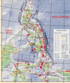
1500 1899 EQs Philippines.png 1,418 × 1,509; 1.93 MB
-
1663 Charlevoix earthquake location.png 214 × 149; 24 KB
-
17254 Grand Canyon Nat Park Historic River Photo (7304988964).jpg 1,024 × 1,142; 300 KB
-
1755 Lisbon Earthquake Location no cap.jpg 329 × 400; 46 KB
-
1755 Lisbon Earthquake Location.png 331 × 420; 100 KB
-
1850s from Niagara Falls (25369570180).jpg 4,546 × 3,238; 1.67 MB
-
1869 Windmill at North Platte Station (15090577757).jpg 1,400 × 943; 759 KB
-
1870 Charlevoix earthquake epicenter.png 214 × 156; 25 KB
-
1872 North Cascades Isoseismal Map.png 1,464 × 1,544; 508 KB
-
1878GeologicMapofYellowstone.jpg 4,520 × 5,216; 6.24 MB
-
1888 WDC Streetcar Map.JPG 1,042 × 816; 326 KB
-
1889 USGS Topographic Map of Brooklyn NY.jpg 4,804 × 5,996; 3.52 MB
-
1893 U. S. Geological Survey Map of Portsmouth Harbor.jpg 800 × 600; 178 KB
-
19 August 2018 Lombok earthquake intensity map.png 1,700 × 1,984; 221 KB
-
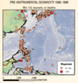
1900 2012 EQ Philippines.png 2,071 × 2,435; 5.36 MB
-
1902 USGS topo map of Baring, Washington.jpg 3,000 × 3,000; 3.94 MB
-
1904 Bunker Hill Mine Stope Map.png 1,442 × 914; 1.1 MB
-
1904BunkerHillMine Richmond(1) Stemwinder(6) Tunnels.png 632 × 894; 782 KB
-
1904BunkerHillStopes.png 950 × 895; 2.28 MB
-
1904BurkeIdaho Tiger-Poorman Hecla Mine shafts.png 1,210 × 891; 1.45 MB
-
1904HerculesSilverMineIdaho.png 1,201 × 826; 1.34 MB
-
1904MullanIdaho.png 1,283 × 897; 1.48 MB
-
1904SullivanMineIdaho.png 656 × 895; 809 KB
-
1904WallaceIdaho.png 1,286 × 891; 1.45 MB
-
1906 Boatwright intensity.jpg 612 × 884; 539 KB
-
1906 earthquake train.jpg 1,149 × 802; 263 KB
-
1906 loma prieta.png 733 × 549; 8 KB
-
1906 San Francisco Earthquake (15104435834).jpg 4,625 × 3,245; 1.34 MB
-
1906 San Francisco Earthquake (22778070880).jpg 4,049 × 2,957; 1.69 MB
-
1906 San Francisco earthquake seismograph.png 674 × 508; 7 KB
-
1907BurkeCanyonIdaho geologicmap.png 1,819 × 899; 4.72 MB
-
1907BurkeIdaho geologic map.png 1,819 × 898; 4.71 MB
-
1907KelloggIdaho geologicmap.png 1,461 × 876; 3.8 MB
-
1907MullanIdaho geologicmap.png 1,819 × 898; 4.77 MB
-
1907MurrayIdaho geologicmap.png 1,821 × 895; 4.76 MB
-
1907OsburnIdaho geologicmap.png 1,819 × 896; 4.78 MB
-
1907SilverValleyIdaho geologicmap.png 1,820 × 897; 4.65 MB
-
1908* Edgartown Light area USGS Topo Map.png 1,174 × 952; 1.85 MB
-
1909 Wabash valley earthquake map.png 250 × 299; 56 KB
-
1915 pleasant valley earthquake map.png 331 × 466; 114 KB
-
1915 Pleasant Valley earthquake scarp.jpg 693 × 700; 340 KB
-
1915 USGS Topo Prosser.jpg 1,526 × 1,017; 909 KB
-
1916 Irondale epicenter map.png 331 × 426; 96 KB
-
1918-10-11 M 7.1 - Puerto Rico region.jpg 612 × 718; 61 KB
-
1925 Charlevoix-Kamouraska earthquake epicenter.png 214 × 156; 25 KB
-
1925 Three Forks, MT earthquake damage.png 790 × 451; 329 KB
-
1928 USGSexcerptOLGA.jpg 2,295 × 1,167; 686 KB
-
1931 Valentine, Texas earthquake ShakeMap.jpg 787 × 1,014; 370 KB
-
1933 Long Beach earthquake damage 1.jpg 1,400 × 1,002; 881 KB
-
1935 Dien Bien, Vietnam earthquake.png 1,009 × 652; 976 KB
-
1935 Timiskaming earthquake epicenter.png 214 × 149; 24 KB
-
1936 State Line earthquake isoseismal map.png 769 × 813; 228 KB
-
1940 12 20 isoseismal map.PNG 646 × 531; 59 KB
-
1942 topographic map of Salem USGS.jpg 3,056 × 3,691; 4.62 MB
-
1943 US 9 end USGS map.jpg 314 × 356; 55 KB
-
1944 Cornwall Massena Isoseismal Map.png 651 × 530; 124 KB
-
1946 Vancouver Island Earthquake.png 182 × 139; 23 KB
-
1946DominicanRepublic.png 214 × 108; 16 KB
-
1950 Calama earthquake.jpg 906 × 1,079; 414 KB
-
1950 eruption of Mauna Loa.jpg 445 × 333; 53 KB
-
1952 Kern County earthquake - Damaged school.tif 1,000 × 667; 934 KB
-
1953 Ionian earthquake shakemap.jpg 787 × 1,013; 285 KB
-
1954-OrientPointLight-USGSMap.jpg 1,015 × 693; 160 KB
-
1959 eruption of Kilauea Volcano.jpg 3,596 × 2,363; 10.95 MB
-
1960 02 29 Agadir earthquake.png 331 × 273; 61 KB
-
1960 05 22 loc.png 338 × 416; 102 KB
-
1960 Valdivia earthquake.jpg 822 × 1,084; 325 KB
-
1960-Chilean-tsunami-Hilo-HI-USGS.jpg 766 × 612; 98 KB
-
1962 Buin Zahra earthquake intensity.jpg 787 × 965; 371 KB
-
1962 Topographical Map of Abandoned Bong Air Force Base.jpg 962 × 749; 597 KB
-
1964 Alaska Quake Kodiak Before and After.jpg 2,293 × 3,628; 4.61 MB
-
1964 Alaska Quake Kodiak-After.jpg 2,288 × 1,573; 1.95 MB
-
1964 Alaska Quake Kodiak-Before.jpg 2,288 × 1,573; 1.93 MB
-
1964 Alaska Quake L Street Apartments.jpg 2,408 × 3,614; 2.91 MB
-
1964 Alaska Quake L Street Slide.jpg 3,936 × 2,571; 3.95 MB
-
1964 Alaska Quake Penney Bldg.jpg 3,582 × 2,376; 3.11 MB
-
1964 Alaska Quake Portage Townsite.jpg 3,592 × 2,401; 5.14 MB
-
1964 Quake- The Great Alaska Earthquake.webm 11 min 37 s, 1,920 × 1,080; 144.17 MB
-
1965 Rat Islands earthquake shakemap.jpg 612 × 719; 61 KB
-
1967 Aratoca earthquake ShakeMap.jpg 864 × 792; 200 KB
-
1967 Guichi Downtown.tif 5,589 × 3,738; 59.79 MB
-
1967 Neiva earthquake ShakeMap.jpg 864 × 792; 229 KB
-
1967-USGSTopoMapExcerpt.jpg 628 × 393; 96 KB
-
1967年的三道桥.png 827 × 578; 575 KB
-
1968 Casiguran earthquake.jpg 612 × 717; 86 KB
-
1968 Illinois earthquake.gif 644 × 615; 63 KB
-
1968 Illinois earthquake.svg 394 × 360; 175 KB
-
1968 Sulawesi earthquake - Shakemap.jpg 612 × 717; 96 KB
-
1968 The main townships of Fuzhou, Fubei, and Shangdongdu.tif 5,712 × 4,912; 26.76 MB
-
1968 USGS flood map Bellows Air Force Station.jpg 983 × 750; 397 KB
-
1969 Santa Barbara Oil Spill CA.jpg 617 × 482; 44 KB
-
1970 Ancash earthquake intensity.jpg 822 × 1,084; 307 KB
-
1970 Bahía Solano earthquake ShakeMap.jpg 864 × 792; 194 KB
-
1970 Chocó earthquake ShakeMap.jpg 864 × 792; 144 KB
-
1970 New Guinea earthquake - ShakeMap.jpg 612 × 717; 104 KB
-
1970 Peru–Ecuador earthquake intensity.jpg 777 × 1,011; 305 KB
-
1970 Tonghai earthquake.png 214 × 156; 25 KB
-
1970年代石林县城-路南石林卫星影像.jpg 4,201 × 4,545; 7.01 MB
-
1970年代石林县城卫星影像.jpg 1,951 × 1,774; 1.25 MB
-
1971 Geologic Map of the Near Side of the Moon Cropped.png 4,095 × 4,590; 26.48 MB
-
1971 Illapel earthquake.jpg 612 × 716; 168 KB
-
1971 San Fernando highway overpass collapse.jpg 700 × 464; 456 KB
-
1972Nicaraguaquake2.jpg 301 × 412; 133 KB
-
1972Nicaraguaquake3.jpg 313 × 412; 147 KB
-
1972Nicaraguaquake4.jpg 252 × 363; 86 KB
-
1972Nicaraguaquake5.jpg 318 × 243; 92 KB
-
1974 Xenia tornado path with 2010 aerial imagery.jpg 2,945 × 2,371; 8.29 MB
-
1975 Chocó earthquake ShakeMap.jpg 864 × 792; 144 KB
-
1975 Coquimbo earthquake.jpg 612 × 722; 157 KB
-
1975 Mauna Loa eruption fountains.jpg 900 × 603; 83 KB
-
1975 Mauna Loa lava cascades.jpg 777 × 559; 76 KB
-
1975 Pavlof volcano eruption, Alaska (1182883978).jpg 2,971 × 2,011; 921 KB
-
1976 papua indonesia earthquake intensity map.jpg 612 × 719; 176 KB
-
1977 Geologic Map of San Juan Quadrangle, Puerto Rico.jpg 2,837 × 2,548; 2.07 MB
-
1977 Vrancea earthquake.jpg 612 × 710; 218 KB
-
1978 Tabas earthquake shakemap.jpg 785 × 1,001; 409 KB
-
19780728-南湖机场旧影像.png 1,292 × 1,548; 2.28 MB
-
19780728-武昌车站.png 2,227 × 1,525; 3.38 MB
-
1979 El Cairo earthquake ShakeMap.jpg 864 × 792; 191 KB
-
1979 Norcia earthquake.jpg 806 × 1,003; 391 KB
-
1979 Tumaco earthquake ShakeMap.jpg 864 × 792; 143 KB
-
1979-USGS-jayneshill.JPG 793 × 754; 206 KB
-
1980 El Asnam earthquake ShakeMap.jpg 612 × 719; 101 KB
-
1980 St. Helens ashmap.png 808 × 550; 11 KB
-
19801123 183453 irpinia quake intensity.jpg 612 × 718; 115 KB
-
1981-06-11 Golbaf, Iran earthquake shakemap.jpg 785 × 1,001; 372 KB
-
1981-07-28 Sirch, Iran earthquake shakemap.jpg 771 × 1,001; 378 KB
-
1983 Guinea earthquake intensity map.jpg 612 × 717; 136 KB
-
1983 Kaoiki earthquake.jpg 787 × 997; 151 KB
-
1983 Map of the south portion of the Jefferson National Forest in southwest Virginia.jpg 13,192 × 9,100; 16.43 MB
-
1983californiamap.png 179 × 181; 24 KB
-
1984 Cachar earthquake.jpg 612 × 718; 142 KB
-
1984 Eruption (23125250919).jpg 502 × 768; 88 KB
-
1984 Mauna Loa lava flows.gif 539 × 327; 11 KB
-
1985 Lago Rapel earthquake.jpg 612 × 716; 169 KB
-
1985 Mexico Earthquake - Building collapsed.jpg 1,368 × 923; 1.46 MB
-
1985 Mexico Earthquake - Collapsed General Hospital.jpg 3,502 × 2,392; 13.07 MB
-
1985 Mexico Earthquake - Damaged Social Security Hospital.jpg 462 × 700; 406 KB
-
1985 Mexico Earthquake - Damages in eight-story building collapsed.jpg 925 × 1,400; 1.62 MB
-
1985 Mexico Earthquake - Eight-story building collapsed 2.jpg 3,550 × 2,336; 9.39 MB
-
1985 Mexico Earthquake - Eight-story building collapsed.jpg 3,678 × 2,432; 9.72 MB
-
1985 Mexico Earthquake - Hotel Continental.jpg 3,582 × 2,376; 8.5 MB
-
1985 Mexico Earthquake - Ministry of Telecommunications and Transportation building 3.jpg 3,550 × 2,368; 9.06 MB
-
1985 Mexico Earthquake - Ministry of Telecommunications and Transportation building2.jpg 3,566 × 2,328; 8.68 MB
-
1985 Mexico Earthquake - Nuevo Leon building 2.jpg 3,598 × 2,368; 10.46 MB
-
1985 Mexico Earthquake - Nuevo Leon building.jpg 2,432 × 3,630; 10.69 MB
-
1985 Mexico Earthquake - Pina Suarez Apartment Complex (2).jpg 922 × 1,400; 1.33 MB
-
1985 Mexico Earthquake - Pina Suarez Apartment Complex (3).jpg 1,400 × 929; 1.66 MB
-
1985 Mexico Earthquake - Pina Suarez Apartment Complex.jpg 1,392 × 928; 1.11 MB
-
1985 Mexico Earthquake - Pino Suarez Apartment Complex damage.jpg 2,376 × 3,606; 11.68 MB
-
1985 Mexico Earthquake 19850919 1317 UTC loc.jpg 612 × 721; 156 KB
-
1985 Mexico Earthquake 21091985 0137 UTC loc.jpg 612 × 720; 171 KB
-
1985 Nahanni earthquakes.png 179 × 181; 24 KB
-
1985 Santiago earthquake.jpg 612 × 720; 157 KB
-
1986 Hualien earthquake intensity map.jpg 612 × 723; 109 KB
-
1986 Kalamata Greece earthquake shakemap.jpg 797 × 1,001; 282 KB
-
1987 Ecuador-Colombia earthquakes ShakeMap.jpg 864 × 792; 205 KB


