File:Municipalities of Rhone location map.svg
Jump to navigation
Jump to search

Size of this PNG preview of this SVG file: 450 × 599 pixels. Other resolutions: 180 × 240 pixels | 360 × 480 pixels | 577 × 768 pixels | 769 × 1,024 pixels | 1,538 × 2,048 pixels | 712 × 948 pixels.
Original file (SVG file, nominally 712 × 948 pixels, file size: 842 KB)
Captions
Captions
Add a one-line explanation of what this file represents
Summary
[edit]
| Description |
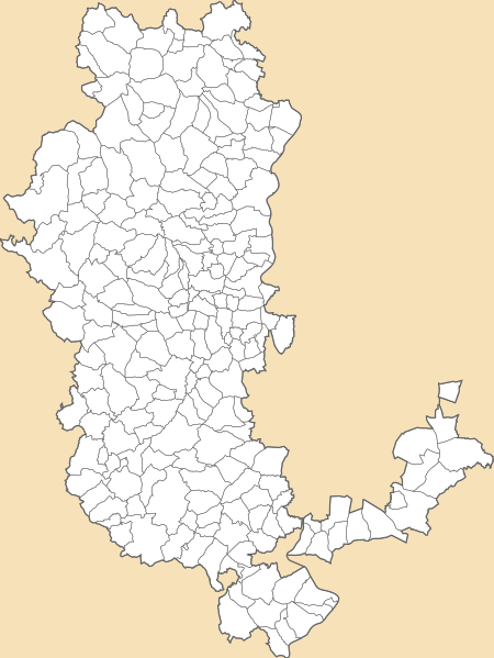
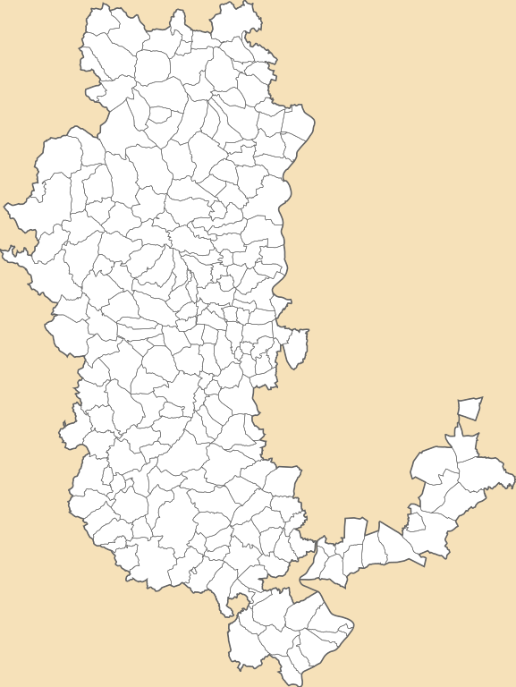
English: Current map of municipalities of Rhône, Rhône-Alpes-Auvergne, France.
Français : Carte actuelle des communes du département du Rhône. Rhône-Alpes-Auvergne, France. |
| Date | |
| Source | File:Municipalities of Rhone in 2011 location map.svg |
| Author | Sémhur ; Flappiefh; modification Métropole de Lyon Otourly |
Licensing
[edit]
I, the copyright holder of this work, hereby publish it under the following licenses:
This file is licensed under the Creative Commons Attribution-Share Alike 3.0 Unported, 2.5 Generic, 2.0 Generic and 1.0 Generic license.
- You are free:
- to share – to copy, distribute and transmit the work
- to remix – to adapt the work
- Under the following conditions:
- attribution – You must give appropriate credit, provide a link to the license, and indicate if changes were made. You may do so in any reasonable manner, but not in any way that suggests the licensor endorses you or your use.
- share alike – If you remix, transform, or build upon the material, you must distribute your contributions under the same or compatible license as the original.
| Copyleft: This work of art is free; you can redistribute it and/or modify it according to terms of the Free Art License. You will find a specimen of this license on the Copyleft Attitude site as well as on other sites. |
You may select the license of your choice.
File history
Click on a date/time to view the file as it appeared at that time.
| Date/Time | Thumbnail | Dimensions | User | Comment | |
|---|---|---|---|---|---|
| current | 17:12, 24 January 2016 | | 712 × 948 (842 KB) | Sémhur (talk | contribs) | Mise à jour commune de Cours (01/01/2016), fusion des communes de Cours-la-Ville, Pont-Trambouze et Thel. |
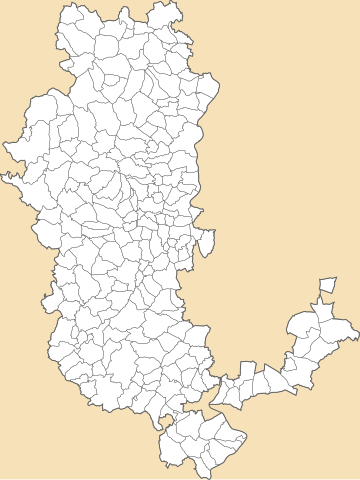
| 19:30, 21 January 2015 |  | 512 × 682 (851 KB) | Otourly (talk | contribs) | update | |
| 19:42, 6 January 2015 |  | 512 × 682 (863 KB) | Otourly (talk | contribs) | - Métropole de Lyon | |
| 15:35, 30 December 2014 |  | 512 × 682 (1,023 KB) | Otourly (talk | contribs) | + Communes fusionnées depuis 2011 | |
| 15:07, 30 December 2014 |  | 512 × 682 (1.01 MB) | Otourly (talk | contribs) | User created page with UploadWizard |
You cannot overwrite this file.
File usage on Commons
The following page uses this file:
- File:Municipalities of Rhone in 2015 location map.svg (file redirect)
File usage on other wikis
The following other wikis use this file:
- Usage on eu.wikipedia.org
- Usage on frp.wikipedia.org
- Usage on fr.wikipedia.org
- Usage on fr.wikinews.org
- Usage on pl.wikibooks.org
- Usage on ru.wikipedia.org