Category:Blank maps of departments of France with communes
Jump to navigation
Jump to search
| NO WIKIDATA ID FOUND! Search for Blank maps of departments of France with communes on Wikidata | |
| Upload media |

Media in category "Blank maps of departments of France with communes"
The following 117 files are in this category, out of 117 total.
-
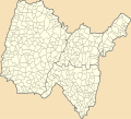
 Blank Map of Ain Department, France, with Communes.svg 1,000 × 908; 155 KB
-
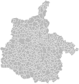
 Blank Map of Aisne Department, France, with Communes.svg 1,000 × 1,459; 284 KB
-
 Blank Map of Allier Department, France, with Communes.svg 1,000 × 732; 147 KB
-
 Blank Map of Alpes-de-Haute-Provence Department, France, with Communes.svg 1,000 × 940; 98 KB
-
 Blank Map of Alpes-Maritimes Department, France, with Communes.svg 1,000 × 1,132; 70 KB
-
 Blank Map of Ardennes Department, France, with Communes.svg 1,000 × 1,064; 207 KB
-
 Blank Map of Ardèche Department, France, with Communes.svg 1,000 × 1,516; 145 KB
-
 Blank Map of Ariège Department, France, with Communes.svg 1,000 × 752; 126 KB
-
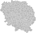
 Blank Map of Aube Department, France, with Communes.svg 1,000 × 806; 200 KB
-
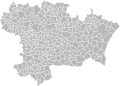 Blank Map of Aude Department, France, with Communes.svg 1,000 × 715; 165 KB
-
 Blank Map of Aveyron Department, France, with Communes.svg 1,000 × 1,083; 403 KB
-
 Blank Map of Bas-Rhin Department, France, with Communes.svg 1,000 × 1,122; 157 KB
-
 Blank Map of Bouches-du-Rhône Department, France, with Communes.svg 1,000 × 663; 60 KB
-
 Blank Map of Calvados Department, France, with Communes.svg 1,000 × 645; 244 KB
-
 Blank Map of Cantal Department, France, with Communes.svg 1,067 × 999; 366 KB
-
 Blank Map of Charente Department, France, with Communes.svg 1,000 × 963; 156 KB
-
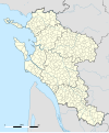
 Blank Map of Charente-Maritime Department, France, with Communes.svg 1,000 × 1,170; 191 KB
-
 Blank Map of Cher Department, France, with Communes.svg 1,000 × 1,358; 133 KB
-
 Blank Map of Corrèze Department, France, with Communes.svg 1,000 × 921; 135 KB
-
 Blank Map of Corse-du-Sud Department, France, with Communes.svg 1,000 × 1,577; 66 KB
-
 Blank Map of Creuse Department, France, with Communes.svg 1,000 × 922; 131 KB
-
 Blank Map of Côte-d'Or Department, France, with Communes.svg 1,000 × 1,150; 267 KB
-
 Blank Map of Côtes-d'Armor Department, France, with Communes.svg 529 × 398; 189 KB
-
 Blank Map of Deux-Sèvres Department, France, with Communes.svg 1,000 × 1,476; 127 KB
-
 Blank Map of Dordogne Department, France, with Communes.svg 1,000 × 1,088; 224 KB
-
 Blank Map of Doubs Department, France, with Communes.svg 1,000 × 1,106; 203 KB
-
 Blank Map of Drôme Department, France, with Communes.svg 1,000 × 1,461; 148 KB
-
 Blank Map of Essonne Department, France, with Communes.svg 1,000 × 1,110; 71 KB
-
 Blank Map of Eure Department, France, with Communes.svg 1,000 × 829; 272 KB
-
 Blank Map of Eure-et-Loir Department, France, with Communes.svg 1,000 × 1,203; 159 KB
-
 Blank Map of Finistère Department, France, with Communes.svg 343 × 291; 160 KB
-
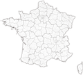
 Blank map of France, with communes and departments.svg 1,000 × 900; 14.7 MB
-
 Blank Map of Gard Department, France, with Communes.svg 1,000 × 877; 142 KB
-
 Blank Map of Gers Department, France, with Communes.svg 1,000 × 716; 186 KB
-
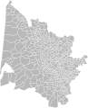 Blank Map of Gironde Department, France, with Communes.svg 1,000 × 1,234; 205 KB
-
 Blank Map of Guadeloupe Department, France, with Communes.svg 512 × 443; 12 KB
-
 Blank Map of Guyane Department, France, with Communes.svg 512 × 620; 54 KB
-
 Blank Map of Haut-Rhin Department, France, with Communes.svg 1,000 × 1,702; 128 KB
-
 Blank Map of Haute-Corse Department, France, with Communes.svg 1,000 × 1,618; 92 KB
-
 Blank Map of Haute-Garonne Department, France, with Communes.svg 1,000 × 1,051; 214 KB
-
 Blank Map of Haute-Loire Department, France, with Communes.svg 1,000 × 690; 123 KB
-
 Blank Map of Haute-Marne Department, France, with Communes.svg 1,000 × 1,318; 298 KB
-
 Blank Map of Haute-Savoie Department, France, with Communes.svg 1,000 × 844; 110 KB
-
 Blank Map of Haute-Saône Department, France, with Communes.svg 1,000 × 786; 172 KB
-
 Blank Map of Haute-Vienne Department, France, with Communes.svg 1,000 × 1,082; 111 KB
-
 Blank Map of Hautes-Alpes Department, France, with Communes.svg 1,000 × 797; 80 KB
-
 Blank Map of Hautes-Pyrénées Department, France, with Communes.svg 1,000 × 1,318; 158 KB
-
 Blank Map of Hauts-de-Seine Department, France, with Communes.svg 1,000 × 1,770; 10 KB
-
 Blank Map of Hérault Department, France, with Communes.svg 1,000 × 632; 145 KB
-
 Blank Map of Ille-et-Vilaine Department, France, with Communes.svg 556 × 710; 185 KB
-
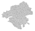
 Blank Map of Indre Department, France, with Communes.svg 1,000 × 1,016; 113 KB
-
 Blank Map of Indre-et-Loire Department, France, with Communes.svg 1,000 × 1,091; 121 KB
-
 Blank Map of Isère Department, France, with Communes.svg 1,000 × 1,043; 196 KB
-
 Blank Map of Jura Department, France, with Communes.svg 1,000 × 1,599; 183 KB
-
 Blank Map of Landes Department, France, with Communes.svg 1,000 × 873; 142 KB
-
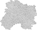
 Blank Map of Loir-et-Cher Department, France, with Communes.svg 1,000 × 842; 122 KB
-
 Blank Map of Loire Department, France, with Communes.svg 1,000 × 1,402; 134 KB
-
 Blank Map of Loire-Atlantique Department, France, with Communes.svg 696 × 613; 121 KB
-
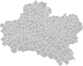 Blank Map of Loiret Department, France, with Communes.svg 1,000 × 796; 138 KB
-
 Blank Map of Lot Department, France, with Communes.svg 1,000 × 961; 139 KB
-
 Blank Map of Lot-et-Garonne Department, France, with Communes.svg 1,000 × 907; 128 KB
-
 Blank Map of Lozère Department, France, with Communes.svg 1,000 × 1,189; 89 KB
-
 Blank Map of Maine-et-Loire Department, France, with Communes.svg 1,000 × 780; 122 KB
-
 Blank Map of Manche Department, France, with Communes.svg 623 × 996; 164 KB
-
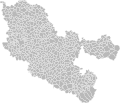
 Blank Map of Marne Department, France, with Communes.svg 1,000 × 828; 282 KB
-
 Blank Map of Martinique Department, France, with Communes.svg 512 × 600; 11 KB
-
 Blank Map of Mayenne Department, France, with Communes.svg 1,000 × 1,010; 140 KB
-
 Blank Map of Mayotte Department, France, with Communes.svg 512 × 678; 5 KB
-
 Blank Map of Meurthe-et-Moselle Department, France, with Communes.svg 1,000 × 1,088; 210 KB
-
 Blank Map of Meuse Department, France, with Communes.svg 1,000 × 1,908; 194 KB
-
 Blank Map of Morbihan Department, France, with Communes.svg 486 × 423; 146 KB
-
 Blank Map of Moselle Department, France, with Communes.svg 1,000 × 859; 318 KB
-
 Blank Map of Nièvre Department, France, with Communes.svg 1,000 × 992; 143 KB
-
 Blank Map of Nord Department, France, with Communes.svg 1,000 × 813; 224 KB
-
 Blank Map of Oise Department, France, with Communes.svg 1,000 × 729; 239 KB
-
 Blank Map of Orne Department, France, with Communes.svg 1,000 × 652; 198 KB
-
 Blank Map of Paris Department, France, with Arrondissements.svg 1,000 × 537; 6 KB
-
 Blank Map of Pas-de-Calais Department, France, with Communes.svg 1,000 × 950; 295 KB
-
 Blank Map of Puy-de-Dôme Department, France, with Communes.svg 1,000 × 870; 198 KB
-
 Blank Map of Pyrénées-Atlantiques Department, France, with Communes.svg 1,000 × 618; 213 KB
-
 Blank Map of Pyrénées-Orientales Department, France, with Communes.svg 1,000 × 547; 84 KB
-
 Blank Map of Rhône Department, France, with Communes.svg 1,000 × 1,334; 103 KB
-
 Blank Map of Réunion Department, France, with Communes.svg 512 × 454; 10 KB
-
 Blank Map of Sarthe Department, France, with Communes.svg 1,000 × 1,003; 188 KB
-
 Blank Map of Savoie Department, France, with Communes.svg 1,000 × 810; 113 KB
-
 Blank Map of Saône-et-Loire Department, France, with Communes.svg 1,000 × 790; 232 KB
-
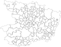
 Blank Map of Seine-et-Marne Department, France, with Communes.svg 1,000 × 1,296; 194 KB
-
 Blank Map of Seine-Maritime Department, France, with Communes.svg 1,000 × 735; 309 KB
-
 Blank Map of Seine-Saint-Denis Department, France, with Communes.svg 1,000 × 992; 13 KB
-
 Blank Map of Somme Department, France, with Communes.svg 1,000 × 677; 264 KB
-
 Blank Map of Tarn Department, France, with Communes.svg 1,000 × 809; 141 KB
-
 Blank Map of Tarn-et-Garonne Department, France, with Communes.svg 1,000 × 692; 83 KB
-
 Blank Map of Territoire de Belfort Department, France, with Communes.svg 1,000 × 1,509; 32 KB
-
 Blank Map of Val-d'Oise Department, France, with Communes.svg 1,000 × 509; 62 KB
-
 Blank Map of Val-de-Marne Department, France, with Communes.svg 1,000 × 857; 14 KB
-
 Blank Map of Var Department, France, with Communes.svg 1,000 × 889; 74 KB
-
 Blank Map of Vaucluse Department, France, with Communes.svg 1,000 × 968; 60 KB
-
 Blank Map of Vendée Department, France, with Communes.svg 821 × 550; 149 KB
-
 Blank Map of Vienne Department, France, with Communes.svg 1,000 × 1,247; 132 KB
-
 Blank Map of Vosges Department, France, with Communes.svg 1,000 × 582; 188 KB
-
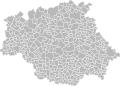
 Blank Map of Yonne Department, France, with Communes.svg 1,000 × 1,085; 180 KB
-
 Blank Map of Yvelines Department, France, with Communes.svg 1,000 × 1,253; 92 KB
-
 Cartes des communes de l'Indre (36).jpg 1,000 × 1,016; 149 KB
-
 Charente-Maritime Communes map.svg 512 × 615; 4.06 MB
-
 Communes du Haut-Rhin.svg 441 × 722; 1.19 MB
-
 Frankreich Gemeinden 2018.png 4,000 × 3,584; 5.41 MB
-
 Frankreich Gemeinden 2019.png 4,000 × 3,584; 5.39 MB
-
 Frankreich Gemeinden 2021.png 4,000 × 3,584; 5.39 MB
-
 Frankreich Gemeinden 2022.png 4,000 × 3,584; 5.18 MB
-
 Frankreich Gemeinden 2023.png 4,000 × 3,584; 5.18 MB
-
 Frankreich Gemeinden 2024.png 4,000 × 3,858; 5.65 MB
-
 Inondations d'octobre 2015 dans les Alpes-Maritimes Map.svg 1,000 × 1,132; 75 KB
-
 Maine-et-Loire administrative map-blank.svg 1,197 × 936; 6.12 MB
-
 Municipalities of Ain in 2011 location map.svg 1,000 × 908; 220 KB
-
 Municipalities of Rhone in 2011 location map.svg 512 × 682; 1,009 KB
-
 Municipalities of Rhone in 2011 map-blank.svg 512 × 682; 893 KB
-
 Municipalities of Rhone location map.svg 712 × 948; 842 KB
.jpg)


