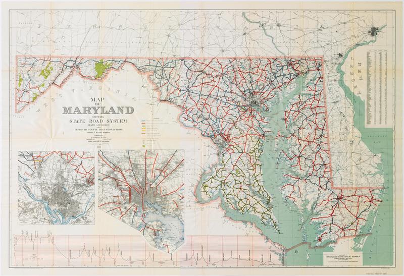
File:Maryland State Highway Map - 1933.pdf

Original file (7,745 × 5,291 pixels, file size: 13.45 MB, MIME type: application/pdf)
Captions
Captions
Summary
[edit]| DescriptionMaryland State Highway Map - 1933.pdf |
English: This PDF document is a scanned 1933 road map of the state of Maryland. |
| Date | |
| Source | Maryland State Roads Commission |
| Author | Maryland State Highway Administration |
| Permission (Reusing this file) |
I was informed by a member of the Office of Communications of the Maryland State Highway Administration that this map is in the public domain and may be redistributed. |
Licensing
[edit]| Public domainPublic domainfalsefalse |
This work is in the public domain because it was published in the United States between 1929 and 1963, and although there may or may not have been a copyright notice, the copyright was not renewed. For further explanation, see Commons:Hirtle chart and the copyright renewal logs.
Note that it may still be copyrighted in jurisdictions that do not apply the rule of the shorter term for US works (depending on the date of the author's death), such as Canada (70 years p.m.a.), Mainland China (50 years p.m.a., not Hong Kong or Macao), Germany (70 years p.m.a.), Mexico (100 years p.m.a.), Switzerland (70 years p.m.a.), and other countries with individual treaties. العربية ∙ Deutsch ∙ English ∙ español ∙ français ∙ galego ∙ italiano ∙ 日本語 ∙ 한국어 ∙ македонски ∙ português ∙ português do Brasil ∙ русский ∙ sicilianu ∙ slovenščina ∙ українська ∙ 简体中文 ∙ 繁體中文 ∙ +/− |
File history
Click on a date/time to view the file as it appeared at that time.
| Date/Time | Thumbnail | Dimensions | User | Comment | |
|---|---|---|---|---|---|
| current | 00:06, 15 December 2009 |  | 7,745 × 5,291 (13.45 MB) | Viridiscalculus (talk | contribs) | (({{Information |Description={{en|1=This PDF document is a scanned 1933 road map of the state of Maryland.}} |Source=Maryland State Roads Commission |Author=Maryland State Highway Administration |Date=1933-01-01 |Permission=I was informed by a member of t |
| 01:48, 13 November 2009 |  | 7,745 × 5,291 (13.45 MB) | Viridiscalculus (talk | contribs) | I uploaded the wrong map the first time. | |
| 01:47, 13 November 2009 | No thumbnail | 0 × 0 (1.49 MB) | Viridiscalculus (talk | contribs) | {{Information |Description={{en|1=This PDF document is a scanned 1933 road map of the state of Maryland.}} |Source=Maryland State Roads Commission |Author=Maryland State Highway Administration |Date=1933-01-01 |Permission=I was informed by a member of the |
You cannot overwrite this file.
File usage on Commons
There are no pages that use this file.
Metadata
This file contains additional information such as Exif metadata which may have been added by the digital camera, scanner, or software program used to create or digitize it. If the file has been modified from its original state, some details such as the timestamp may not fully reflect those of the original file. The timestamp is only as accurate as the clock in the camera, and it may be completely wrong.
| File change date and time | 11:47, 8 January 2008 |
|---|---|
| Date and time of digitizing | 11:47, 8 January 2008 |
| Date metadata was last modified | 11:47, 8 January 2008 |
| Software used | Adobe Acrobat 7.08 |
| Conversion program | Adobe Acrobat 7.08 Image Conversion Plug-in |
| Encrypted | no |
| Page size | 3718.56 x 2540.88 pts |
| Version of PDF format | 1.6 |
