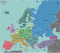
File:Europe regions.svg
From Wikimedia Commons, the free media repository
Jump to navigation
Jump to search

Size of this PNG preview of this SVG file: 688 × 599 pixels. Other resolutions: 276 × 240 pixels | 551 × 480 pixels | 881 × 768 pixels | 1,175 × 1,024 pixels | 2,350 × 2,048 pixels | 1,500 × 1,307 pixels.
Original file (SVG file, nominally 1,500 × 1,307 pixels, file size: 1.4 MB)
File information
Structured data
Captions
Captions
Add a one-line explanation of what this file represents
Summary
[edit]| DescriptionEurope regions.svg | Map of Europe for use on Wikivoyage, multilingual SVG source |
| Date | |
| Source | Own work based on the blank map of Europe by Historicair |
| Author | Stefan Ertmann, Dutch translation by Globe-trotter, French translation by Joelf, Russian translation by Alexander Tsirlin, Ukrainian translation by Vladimirs Metencuks |
| Other versions |
[edit]
Notes:
|
| Other information InfoField |
Licensing
[edit]
|
Permission is granted to copy, distribute and/or modify this document under the terms of the GNU Free Documentation License, Version 1.2 or any later version published by the Free Software Foundation; with no Invariant Sections, no Front-Cover Texts, and no Back-Cover Texts. A copy of the license is included in the section entitled GNU Free Documentation License.http://www.gnu.org/copyleft/fdl.htmlGFDLGNU Free Documentation Licensetruetrue |
This file is licensed under the Creative Commons Attribution-Share Alike 4.0 International, 3.0 Unported, 2.5 Generic, 2.0 Generic and 1.0 Generic license.
- You are free:
- to share – to copy, distribute and transmit the work
- to remix – to adapt the work
- Under the following conditions:
- attribution – You must give appropriate credit, provide a link to the license, and indicate if changes were made. You may do so in any reasonable manner, but not in any way that suggests the licensor endorses you or your use.
- share alike – If you remix, transform, or build upon the material, you must distribute your contributions under the same or compatible license as the original.
Original upload log
[edit]| This file was imported from Wikivoyage WTS. |
The original description page was here. All following user names refer to wts.wikivoyage-old.
- 2009-02-01 05:54 (WT-shared) Sertmann[dead link] 1500×1307 (831123 bytes) {{Imagecredit|credit=Stefan Ertmann|captureDate=January 2008|location=Europe|source=http://commons.wikimedia.org/wiki/File:Blank_map_of_Euro (Import from wikitravel.org/shared)
- 2009-02-01 18:03 (WT-shared) Sertmann[dead link] 1500×1307 (849820 bytes) (Import from wikitravel.org/shared)
- 2009-02-01 19:44 (WT-shared) Sertmann[dead link] 1500×1307 (851299 bytes) (Import from wikitravel.org/shared)
- 2010-10-29 03:44 (WT-shared) Joelf[dead link] 1500×1307 (800252 bytes) (Import from wikitravel.org/shared)
- 2011-01-06 03:15 (WT-shared) Joelf[dead link] 1500×1307 (800252 bytes) +fr; switched France to a different color as a separate region from Benelux. (Import from wikitravel.org/shared)
- 2011-06-11 21:34 (WT-shared) Peterfitzgerald archive copy at the Wayback Machine 1500×1307 (827581 bytes) en typo (Import from wikitravel.org/shared)
- 2011-08-02 01:41 (WT-shared) Globe-trotter[dead link] 1500×1307 (827602 bytes) changed the color of France to make it match the colors of the USA map (Import from wikitravel.org/shared)
- 2012-01-22 15:57 (WT-shared) Globe-trotter[dead link] 1500×1307 (983059 bytes) +nl, other minor changes (Import from wikitravel.org/shared)
- 2012-09-06 20:12 Atsirlin[dead link] 1500×1307 (1178957 bytes) +ru, cleanup
- 2012-09-19 19:37 Globe-trotter[dead link] 1500×1307 (1183979 bytes) SVG in English
File history
Click on a date/time to view the file as it appeared at that time.
| Date/Time | Thumbnail | Dimensions | User | Comment | |
|---|---|---|---|---|---|
| current | 06:23, 30 March 2021 |  | 1,500 × 1,307 (1.4 MB) | Sbb1413 (talk | contribs) | Alt name Kyiv. |
| 08:15, 24 May 2016 |  | 1,500 × 1,307 (1.44 MB) | Ricordisamoa (talk | contribs) | remove flowRoot (black rect) | |
| 21:18, 26 June 2013 |  | 1,500 × 1,307 (1.44 MB) | Tzafrir (talk | contribs) | One Hebrew string was accidentally left untraslateed in the previous upload. | |
| 05:30, 25 June 2013 |  | 1,500 × 1,307 (1.44 MB) | Tzafrir (talk | contribs) | Hebrew ("he") translations added | |
| 21:46, 1 February 2013 |  | 1,500 × 1,307 (1.28 MB) | Voll (talk | contribs) | Ukrainian translations was added to the file ~~~~ | |
| 15:08, 21 November 2012 |  | 1,500 × 1,307 (1.13 MB) | OgreBot (talk | contribs) | (BOT): Reverting to most recent version before archival | |
| 15:08, 21 November 2012 |  | 1,500 × 1,307 (1.12 MB) | OgreBot (talk | contribs) | (BOT): Uploading old version of file from wts.wikivoyage-old; originally uploaded on 2012-09-06 20:12:21 by Atsirlin | |
| 15:08, 21 November 2012 |  | 1,500 × 1,307 (960 KB) | OgreBot (talk | contribs) | (BOT): Uploading old version of file from wts.wikivoyage-old; originally uploaded on 2012-01-22 15:57:35 by (WT-shared) Globe-trotter | |
| 15:07, 21 November 2012 |  | 1,500 × 1,307 (808 KB) | OgreBot (talk | contribs) | (BOT): Uploading old version of file from wts.wikivoyage-old; originally uploaded on 2011-08-02 01:41:47 by (WT-shared) Globe-trotter | |
| 15:07, 21 November 2012 |  | 1,500 × 1,307 (808 KB) | OgreBot (talk | contribs) | (BOT): Uploading old version of file from wts.wikivoyage-old; originally uploaded on 2011-06-11 21:34:14 by (WT-shared) Peterfitzgerald |
You cannot overwrite this file.
File usage on Commons
The following 25 pages use this file:
- User:Chumwa/OgreBot/Transport Maps/2021 March 21-31
- User:Chumwa/OgreBot/Travel and communication maps/2016 May 21-31
- User:Chumwa/OgreBot/Travel and communication maps/2021 March 21-31
- File:Europe regions(ja).png
- File:Europe regions(pt).png
- File:Europe regions(sv).png
- File:Europe regions.png
- File:Europe regions.svg
- File:Europe regions (cs).svg
- File:Europe regions (fi).png
- File:Europe regions (fr).png
- File:Europe regions (nl).png
- File:Europe regions (ru).png
- File:Europe regions (sr).png
- File:Europe regions (uk).png
- File:Europe regions (zh-hans)-欧洲全图.png
- File:Europe regions AR.svg
- File:Europe regions minimal cities.png
- File:Europe regions minimal cities.svg
- File:Europe regions minimal cities (az).svg
- File:Europe regions minimal cities (it).png
- File:Europe regions minimal cities hi.svg
- File:Map of Europe.svg (file redirect)
- File:خريطة اوروبا السياسية.png
- Template:Other versions/Europe regions
File usage on other wikis
The following other wikis use this file:
- Usage on bg.wikipedia.org
- Usage on en.wikipedia.org
- Anastaseos tou Kyriou
- Assistens Cemetery
- Osobowice Cemetery
- Aşiyan Asri Cemetery
- Hietzing Cemetery
- Saburtalo Pantheon
- Didube Pantheon
- French Military Cemetery, Korçë
- Limassol Armenian cemetery
- Brno Ossuary
- Jewish Cemetery of Diemen
- Eternitatea cemetery
- Jewish Cemetery, Tarnobrzeg
- Uppsala Old Cemetery
- Partisan cemetery in Livno
- Agios Georgios Kontou cemetery
- Ostrusha mound
- Chełm-Gdańsk Cemetery
- Łostowicki cemetery
- Miikse graveyard
- Hajongard cemetery
- Template:Europe-cemetery-stub
- Red Farm Military Cemetery
- Służew New Cemetery
- Usage on es.wikipedia.org
- Usage on incubator.wikimedia.org
- Usage on mk.wikipedia.org
Metadata
This file contains additional information such as Exif metadata which may have been added by the digital camera, scanner, or software program used to create or digitize it. If the file has been modified from its original state, some details such as the timestamp may not fully reflect those of the original file. The timestamp is only as accurate as the clock in the camera, and it may be completely wrong.
| Width | 1499.9186 |
|---|---|
| Height | 1306.6454 |


