Category:Travel maps of Europe
Jump to navigation
Jump to search
Subcategories
This category has the following 54 subcategories, out of 54 total.
+
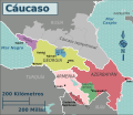
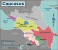
- Travel maps of Caucasus (4 F)
A
- Travel maps of Abkhazia (2 F)
B
C
D
E
F
G
- Travel maps of Gibraltar (2 F)
H
I
K
L
M
N
P
R
- Route maps in Europe (3 F)
S
T
U
V
Media in category "Travel maps of Europe"
The following 126 files are in this category, out of 126 total.
-
 2016-08 Frachtschiffreise MS Dornbusch Einfahrt Ahus.jpg 881 × 632; 317 KB
-
 2016-08 Frachtschiffreise MS Dornbusch Einfahrt Bremerhaven.jpg 1,087 × 749; 653 KB
-
 2016-08 Frachtschiffreise MS Dornbusch Einfahrt Stockholm.jpg 1,540 × 742; 828 KB
-
 2016-08 Frachtschiffreise MS Dornbusch Einfahrt Södertälje.jpg 550 × 886; 390 KB
-
 2016-08 Frachtschiffreise MS Dornbusch Reiseroute.jpg 563 × 543; 244 KB
-
 2016-08 Frachtschiffreise MS Dornbusch Start-Ziel Hamburg.jpg 1,233 × 777; 884 KB
-
-
 Alpenregionen.png 2,000 × 1,472; 428 KB
-
 Alps regions.png 2,000 × 1,472; 390 KB
-
 Alps regions.svg 406 × 299; 456 KB
-

-
 Balkans regions map (cs).png 1,879 × 1,413; 554 KB
-
 Balkans regions map(pt).png 2,007 × 1,510; 657 KB
-
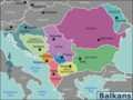 Balkans regions map.png 2,000 × 1,504; 771 KB
-
 Balkans regions map.svg 37 × 28; 3.47 MB
-
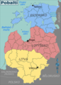 Baltic States map (cs).png 1,552 × 2,157; 1.16 MB
-
 Baltic states regions map ru.png 2,000 × 2,836; 2.09 MB
-
 Baltic states regions map(pt).png 1,655 × 2,301; 1,022 KB
-
 Baltic states regions map.png 1,704 × 1,363; 654 KB
-
 Baltic states regions map.svg 1,832 × 2,670; 1.52 MB
-
 Baltics (ru).png 1,704 × 1,363; 659 KB
-
 Baltics (uk).png 1,704 × 1,363; 647 KB
-
 Benelux regions map (cs).png 1,281 × 1,658; 260 KB
-
 Benelux regions map (ru).png 1,367 × 1,769; 278 KB
-
 Benelux(pt).png 1,367 × 1,769; 282 KB
-
 Benelux-map (he).png 1,367 × 1,769; 223 KB
-
 Benelux-map (ja).png 1,367 × 1,769; 293 KB
-
 Benelux-map hi.svg 1,367 × 1,769; 1.57 MB
-
 Benelux-map.svg 1,367 × 1,769; 1.57 MB
-
 Benelux.png 1,367 × 1,769; 278 KB
-
 Caminho de Edith.PNG 450 × 422; 16 KB
-

-
 Cartina La tregua - Primo Levi.gif 1,066 × 707; 296 KB
-
 Caucasus region map (it).svg 1,717 × 1,664; 797 KB
-
 Caucasus regions map (cs).png 1,638 × 1,376; 461 KB
-
 Caucasus regions map (ru).png 2,000 × 2,325; 901 KB
-
 Caucasus regions map ka.svg 2,006 × 1,618; 151 KB
-
 Caucasus regions map(pt).png 982 × 793; 279 KB
-
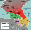
 Caucasus regions map.png 2,000 × 1,614; 662 KB
-
 Caucasus regions map.svg 982 × 946; 905 KB
-
 Caucasus regions map2 ru.svg 874 × 751; 1.11 MB
-
 Caucasus regions map2-es.svg 874 × 751; 1.8 MB
-
 Caucasus regions map2.png 2,070 × 1,789; 515 KB
-
 Caucasus regions map2.svg 874 × 751; 1.16 MB
-
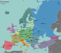
 Central Europe Regions (cs).png 2,013 × 1,681; 640 KB
-
 Central Europe Regions (eo).png 2,137 × 1,784; 603 KB
-
 Central Europe Regions (pl).svg 1,069 × 892; 380 KB
-
 Central Europe Regions(it).png 1,074 × 895; 289 KB
-
 Central Europe Regions(pt).png 2,137 × 1,784; 647 KB
-
 Central Europe Regions.png 2,137 × 1,784; 634 KB
-
 Central Europe Regions.svg 1,069 × 892; 381 KB
-
 Colin and Julie's route through the Mediterranean.jpg 4,559 × 1,382; 1.39 MB
-
 DESTINO IBERIA EUROPA.gif 720 × 360; 19 KB
-
 DeWaal.jpg 1,280 × 1,041; 93 KB
-
 Déplacements et séjours de Marie-Thérèse de France en Europe de 1795 à 1814.png 1,129 × 764; 2.22 MB
-
 Eastern Europe regions (cs).png 1,034 × 1,183; 234 KB
-
 Eastern Europe regions.png 1,000 × 1,188; 237 KB
-
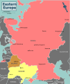 Eastern Europe regions.svg 800 × 950; 1,016 KB
-
 Eurohierarchy.png 1,000 × 743; 136 KB
-
 Eurohierarchy2.png 1,000 × 743; 187 KB
-
 Eurohierarchy4.png 1,000 × 743; 186 KB
-
 Europe alcohol belts.png 689 × 599; 98 KB
-
 Europe alcohol belts.svg 1,500 × 1,307; 792 KB
-
 Europe regions (fi).png 1,500 × 1,308; 452 KB
-
 Europe regions (fr).png 2,000 × 1,743; 812 KB
-
 Europe regions (nl).png 2,000 × 1,743; 816 KB
-
 Europe regions (ru).png 2,000 × 1,743; 813 KB
-
 Europe regions (sr).png 2,000 × 1,743; 813 KB
-
 Europe regions (uk).png 2,000 × 1,743; 803 KB
-
 Europe regions (zh-hans)-欧洲全图.png 1,500 × 1,305; 591 KB
-
 Europe regions minimal cities (az).svg 1,500 × 1,307; 1.51 MB
-
 Europe regions minimal cities (eo).png 1,500 × 1,307; 528 KB
-
 Europe regions minimal cities (he).png 1,500 × 1,307; 500 KB
-
 Europe regions minimal cities (it).png 3,000 × 2,613; 1.22 MB
-
 Europe regions minimal cities hi.svg 1,500 × 1,307; 1.5 MB
-
 Europe regions minimal cities--mod Latin Europe.png 3,000 × 2,610; 1.2 MB
-
 Europe regions minimal cities--mod Latin Europe.svg 1,600 × 1,394; 1.53 MB
-
 Europe regions minimal cities.png 1,500 × 1,307; 507 KB
-
 Europe regions minimal cities.svg 1,500 × 1,307; 465 KB
-
 Europe regions(ja).png 1,500 × 1,305; 609 KB
-
 Europe regions(pt).png 1,500 × 1,305; 622 KB
-
 Europe regions(sv).png 1,500 × 1,307; 622 KB
-
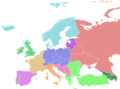
 Europe regions.png 2,000 × 1,743; 815 KB
-
 Europe regions.svg 1,500 × 1,307; 1.4 MB
-
 Flight of Earls (1607).svg 800 × 770; 2.76 MB
-
 Flugroute von Mathias Rust-en.svg 1,125 × 816; 1.38 MB
-
 Flugroute von Mathias Rust-ru.svg 1,125 × 816; 1.38 MB
-

-
 Heliga Birgittas färder.svg 1,052 × 744; 544 KB
-
 Holiday Again - 2013 - I'm Off for Now (9594753902).jpg 600 × 738; 249 KB
-
 Iberia regions map (cs).png 1,875 × 1,382; 319 KB
-
 Iberia regions map(pt).png 2,000 × 1,475; 314 KB
-
 Iberia regions map.png 1,997 × 1,471; 293 KB
-
 Iberia regions map.svg 644 × 458; 1.45 MB
-
-
 Itinéraire de Champollion et Rossellini 1828.png 935 × 673; 119 KB
-
 Karte Melchior Hofmann.png 1,873 × 1,437; 2.67 MB
-
 KARTE.jpg 2,400 × 1,611; 674 KB
-
 Latin Europe Wikivoyage Map.png 3,000 × 2,100; 818 KB
-
 Latin Europe Wikivoyage Map.svg 802 × 562; 256 KB
-
 Lenin Sealed Train Map-pl.svg 273 × 340; 503 KB
-
 Mitteleuropa BV042512226.jpg 2,649 × 1,858; 867 KB
-
 Northwestern Russia regions (it).png 1,202 × 923; 409 KB
-
 Omar Blondin Diop Carte.jpg 4,200 × 2,550; 2.18 MB
-
 OmarBlondinDiop Déplacements.jpg 11,200 × 6,800; 7.59 MB
-
 OmarBlondinDiop Trajectoire.jpg 11,200 × 6,800; 7.58 MB
-
 Osteuropa BV023236953.jpg 6,882 × 4,403; 2.87 MB
-
 Print, book-illustration, map (BM 1868,0822.4681).jpg 2,065 × 1,541; 684 KB
-
 Scandinavia regions map (cs).png 1,407 × 1,331; 735 KB
-
 Scandinavia regions map.png 1,500 × 1,412; 536 KB
-
 Scandinavia regions map.svg 313 × 294; 965 KB
-
 Scandinavia.png 841 × 731; 176 KB
-
 ScotlandtoSyriamap3.png 3,881 × 2,519; 2.91 MB
-
 Tourist Density DACH 2017.png 1,258 × 1,434; 338 KB
-
 Tourist Density Europe 2017.png 1,200 × 1,001; 76 KB
-
 Transport européen autoroutier 2007.png 1,474 × 1,444; 958 KB
-
 Trasa rejsu Chatki Puchatków przez Europę.jpg 500 × 500; 83 KB
-
 Travel time by car or ferry from the geographical center of Europe.jpg 1,881 × 1,616; 396 KB
-
 Treasurehunt09.png 398 × 286; 13 KB
-
 Willughby ray europe.jpg 510 × 410; 53 KB
-
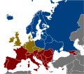
 WV Eastern Europe.svg 990 × 340; 607 KB
-
 中欧地区概图.png 2,137 × 1,784; 679 KB
-
 伊比利亚概图.png 2,000 × 1,475; 284 KB
-
 斯堪的纳维亚概图.png 1,525 × 1,329; 510 KB
-
 比荷卢联盟概图.png 2,457 × 3,180; 719 KB
-
 高加索概图.png 2,070 × 1,789; 549 KB


%27_(11087559484).jpg)


.jpg)
.png)
.png)


.png)

.png)


.png)
.png)
.png)
.png)
.png)
.png)
.png)


..._-_btv1b8444330k.jpg)

.svg)
.png)
.png)

.png)


.png)
.png)
.svg)
.png)
.png)


.png)


.png)
.png)
.png)
.png)
.png)
.png)
-%E6%AC%A7%E6%B4%B2%E5%85%A8%E5%9B%BE.png)
.svg)
.png)
.png)
.png)


.png)
.png)
.png)


.svg)


_(14775900531).jpg)

.jpg)
.png)
.png)


.jpg)


.png)


.jpg)
.png)


