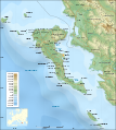
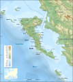
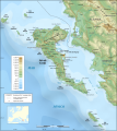
File:Corfu topographic map-es.svg

Original file (SVG file, nominally 2,100 × 2,345 pixels, file size: 2.49 MB)
Captions
Captions
Detailed map of large dimension. For a better viewing, click on the link of the image above.
Mapa detallado de gran dimensión. Para una visualización óptima, cliquea en el enlace de la imagen superior.
Summary
[edit]
|
| DescriptionCorfu topographic map-es.svg |
English: Topographic map in Spanish of the Corfu island area in Greece.
Note : The shaded relief is a raster image embedded in the SVG file. Español: Mapa topográfico en español de la zona de la isla de Corfu en Grecia.
Nota : El relieve con sombra es una imagen de trama integrada al archivo SVG. Français : Carte topographique en français de la zone de l'île de Corfou en Grèce.
Note : Le relief ombré est une image bitmap embarquée dans le fichier SVG. UTM projection ; WGS84 datum ; shaded relief (composite image of N-W, W and N lightning positions) ;
|
||
| Date | March 2007 (modified 09/2008) | ||
| Source |
Own work ;
|
||
| Author | Eric Gaba (Sting - fr:Sting), translated by molorco (molorco) | ||
| Permission (Reusing this file) |
GFDL + CC-BY-SA | ||
| Other versions |
[edit]
|
||
| SVG development InfoField |
|
Licensing
[edit]
|
Permission is granted to copy, distribute and/or modify this document under the terms of the GNU Free Documentation License, Version 1.2 or any later version published by the Free Software Foundation; with no Invariant Sections, no Front-Cover Texts, and no Back-Cover Texts. A copy of the license is included in the section entitled GNU Free Documentation License.http://www.gnu.org/copyleft/fdl.htmlGFDLGNU Free Documentation Licensetruetrue |
| This file is licensed under the Creative Commons Attribution-Share Alike 3.0 Unported license. | ||
| ||
| This licensing tag was added to this file as part of the GFDL licensing update.http://creativecommons.org/licenses/by-sa/3.0/CC BY-SA 3.0Creative Commons Attribution-Share Alike 3.0truetrue |
- You are free:
- to share – to copy, distribute and transmit the work
- to remix – to adapt the work
- Under the following conditions:
- attribution – You must give appropriate credit, provide a link to the license, and indicate if changes were made. You may do so in any reasonable manner, but not in any way that suggests the licensor endorses you or your use.
- share alike – If you remix, transform, or build upon the material, you must distribute your contributions under the same or compatible license as the original.
File history
Click on a date/time to view the file as it appeared at that time.
| Date/Time | Thumbnail | Dimensions | User | Comment | |
|---|---|---|---|---|---|
| current | 23:42, 4 September 2008 |  | 2,100 × 2,345 (2.49 MB) | Sting (talk | contribs) | Using bathymetry from ETOPO1 ; new standard colors |
| 17:13, 29 October 2007 |  | 2,100 × 2,345 (3.19 MB) | Sting (talk | contribs) | "Pavllo" river name correction | |
| 21:00, 1 October 2007 |  | 2,100 × 2,345 (3.19 MB) | Molorco (talk | contribs) | <br/> <div style="background:#ffffd9; border:1px solid #aaaaaa;" align="left" cellpadding="7" cellspacing="1" width="100%"> <div style="float:left; margin: 0.4em;"> 28px|Para agrandar la imagen </div> <small> ''Detailed map of l |
You cannot overwrite this file.
File usage on Commons
The following 14 pages use this file:
- File:Corfu topographic map-Stad.PNG
- File:Corfu topographic map-be.svg
- File:Corfu topographic map-blank.svg
- File:Corfu topographic map-de.svg
- File:Corfu topographic map-el.svg
- File:Corfu topographic map-en.svg
- File:Corfu topographic map-en librsvg.png
- File:Corfu topographic map-en rendersvg.png
- File:Corfu topographic map-es.svg
- File:Corfu topographic map-fr.svg
- File:Corfu topographic map-hu.svg
- File:Corfu topographic map-mk.svg
- File:Corfu topographic map-nb.svg
- Template:Other versions/Corfu topographic map
File usage on other wikis
The following other wikis use this file:
- Usage on ar.wikipedia.org
- Usage on bg.wikipedia.org
- Usage on es.wikipedia.org
- Corfú
- Butrinto
- Historia de Corfú
- Batalla de Síbota
- Wikipedia:Recurso del día/abril de 2008
- Wikipedia:Candidatos a recursos destacados/Corfu topographic map-es.svg
- Plantilla:RDD/102
- Wikipedia:Imágenes destacadas/Diagramas, dibujos y mapas
- Paxoí
- Antípaxos
- Wikipedia:Recurso del día/101 - 200
- Wikipedia:Recurso del día/enero de 2009
- Wikipedia:Recurso del día/marzo de 2010
- Estrechos de Corfú
- Erikusa
- Ozoní
- Mazraki
- Diapondia
- Wikipedia:Recurso del día/septiembre de 2011
- Wikipedia:Recurso del día/septiembre de 2013
- Wikipedia:Recurso del día/abril de 2016
- Wikipedia:Recurso del día/junio de 2018
- Wikipedia:Recurso del día/octubre de 2020
- Wikipedia:Recurso del día/septiembre de 2023
- Usage on hu.wikipedia.org
- Usage on hyw.wikipedia.org
- Usage on pl.wikipedia.org
- Usage on sr.wikipedia.org
- Usage on www.wikidata.org
Structured data
Elementos representados en este archivo
depicts
image/svg+xml
835cbb08c5d0176f61090d5312335238d5e454fc
2,607,687 byte
2,345 pixel
2,100 pixel
- Featured pictures on Wikipedia, Spanish
- Files with Assessments template missing SDC Commons no value quality assessment
- SVG created with Inkscape:Important
- Invalid SVG created with Inkscape:Maps
- SVG maps:Translation possible
- Map Lab-fr
- SVG maps with topographic raster graphics
- License migration redundant
- GFDL
- CC-BY-SA-3.0-migrated
- CC-BY-SA-2.5,2.0,1.0
- Self-published work


