Category:SVG maps with topographic raster graphics
Jump to navigation
Jump to search
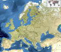
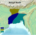
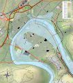
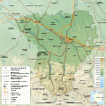
Maps in this category contain various types of terrain cartography to show their topographic structures.
When used for that purpose, embedding raster graphics is an option of SVG too difficult to be replaced by other methods; it is neither an error, nor something needing cleanup.
Files are categorized therein with Template:TopoSVG (the Template:Image generation does it with the parameter !=t)
Media in category "SVG maps with topographic raster graphics"
The following 200 files are in this category, out of 659 total.
(previous page) (next page)-
1918 Flu pandemic-en.svg 560 × 375; 224 KB
-
2012 Summer Olympics torch relay map.svg 512 × 1,024; 541 KB
-
20200203142615!Maarat Al-Numan Offensive (jan 2020).svg 1,647 × 2,740; 9.39 MB
-
2022 Russian invasion of Ukraine - de.svg 1,449 × 974; 1.95 MB
-
2022 Winter Olympics clusters location map-en.svg 1,747 × 1,421; 5.27 MB
-
2022 Winter Olympics clusters location map-fr.svg 1,747 × 1,421; 5.26 MB
-
2023 Israel–Hamas war - West Bank.svg 4,411 × 8,705; 10.14 MB
-
3.PzDiv - Gefechtsabschnitt.svg 1,087 × 582; 787 KB
-
4U9525 flight path2.svg 900 × 822; 1.33 MB
-
Abies beshanzuensis distribution map.svg 1,241 × 1,177; 1.22 MB
-
Abies cephalonica distribution map.svg 698 × 660; 685 KB
-
Abisko national park map-fr.svg 1,206 × 1,048; 4.02 MB
-
Abkhazia in Asia (relief) (-mini map).svg 1,181 × 1,050; 5.66 MB
-
Abkhazia in Asia (relief) (special marker) (-mini marker).svg 1,181 × 1,050; 5.67 MB
-
Abkhazia in Asia (relief).svg 1,181 × 1,050; 5.63 MB
-
Abkhazia in Europe (blue marble) (de-facto) (-mini map).svg 1,401 × 1,198; 10.89 MB
-
Abkhazia in Europe (blue marble) (de-facto).svg 1,401 × 1,198; 2 MB
-
Abkhazia in Europe (natural) (-mini map).svg 1,401 × 1,198; 7.16 MB
-
Abkhazia in Europe (natural).svg 1,401 × 1,198; 8.42 MB
-
Abkhazia in Europe (relief) (-mini map).svg 1,401 × 1,198; 8.09 MB
-
Abkhazia in Europe (relief).svg 1,401 × 1,198; 8.62 MB
-
Abkhazia map-ab.svg 945 × 737; 810 KB
-
Abkhazia map-es.svg 1,008 × 786; 3.35 MB
-
Abkhazia map-fr librsvg.png 945 × 737; 785 KB
-
Abkhazia map-fr rendersvg.png 945 × 737; 993 KB
-
Abkhazia map-fr.svg 945 × 737; 813 KB
-
Abkhazia map-mk.svg 945 × 737; 786 KB
-
Acadia 1604-1607 topographic map-fr.svg 700 × 640; 422 KB
-
Acadia 1604-1607 topographic map-ru.svg 700 × 640; 412 KB
-
Acadia 1610-1613 topographic map-fr.svg 546 × 403; 553 KB
-
Acadia 1610-1613 topographic map-ru.svg 546 × 403; 547 KB
-
Acadia New Brunswick general map-fr.svg 2,237 × 2,199; 3.9 MB
-
Achaemenid Empire it.svg 1,500 × 680; 2.35 MB
-
Achean league 150aC-it.svg 785 × 509; 6.25 MB
-
Actinote zikani distribution map.svg 1,051 × 1,131; 1.17 MB
-
AD 0412 Four-step Theory of Burgundian Migration - DA.svg 1,142 × 760; 671 KB
-
AD 0412 Four-step Theory of Burgundian Migration - EN.svg 1,142 × 760; 671 KB
-
Administrative areas of New Brunswick topographic map-blank.svg 2,237 × 2,199; 3.75 MB
-
Administrative areas of New Brunswick with First Nations land topographic map-blank.svg 2,237 × 2,199; 3.83 MB
-
Adriatic Sea map mk.svg 673 × 916; 460 KB
-
Aegean sea Anatolia and Armenian highlands regions large topographic basemap.svg 7,409 × 2,600; 21.62 MB
-
Aegean sea and Western Anatolia regions large topographic basemap.svg 4,001 × 2,600; 6.16 MB
-
Aegean Sea map bathymetry-es.svg 3,750 × 4,560; 3.42 MB
-
Aegean Sea map bathymetry-fi.svg 3,750 × 4,560; 3.52 MB
-
Aegean Sea map bathymetry-fr.svg 3,750 × 4,560; 3.57 MB
-
Africa.svg 512 × 641; 3.23 MB
-
Aipysurus foliosquama distribution map.svg 1,984 × 1,780; 1,004 KB
-
Akita-ken géolocalisation relief.svg 1,720 × 2,574; 2.61 MB
-
Albania in Europe (blue marble) (-mini map).svg 1,401 × 1,198; 10.89 MB
-
Albania in Europe (blue marble).svg 1,401 × 1,198; 11.42 MB
-
Albania in Europe (natural) (-mini map).svg 1,401 × 1,198; 7.16 MB
-
Albania in Europe (natural).svg 1,401 × 1,198; 8.42 MB
-
Albania in Europe (relief) (-mini map).svg 1,401 × 1,198; 8.09 MB
-
Albania in Europe (relief).svg 1,401 × 1,198; 8.62 MB
-
Albania map-ce.svg 1,880 × 3,850; 6.84 MB
-
Albania map-de.svg 1,880 × 3,850; 6.17 MB
-
Albania map-en.svg 1,880 × 3,850; 6.17 MB
-
Albania map-fr.svg 1,880 × 3,850; 6.85 MB
-
Albania map-it.svg 1,880 × 3,850; 6.84 MB
-
Albania map-mk.svg 1,880 × 3,850; 7.43 MB
-
Albania map-ru.svg 1,880 × 3,850; 6.85 MB
-
Albania map-sq.svg 1,880 × 3,850; 6.87 MB
-
Aldabra islands seychelles-fr.svg 990 × 502; 302 KB
-
Alger department 1934-1955 map-fr.svg 1,287 × 1,278; 1.79 MB
-
Alpilles topographic map-fr.svg 830 × 511; 1.31 MB
-
Alpilles topographic map-ru.svg 830 × 511; 1.33 MB
-
Amokfahrt von Graz.svg 964 × 654; 1.81 MB
-
Amtrak Adirondack.svg 411 × 800; 675 KB
-
Amtrak Blue Water.svg 800 × 347; 316 KB
-
Amtrak Capitol Corridor.svg 647 × 800; 665 KB
-
Amtrak Cardinal.svg 1,200 × 497; 617 KB
-
Amtrak Pere Marquette.svg 800 × 661; 488 KB
-
Anatolian Plate Vectoral Ar.svg 2,477 × 1,554; 8.62 MB
-
Anatolian Plate Vectoral ku.svg 2,477 × 1,554; 3.07 MB
-
Anatolian Plate Vectoral mk.svg 2,477 × 1,554; 8.69 MB
-
Anatolian Plate Vectoral-tr.svg 2,477 × 1,554; 8.61 MB
-
Anatolian Plate Vectoral.svg 2,477 × 1,554; 8.63 MB
-
Anatolie hittite-es.svg 1,375 × 779; 2 MB
-
Anisolabis seychellensis distribution map.svg 1,045 × 1,254; 1,020 KB
-
Antilophia bokermanni distribution map.svg 1,780 × 1,665; 1.71 MB
-
Apis andreniformis distribution map.svg 863 × 443; 1.85 MB
-
Apis cerana distribution map.svg 863 × 443; 1.85 MB
-
Apis distribution map.svg 863 × 443; 1.85 MB
-
Apis dorsata distribution map.svg 863 × 443; 1.85 MB
-
Apis florea distribution map.svg 863 × 443; 1.85 MB
-
Apis koschevnikovi distribution map.svg 863 × 443; 1.85 MB
-
Apis mellifera distribution map.svg 863 × 443; 1.85 MB
-
Apis nigrocincta distribution map.svg 863 × 443; 1.85 MB
-
Apollo 15 Traverses - ru.svg 3,003 × 5,161; 2.73 MB
-
Apollo 16 Traverses - ru.svg 2,456 × 6,292; 1.94 MB
-
Apollo 17 Traverses - ru.svg 6,001 × 3,219; 2.85 MB
-
Armenia in Europe (blue marble).svg 1,401 × 1,198; 11.42 MB
-
Arques drainage basin-fr.svg 2,258 × 1,975; 2 MB
-
Artemis Orthia location en.svg 991 × 784; 536 KB
-
Artemis Orthia location.svg 991 × 784; 96 KB
-
Artsakh in Europe (blue marble).svg 1,401 × 1,198; 11.43 MB
-
Asia Minor ca 842 AD.svg 1,317 × 687; 2.43 MB
-
Asia.svg 506 × 670; 679 KB
-
Atelopus balios distribution map.svg 1,499 × 1,511; 1.63 MB
-
Ausschliessliche Wirtschaftszonen Schwarzes Meer (Reliefkarte).svg 532 × 331; 4.6 MB
-
Austria in Europe (blue marble).svg 1,401 × 1,198; 11.42 MB
-
Austria Salzburg relief location map.svg 1,071 × 918; 2.2 MB
-
Austria Tyrol relief location map.svg 1,504 × 1,026; 5.18 MB
-
Avnyugskaya forestry narrow gauge railway.svg 800 × 340; 94 KB
-
Azawad Tuareg rebellion 2012 de.svg 791 × 756; 954 KB
-
Azawad Tuareg rebellion 2012 mk.svg 1,315 × 1,254; 692 KB
-
Azerbaijan in Europe (blue marble).svg 1,401 × 1,198; 11.42 MB
-
Azerbaijan state reserves and national parks location map.svg 1,200 × 919; 288 KB
-
Azerbaijan topographic map-de.svg 757 × 502; 3.14 MB
-
Azerbaijan topographic map-it.svg 757 × 502; 3.06 MB
-
Aïn Sefra territory 1934-1955 map-fr.svg 1,287 × 1,278; 1.84 MB
-
Bagratuni Armenia 1000-ar.svg 2,717 × 1,595; 784 KB
-
Bahnstrecke Herford-Altenbeken.svg 1,170 × 1,596; 7.19 MB
-
Bancroft uranium mining map.svg 739 × 545; 3.35 MB
-
Base map Senegambian stone circles.svg 1,205 × 621; 340 KB
-
Baserefl composite comparison fr.svg 1,141 × 543; 1.18 MB
-
Basin of Mexico 1519 map-en.svg 1,412 × 1,883; 526 KB
-
Basin of Mexico 1519 map-es.svg 1,412 × 1,883; 526 KB
-
Basin of Mexico 1519 map-fr.svg 1,412 × 1,883; 528 KB
-
Basin of Mexico 1519 map-zh-cn.svg 1,412 × 1,883; 526 KB
-
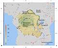
Bassin versant de l'Ogooué-fr.svg 815 × 965; 1.65 MB
-
Battaglia del Trasimeno (217 a. C.) - Teoria Susini.svg 1,200 × 938; 384 KB
-
Battaglia dello Scire.svg 932 × 1,462; 3.39 MB
-
Batu Kepulauan peta topografi id.svg 2,000 × 1,454; 796 KB
-
Bavay - Gembloux 2.svg 600 × 332; 63 KB
-
Belarus (night train).svg 600 × 196; 624 KB
-
Belarus in Europe (blue marble).svg 1,401 × 1,198; 11.42 MB
-
Belgian Coast Tram.svg 800 × 507; 468 KB
-
Belgium in Europe (blue marble).svg 1,401 × 1,198; 11.42 MB
-
Bengal Basin.svg 1,005 × 975; 1,011 KB
-
Berg River Dam catchment map.svg 615 × 651; 1.68 MB
-
Bergrivier LM topographic map.svg 1,198 × 1,011; 8.15 MB
-
Besançon 1910 flood map.svg 877 × 986; 1.67 MB
-
Bise noire.svg 1,280 × 795; 176 KB
-
Bise.svg 1,280 × 795; 176 KB
-
Blackpool trams.svg 322 × 800; 364 KB
-
BLANK in Europe (blue marble) (white borders).svg 1,401 × 1,198; 11.43 MB
-
BLANK in Europe (blue marble).svg 1,401 × 1,198; 11.43 MB
-
Blank topographic map of the Canary Islands.svg 3,045 × 1,303; 750 KB
-
Bosnia and Herzegovina in Europe (blue marble).svg 1,401 × 1,198; 11.42 MB
-
Braddock Expedition - ru.svg 1,367 × 1,011; 2.13 MB
-
Brightline Train Florida.svg 389 × 800; 252 KB
-
BRW PGW and OCP sites near Haryana and Uttar Pradesh 1.svg 652 × 633; 711 KB
-
Bulgaria GeorgiDamyanovo Municipality geographic map bg.svg 1,000 × 1,542; 3.12 MB
-
Bulgaria in Europe (blue marble).svg 1,401 × 1,198; 11.42 MB
-
Burnside High School.svg 665 × 800; 104 KB
-
Béarn topographic map-fr.svg 1,608 × 1,600; 2.57 MB
-
Cairngorm relief map for 1971 disaster.svg 712 × 811; 904 KB
-
Calella OSM.svg 1,223 × 974; 7.98 MB
-
Cambodia in Asia (relief) (-mini map).svg 1,181 × 1,050; 5.63 MB
-
Cambodia in Asia (relief).svg 1,181 × 1,050; 5.4 MB
-
Cambodia location map, admin relief (2020)-en.svg 1,280 × 1,127; 1.25 MB
-
Cambodia location map, admin-topographic relief (2018)-en.svg 1,280 × 1,127; 2.62 MB
-
Cambodia location map, admin-topographic relief (2018).svg 1,280 × 1,127; 2.62 MB
-
Cambodia, Rôtânôkiri locator map, admin relief (2020)-en.svg 1,280 × 1,127; 1.25 MB
-
Cambodia, Rôtânôkiri locator map, admin-topographic relief (2018)-en.svg 1,280 × 1,127; 2.62 MB
-
Caminos de Santiago Centroeuropa.svg 1,113 × 1,306; 1.7 MB
-
Caminos Santiago actuales - 01 Camino Francés.svg 776 × 375; 562 KB
-
Canada relief map 2.svg 1,114 × 942; 1.47 MB
-
Cantabria prerromana.svg 992 × 694; 3.05 MB
-
Carte des attaques du Monstre du Valais-fr.svg 1,719 × 1,290; 538 KB
-
Carte des pierres à cupules de Billème.svg 750 × 750; 359 KB
-
Carte des sites majeurs de Vauban.svg 1,996 × 1,918; 1.07 MB
-
Carte topographique de la Bèze.svg 1,395 × 2,790; 5.23 MB
-
Carte topographique Nouvelle-Écosse de-William Alexander 1632.svg 2,928 × 2,106; 723 KB
-
Cascade Range blank map protected areas map-fr.svg 403 × 693; 3.21 MB
-
Castilla León montanas.svg 2,697 × 2,110; 7.49 MB
-
Catalonia relief location map.svg 2,776 × 2,488; 4.73 MB
-
Cederberg LM topographic map.svg 1,113 × 1,087; 9.7 MB
-
Celtic Sea and Bay of Biscay bathymetric map-en.svg 3,479 × 3,805; 4.93 MB
-
Celtic Sea and Bay of Biscay bathymetric map-fr.svg 3,478 × 3,804; 4.93 MB
-
CERA-USGS-labeled.svg 535 × 383; 843 KB
-
Ceres journey in Sicily map-tag.svg 960 × 726; 1.11 MB
-
Cerro de las Tres Cruces.svg 584 × 600; 266 KB
-
Channels-of-the-Hawaiian-Islands.svg 1,441 × 935; 335 KB
-
China great mountains map.svg 1,000 × 1,000; 281 KB
-
China-Grand canal, Sui and Tang.svg 667 × 717; 1.28 MB
-
China-Historic macro areas.svg 1,438 × 1,047; 3.61 MB
-
Chinese history frames - 51E146W, 14N52N-color topography, borders, coordinates.svg 3,188 × 1,275; 3.52 MB
-
Ciconia boyciana distribution map.svg 2,100 × 1,950; 1.57 MB
-
Cilician Armenia-hy.svg 2,508 × 1,789; 655 KB
-
Circum-Baikal Railway.svg 800 × 649; 772 KB
-
Clima de Portugal (Köppen).svg 765 × 1,701; 270 KB
-
Cluse de Chambéry - Carte des infrastructures de transport.svg 1,898 × 2,050; 6.59 MB
-
Cluse de Chambéry - Carte du relief.svg 1,898 × 2,050; 7.48 MB
-
Col d'Arpy map-fr.svg 2,343 × 2,302; 2.66 MB
-
Col de Joux map-fr.svg 1,939 × 1,945; 1.86 MB
-
Congo-Nile Divide.svg 1,150 × 956; 1.09 MB
-
Constantine department 1934-1955 map-fr.svg 1,287 × 1,278; 1.79 MB
-
Controffensiva etiope - dicembre 1935.svg 1,861 × 1,292; 5.79 MB
-
Corfu Channel topographic map-en.svg 595 × 755; 2.23 MB
-
Corfu Channel topographic map-fr.svg 595 × 755; 2.22 MB
-
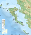
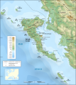
Corfu topographic map-be.svg 2,100 × 2,345; 2.43 MB
-
Corfu topographic map-blank.svg 2,100 × 2,345; 2.29 MB
-
Corfu topographic map-el.svg 2,100 × 2,345; 2.45 MB
-
Corfu topographic map-en librsvg.png 2,096 × 2,341; 2.1 MB
-
Corfu topographic map-en rendersvg.png 2,096 × 2,341; 2.7 MB
-
Corfu topographic map-en.svg 2,096 × 2,341; 2.19 MB
-
Corfu topographic map-es.svg 2,100 × 2,345; 2.49 MB


