File:Conrail FSP Freight Lines Map 1975.pdf
Jump to navigation
Jump to search

Size of this JPG preview of this PDF file: 800 × 580 pixels. Other resolutions: 320 × 232 pixels | 640 × 464 pixels | 1,024 × 743 pixels | 1,280 × 928 pixels | 2,560 × 1,857 pixels | 5,170 × 3,750 pixels.
Original file (5,170 × 3,750 pixels, file size: 2.47 MB, MIME type: application/pdf)
Captions
Captions
Add a one-line explanation of what this file represents

|
File:Conrail FSP Freight Lines Map 1975.svg is a vector version of this file. It should be used in place of this PDF file when not inferior.
File:Conrail FSP Freight Lines Map 1975.pdf → File:Conrail FSP Freight Lines Map 1975.svg
For more information, see Help:SVG. |
 |
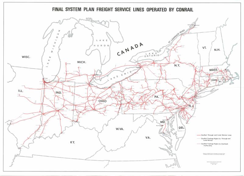
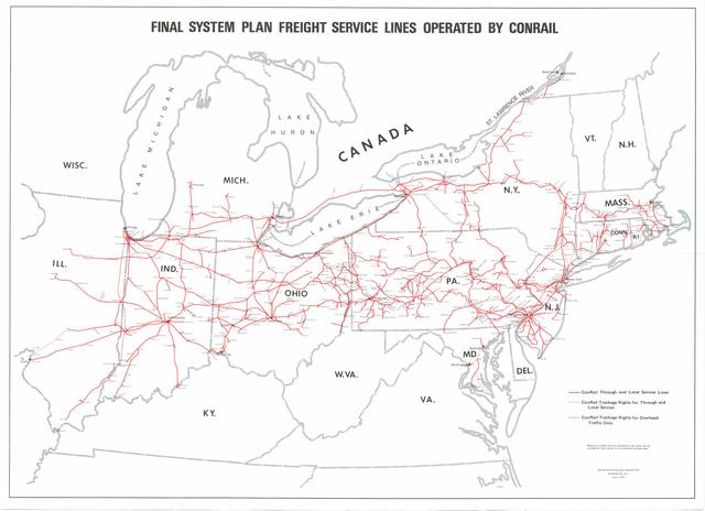
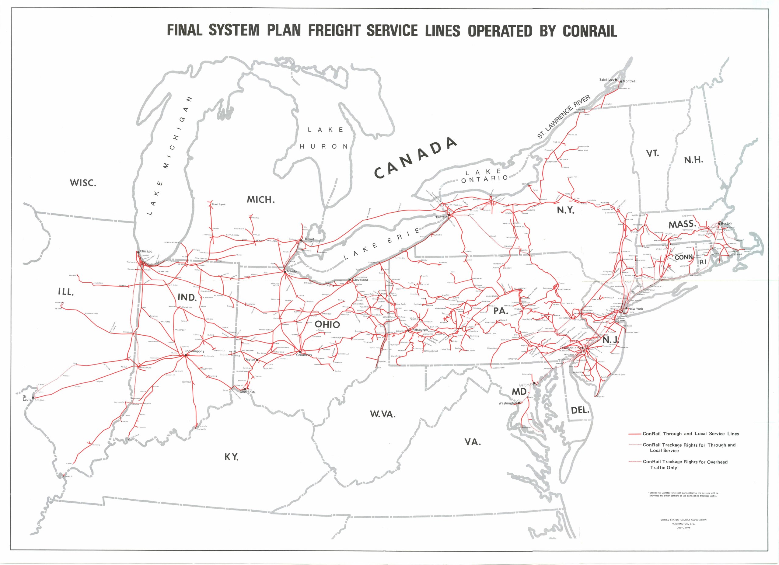
| Description | Map of Final System Plan Freight Service Lines Operated by Conrail. Plan formulated by United States Railway Association. | ||||||
| Date | |||||||
| Source | "United States Railway Administration Final System Plan" | ||||||
| Author | United States Railway Association, Washington, DC | ||||||
| Permission (Reusing this file) |
|
||||||

File history
Click on a date/time to view the file as it appeared at that time.
| Date/Time | Thumbnail | Dimensions | User | Comment | |
|---|---|---|---|---|---|
| current | 04:04, 1 March 2011 |  | 5,170 × 3,750 (2.47 MB) | Caseyjonz (talk | contribs) | {{Information |Description=Map of Final System Plan Freight Service Lines Operated by Conrail. Plan formulated by United States Railway Association. |Source=[http://multimodalways.org/archives/govts/fe |
You cannot overwrite this file.
File usage on Commons
There are no pages that use this file.
File usage on other wikis
The following other wikis use this file:
- Usage on en.wikipedia.org