Category:System maps of defunct U.S. railroads
Jump to navigation
Jump to search
Subcategories
This category has the following 14 subcategories, out of 14 total.
Media in category "System maps of defunct U.S. railroads"
The following 87 files are in this category, out of 87 total.
-
 1923 MEC.jpg 954 × 1,213; 456 KB
-
 AroostookValleyRailroadMap.png 1,306 × 2,212; 205 KB
-
 Baltimore & Harrisburg Rwy map.jpg 1,244 × 1,001; 261 KB
-
 Bridgton&SacoRiver RRmap.png 1,244 × 1,944; 363 KB
-
 C&S RR map.jpg 1,024 × 768; 184 KB
-
 Camas Prairie RR map.jpg 900 × 576; 236 KB
-
 Central-ny 1913 interurban.jpg 761 × 645; 576 KB
-
 Chicago and Alton Railroad system map (1918).svg 1,120 × 640; 1.52 MB
-
 Chicago, Peoria and St. Louis Railroad system map (1918).svg 1,400 × 800; 499 KB
-
 Cincinnati Northern Railroad system map (1918).svg 1,120 × 640; 6.41 MB
-
 Cincinnati, Jackson and Mackinaw Railway system map (1897).svg 1,120 × 640; 713 KB
-
 Cincinnati, Lebanon and Northern Railway map (1918) with terrain.png 2,986 × 1,706; 961 KB
-
 Cleveland, Cincinnati, Chicago and St. Louis Railway system map (1918).svg 1,120 × 640; 6.57 MB
-
 Conrail FSP Chessie.jpg 2,133 × 1,461; 377 KB
-
 Conrail FSP D&H SOU.jpg 575 × 1,463; 112 KB
-
 Conrail FSP Freight Lines Map 1975.jpg 10,188 × 7,337; 5.55 MB
-
 Conrail FSP Freight Lines Map 1975.pdf 5,170 × 3,750; 2.47 MB
-
 Conrail FSP Freight Lines Map 1975.svg 9,927 × 7,200; 1,013 KB
-
 Conrail FSP N&W.jpg 2,130 × 1,452; 293 KB
-
 Conrail FSP short lines.jpg 1,129 × 1,048; 167 KB
-
 Conrail FSP.jpg 1,850 × 1,407; 317 KB
-
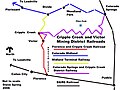 Cripple Creek, Victor Mining District Railroads Map.jpg 800 × 600; 153 KB
-
 Detroit united railway map-1904.PNG 613 × 890; 430 KB
-
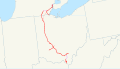 Detroit, Toledo and Ironton Railroad system map (1918).svg 1,120 × 640; 1.26 MB
-
 Easton and Amboy Railroad.svg 400 × 400; 276 KB
-
 Franklin&MeganticRRmap.png 1,223 × 2,070; 319 KB
-
 FranklinSomerset&KennebecRailwayMap.png 1,566 × 1,926; 1.39 MB
-
 Granite Railway map section.png 461 × 510; 65 KB
-
 Granite Railway map.png 8,184 × 6,590; 1.03 MB
-
 Jersey City Newark and Western Railway.svg 400 × 400; 278 KB
-
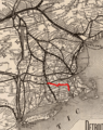
 L&NE on US map cropped.png 300 × 227; 9 KB
-
 L&NE on US map.png 5,912 × 4,003; 1.85 MB
-
 Lake Erie and Western Railroad system map (1918).svg 1,120 × 640; 6.44 MB
-
 Lake Shore and Michigan Southern Railway system map (1914).svg 1,120 × 640; 6.54 MB
-
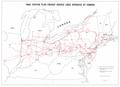
 Large-scale-detailed-old-map-exhibiting-the-several-pacific-railroads-1883.jpg 10,030 × 6,250; 33.15 MB
-
 Lehigh Valley Jersey City Terminal.png 800 × 600; 282 KB
-
 Lehigh Valley Railroad System Map.svg 800 × 600; 447 KB
-
 Lehigh Valley Terminal Railway.svg 400 × 400; 313 KB
-
 LO&S RR map 1895.jpg 960 × 720; 205 KB
-
 Ma and Pa RR map.png 1,088 × 1,181; 772 KB
-
 Map of Florence & Cripple Creek Railroad.gif 400 × 400; 15 KB
-
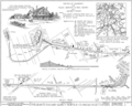
 MEC Rockland Branch Map 1920.jpg 1,696 × 636; 341 KB
-
 Michigan Central Railroad system map (1918).svg 1,120 × 640; 6.5 MB
-
 Missouri, Kansas and Texas Railway system map (1918).svg 1,120 × 640; 328 KB
-
 MonsonL2.png 743 × 1,926; 308 KB
-
 Montour Railroad - System Index Map.jpg 3,059 × 4,567; 5.47 MB
-
 MSTL Map.png 1,038 × 933; 275 KB
-
 Mtgretna.png 1,944 × 1,029; 395 KB
-
 Newark and Passaic Railway.svg 400 × 400; 256 KB
-
 Newark and Roselle Railway.svg 400 × 400; 290 KB
-
 Newark Railway.svg 400 × 400; 296 KB
-
 Norfolk Southern Railway (old).svg 995 × 549; 41 KB
-
 Norwich and Worcester map.jpg 792 × 550; 138 KB
-
 NYSW Historical NJ and PA.svg 800 × 600; 675 KB
-
 NYSW Wilkes-Barre and Eastern.svg 800 × 600; 731 KB
-
 NYWB-Map.jpg 476 × 1,265; 265 KB
-
 Oregon and California Railroad system map (1918).svg 1,400 × 800; 1.09 MB
-
 Oregon Eastern Railway system map.svg 1,400 × 800; 732 KB
-
 P&W System Map - May 1907.jpg 1,731 × 516; 253 KB
-
 P&WV map.svg 414 × 213; 27 KB
-
 PacificCoastRailwayMap.png 707 × 1,290; 73 KB
-
 Peoria and Eastern Railway system map (1918).svg 1,120 × 640; 6.4 MB
-
 Petaluma&SantaRosaRailroadMap.png 1,387 × 1,532; 140 KB
-
 Pittsburgh and Lake Erie Railroad system map (1918).svg 1,120 × 640; 6.43 MB
-
 PortlandTerminalCompanyMap.png 1,360 × 1,720; 366 KB
-
 PRSL on US map cropped.png 150 × 161; 7 KB
-
 PRSL on US map.png 5,912 × 4,003; 1.85 MB
-
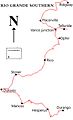 Rio Grande Southern - Map of mainline.jpg 500 × 819; 80 KB
-
 Roselle and South Plainfield Railroad.svg 400 × 400; 240 KB
-
 RW&O eastern divisions, 1889.jpg 539 × 651; 426 KB
-
 RW&O system map 1889.jpg 949 × 884; 871 KB
-
 Seaboard Air Line RR main lines 1950.gif 582 × 710; 125 KB
-
 Shore Line map.JPG 2,013 × 1,983; 624 KB
-
 SilverCityPinosAltos&MogollonRailroadMap.png 979 × 1,514; 172 KB
-
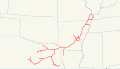
 Silverton Northern map.gif 500 × 482; 18 KB
-
 Silverton Railroad map.gif 500 × 482; 23 KB
-
 Silverton, Gladstone & Northerly map.gif 500 × 482; 15 KB
-
 SNE map.png 696 × 880; 502 KB
-
 SouthPacificCoastRailroadMap.png 1,196 × 1,667; 120 KB
-
 SR&RLv1.png 1,432 × 1,751; 530 KB
-
 St. Louis Southwestern Railway system map (1918).svg 1,120 × 640; 2.06 MB
-
 St. Louis-San Francisco Railway system map (1918).svg 1,400 × 800; 505 KB
-
 The Commercial and financial chronicle (1906) (14595387818).jpg 4,180 × 2,576; 1.88 MB
-
 Toledo, Cincinnati and St. Louis Railroad system map (1884).svg 1,120 × 640; 1.44 MB
-
 Toledo, St. Louis and Western Railroad system map (1918).svg 1,120 × 640; 1.52 MB
-
 Western Maryland Railway 1950s.svg 990 × 765; 42 KB
-
 Wwf-karte.png 462 × 510; 474 KB


.svg)
.svg)
.svg)
.svg)
_with_terrain.png)
.svg)


.svg)


.svg)
.svg)


.svg)
.svg)


.svg)


.svg)


.svg)

.svg)


.svg)
.svg)
_(14595387818).jpg)
.svg)
.svg)

