Commons:Wiki Loves Monuments in Switzerland/St. Gallen/A-M
Jump to navigation
Jump to search
Altstätten
| Location | Upload | Photo | Object | Cat. | Coordinates | KGS-Nr | |
|---|---|---|---|---|---|---|---|
| Altstätten | 
|
Pfarrkirche St. Nikolaus | B | 47°22′40″N 9°32′29″E / 47.3778°N 9.54132°E | 8077 | ||
| Altstätten | 
|
Historisches Museum Prestegg | B | 47°22′40″N 9°32′18″E / 47.377782°N 9.538426°E | 14002 | ||
| Altstätten | 
|
Burg Neu-Altstätten | B | 47°23′24″N 9°32′58″E / 47.389972°N 9.549374°E | 8074 | ||
| Altstätten | 
|
Haus zum Raben (Ende 18. Jh.) | B | 47°22′41″N 9°32′20″E / 47.377936°N 9.538896°E | 8075 | ||
| Altstätten | 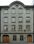
|
Haus zur Reburg (1772) | B | 47°22′41″N 9°32′27″E / 47.378015°N 9.540939°E | 8076 | ||
| Altstätten | 
|
Prestegg (Historisches Museum) | B | 47°22′40″N 9°32′19″E / 47.37773°N 9.53849°E | 8078 | ||
| Altstätten | 
|
Reformierte Kirche (1906) | B | 47°22′44″N 9°32′30″E / 47.378792°N 9.541751°E | 8079 | ||
| Altstätten | 
|
Untertor | B | 47°22′39″N 9°32′27″E / 47.377394°N 9.540968°E | 8080 | ||
| Altstätten | 
|
Schlosslandschaft Ober-/Unterrheintal | ISOS | 47°24′07″N 9°34′44″E / 47.4019°N 9.579°E | |||
| Altstätten | 
|
Altstätten | ISOS | 47°22′41″N 9°32′56″E / 47.37801°N 9.54875°E | |||
Amden
| Location | Upload | Photo | Object | Cat. | Coordinates | KGS-Nr | |
|---|---|---|---|---|---|---|---|
| Amden | 
|
Burgruine Strahlegg | A | 47°08′06″N 9°08′51″E / 47.135°N 9.1475°E | 9649 | ||
| Amden | 
|
Pfarrkirche St. Gallus | B | 47°08′56″N 9°08′27″E / 47.149°N 9.14091°E | 8083 | ||
| Amden | 
|
Gmür-Haus in Vorderächern (1822) | B | 47°08′50″N 9°08′56″E / 47.147361°N 9.148771°E | 8082 | ||
Andwil
| Location | Upload | Photo | Object | Cat. | Coordinates | KGS-Nr | |
|---|---|---|---|---|---|---|---|
| Andwil | 
|
Haus zum Hirschen (1732) | B | 47°26′22″N 9°16′16″E / 47.439371°N 9.271128°E | 8084 | ||
| Andwil | 
|
Katholische Kirche St. Otmar | B | 47°26′22″N 9°16′12″E / 47.439397°N 9.270054°E | 14003 | ||
| Andwil | 
|
Kulturlandschaft Matten/Wilen/Zinggenhueb | ISOS | 47°25′45″N 9°16′00″E / 47.42911°N 9.26656°E | |||
Au
| Location | Upload | Photo | Object | Cat. | Coordinates | KGS-Nr | |
|---|---|---|---|---|---|---|---|
| Au | 
|
Katholische Kirche Maria Geburt | B | 47°26′00″N 9°38′01″E / 47.433434°N 9.633709°E | 14005 | ||
| Au | 
|
Villa Stoffel | B | 47°24′26″N 9°37′29″E / 47.407153°N 9.624634°E | 14004 | ||
| Au | 
|
Balgach/Heerbrugg | ISOS | 47°24′36″N 9°37′16″E / 47.41°N 9.6212°E | |||
Bad Ragaz
| Location | Upload | Photo | Object | Cat. | Coordinates | KGS-Nr | |
|---|---|---|---|---|---|---|---|
| Bad Ragaz | 
|
Evangelische Kirche Bad Ragaz | B | 47°00′06″N 9°30′18″E / 47.001577777°N 9.505105555°E | 8091 | ||
| Bad Ragaz | 
|
Dorfbad mit Trinkhalle | A | 47°00′09″N 9°30′03″E / 47.002386°N 9.500742°E | 9390 | ||
| Bad Ragaz | 
|
Kapelle St. Leonhard | A | 47°00′48″N 9°29′35″E / 47.013467°N 9.492985°E | 8090 | ||
| Bad Ragaz | 
|
Bahnhof (1875) | B | 47°00′37″N 9°30′19″E / 47.010243°N 9.505201°E | 8087 | ||
| Bad Ragaz | 
|
Hof mit Kuranstalten und Park | B | 47°00′01″N 9°30′08″E / 47.000164°N 9.502209°E | 8088 | ||
| Bad Ragaz | 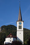
|
Katholische Kirche St. Pankraz | B | 47°00′15″N 9°30′03″E / 47.00403°N 9.500937°E | 8089 | ||
| Bad Ragaz | 
|
Burg Freudenberg (Bad Ragaz) | A | 47°00′32″N 9°29′33″E / 47.0089°N 9.4925°E | 8085 | ||
Balgach
| Location | Upload | Photo | Object | Cat. | Coordinates | KGS-Nr | |
|---|---|---|---|---|---|---|---|
| Balgach | 
|
Altes Rathaus | A | 47°24′29″N 9°36′26″E / 47.407951°N 9.607131°E | 8092 | ||
| Balgach | 
|
Katholische Kirche Heilige drei Könige | B | 47°24′26″N 9°37′04″E / 47.407094°N 9.617753°E | 14007 | ||
| Balgach | 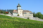
|
Schloss Grünenstein (13. und 18. Jh.) | B | 47°24′22″N 9°35′45″E / 47.406148°N 9.59574°E | 8094 | ||
| Balgach | 
|
Villa Schmidheiny | B | 47°24′37″N 9°37′20″E / 47.410168°N 9.622213°E | 14006 | ||
| Balgach | 
|
Schlosslandschaft Ober-/Unterrheintal | ISOS | 47°24′07″N 9°34′44″E / 47.4019°N 9.579°E | |||
| Balgach | 
|
Balgach/Heerbrugg | ISOS | 47°24′36″N 9°37′16″E / 47.41°N 9.6212°E | |||
Benken
| Location | Upload | Photo | Object | Cat. | Coordinates | KGS-Nr | |
|---|---|---|---|---|---|---|---|
| Benken | 
|
Maria Bildstein | B | 47°11′33″N 9°01′16″E / 47.1924°N 9.02107°E | 14008 | ||
| Benken | 
|
Kastlet, eisenzeitliche Höhensiedlung | B | 47°11′17″N 9°00′37″E / 47.188167°N 9.010184°E | 8097 | ||
| Benken | 
|
Katholische Kirche St. Peter und Paul (1795, 1917) | B | 47°11′57″N 9°00′21″E / 47.199121°N 9.00586°E | 8096 | ||
Berg
| Location | Upload | Photo | Object | Cat. | Coordinates | KGS-Nr | |
|---|---|---|---|---|---|---|---|
| Berg | 
|
Bauernhaus Frankenrüti | B | 47°29′23″N 9°25′00″E / 47.489679°N 9.416557°E | 14009 | ||
| Berg | 
|
Katholische Kirche St. Michael (1776) | B | 47°29′12″N 9°24′29″E / 47.486604°N 9.408001°E | 8099 | ||
| Berg | 
|
Schloss Grosser Hahnberg (17. und 18. Jh.) | B | 47°29′40″N 9°25′02″E / 47.494508°N 9.417201°E | 8098 | ||
| Berg | 
|
Schloss Pfauenmoos (1564, Ende 18. Jh.) | B | 47°29′12″N 9°25′11″E / 47.486582°N 9.419813°E | 8100 | ||
| Berg | 
|
Kulturlandschaft Dottenwil/Zwingensteinhueb | ISOS | 47°28′29″N 9°23′12″E / 47.4747°N 9.3866°E | |||
| Berg | 
|
Schlosslandschaft Berg/Mörschwil | ISOS | 47°28′42″N 9°25′27″E / 47.4783°N 9.4241°E | |||
| Berg | 
|
Schloss Kleiner Hahnberg | A | 47°29′41″N 9°24′57″E / 47.494711°N 9.415868°E | 9509 | ||
Berneck
| Location | Upload | Photo | Object | Cat. | Coordinates | KGS-Nr | |
|---|---|---|---|---|---|---|---|
| Berneck | 
|
Burgruine Rosenberg mit Rebhäuschen | B | 47°25′17″N 9°37′03″E / 47.421255°N 9.617365°E | 8101 | ||
| Berneck | 
|
Fürstenhaus (1729) | B | 47°25′14″N 9°37′14″E / 47.420539°N 9.620504°E | 8105 | ||
| Berneck | 
|
Haus zum Torggel (16. Jh., mit heimatkundlicher Sammlung) | B | 47°25′29″N 9°36′29″E / 47.42477°N 9.607949°E | 8103 | ||
| Berneck | 
|
Heiligkreuzkapelle (1759) | B | 47°25′28″N 9°36′33″E / 47.4244285°N 9.609091°E | 14010 | ||
| Berneck | 
|
Katholische Kirche Unserer Lieben Frau (15. und 18. Jh.) | B | 47°25′28″N 9°36′34″E / 47.424573°N 9.609333°E | 8104 | ||
| Berneck | 
|
Schlössli Buechholz | B | 47°25′29″N 9°36′24″E / 47.424829°N 9.606745°E | 14105 | ||
| Berneck | 
|
Schlosslandschaft Ober-/Unterrheintal | ISOS | 47°24′07″N 9°34′44″E / 47.4019°N 9.579°E | |||
| Berneck | 
|
Balgach/Heerbrugg | ISOS | 47°24′36″N 9°37′16″E / 47.41°N 9.6212°E | |||
| Berneck | 
|
Berneck | ISOS | 47°25′29″N 9°36′45″E / 47.42465°N 9.61254°E | |||
Buchs
| Location | Upload | Photo | Object | Cat. | Coordinates | KGS-Nr | |
|---|---|---|---|---|---|---|---|
| Buchs | 
|
Gasthaus Traube | B | 47°26′07″N 9°28′47″E / 47.435158°N 9.479692°E | 8110 | ||
| Buchs | 
|
Katholische Kirche Herz Jesu | B | 47°09′50″N 9°28′15″E / 47.163942°N 9.470716°E | 14012 | ||
| Buchs | 
|
Werdenberg | ISOS | 47°10′06″N 9°46′31″E / 47.168333333°N 9.775277777°E | |||
Bütschwil-Ganterschwil
| Location | Upload | Photo | Object | Cat. | Coordinates | KGS-Nr | |
|---|---|---|---|---|---|---|---|
| Bütschwil-Ganterschwil | 
|
Dreifaltigkeitskapelle | B | 47°20′49″N 9°04′44″E / 47.346818°N 9.078752°E | 14013 | ||
| Bütschwil-Ganterschwil | 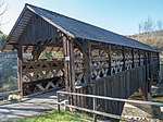
|
Holzbrücke Anzenwil (1862) | B | 47°22′26″N 9°07′19″E / 47.373898°N 9.121871°E | 8138 | ||
| Bütschwil-Ganterschwil | 
|
Letzibrücke (Mitte 19. Jh.) | B | 47°23′31″N 9°05′01″E / 47.391813°N 9.083488°E | 8139 | ||
| Bütschwil-Ganterschwil | 
|
Reformierte Kirche (15. Jh.) | B | 47°22′52″N 9°05′25″E / 47.381102°N 9.090178°E | 8141 | ||
| Bütschwil-Ganterschwil | 
|
Villa Sonnenbüel | B | 47°20′25″N 9°04′57″E / 47.340343°N 9.082363°E | 14106 | ||
| Bütschwil-Ganterschwil | 
|
Weisses Haus (17. Jh.) | B | 47°21′43″N 9°04′25″E / 47.361834°N 9.073626°E | 8111 | ||
| Bütschwil-Ganterschwil | 
|
Bütschwil | ISOS | 47°20′59″N 9°04′00″E / 47.349722222°N 9.066666666°E | |||
Degersheim
| Location | Upload | Photo | Object | Cat. | Coordinates | KGS-Nr | |
|---|---|---|---|---|---|---|---|
| Degersheim | 
|
Kloster Magdenau | A | 47°24′09″N 9°10′15″E / 47.402438°N 9.170702°E | 8112 | ||
| Degersheim | 
|
Ehemalige Pfarrkirche St. Verena | A | 47°24′02″N 9°10′02″E / 47.400667°N 9.167237°E | 8114 | ||
| Degersheim | 
|
Ehemalige Stickerfabrik Grauer | B | 47°22′24″N 9°11′36″E / 47.37323°N 9.193338°E | 14016 | ||
| Degersheim | 
|
Magdenau, Gasthaus Rössli mit Saal | B | 47°24′05″N 9°10′18″E / 47.401391°N 9.171618°E | 14017 | ||
| Degersheim | 
|
Reformierte Kirche | B | 47°22′30″N 9°11′58″E / 47.374884°N 9.199326°E | 14014 | ||
| Degersheim | 
|
Villa Grauer | B | 47°22′20″N 9°11′33″E / 47.372206°N 9.192616°E | 14015 | ||
| Degersheim | 
|
Magdenau | ISOS | 47°24′05″N 9°10′12″E / 47.40138°N 9.16999°E | |||
| Degersheim | 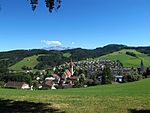
|
Degersheim | ISOS | 47°22′00″N 9°11′59″E / 47.366666666°N 9.199722222°E | |||
Ebnat-Kappel
| Location | Upload | Photo | Object | Cat. | Coordinates | KGS-Nr | |
|---|---|---|---|---|---|---|---|
| Ebnat-Kappel | 
|
Reformierte Kirche Ebnat | B | 47°15′45″N 9°07′26″E / 47.2624°N 9.12398°E | 14018 | ||
| Ebnat-Kappel | 
|
Heimatmuseum Ackerhus | B | 47°16′02″N 9°07′20″E / 47.267284°N 9.122212°E | 8116 | ||
| Ebnat-Kappel | 
|
Haus Felsenstein | B | 47°15′59″N 9°07′02″E / 47.266277°N 9.117197°E | 8117 | ||
| Ebnat-Kappel | 
|
Weberei Trempel | B+ISOS | 47°14′58″N 9°09′53″E / 47.249473°N 9.1646025°E | 14019 | ||
| Ebnat-Kappel | 
|
Ebnat-Kappel | ISOS | 47°15′48″N 9°07′24″E / 47.2632°N 9.1234°E | |||
Eggersriet
| Location | Upload | Photo | Object | Cat. | Coordinates | KGS-Nr | |
|---|---|---|---|---|---|---|---|
| Eggersriet | 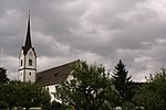
|
Katholische Kirche St. Anna | B | 47°26′33″N 9°28′18″E / 47.442388°N 9.47176°E | 14020 | ||
| Eggersriet | 
|
Katholische Kirche St. Johannes Baptist Grub (18. Jh.) | B | 47°27′07″N 9°30′46″E / 47.451935°N 9.512701°E | 8119 | ||
| Eggersriet | 
|
Fürschwendi | ISOS | 47°27′01″N 9°30′07″E / 47.45034°N 9.50184°E | |||
Eschenbach
| Location | Upload | Photo | Object | Cat. | Coordinates | KGS-Nr | |
|---|---|---|---|---|---|---|---|
| Eschenbach | 
|
Fründsberg, Burgstelle | A | 47°17′01″N 8°56′29″E / 47.283593°N 8.941272°E | 10481 | ||
| Eschenbach | 
|
Kusterhaus (Landrichterhaus) | A | 47°14′23″N 8°55′20″E / 47.239625°N 8.922136°E | 8120 | ||
| Eschenbach | 
|
Balmenrain, eisenzeitliche Höhensiedlung | B | 47°13′58″N 8°56′03″E / 47.232814°N 8.93411°E | 8121 | ||
| Eschenbach | 
|
Chastel, eisenzeitliche Höhensiedlung | B | 47°14′43″N 8°57′03″E / 47.245189°N 8.950826°E | 8122 | ||
| Eschenbach | 
|
Katholische Kirche St. Laurentius und Gallus (1755, Grubenmann) mit Beinhauskapelle (1667) | B | 47°14′43″N 8°58′07″E / 47.245386°N 8.968627°E | 8357 | ||
| Eschenbach | 
|
Katholische Kirche St. Nikolaus (1681, 1784) | B | 47°15′46″N 8°58′01″E / 47.26279°N 8.966919°E | 8143 | ||
| Eschenbach | 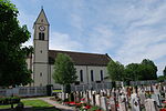
|
Katholische Kirche St. Vinzenz (1723/26 u. 1753/54) | B | 47°14′22″N 8°55′11″E / 47.239476°N 8.919755°E | 8123 | ||
| Eschenbach | 
|
Neuhaus, gedeckte Holzbrücke (1830) über das Aabachtobel | B | 47°14′37″N 8°57′01″E / 47.243551°N 8.950252°E | 8124 | ||
| Eschenbach | 
|
Pfarrhaus (1759) | B | 47°14′44″N 8°58′10″E / 47.245547°N 8.969398°E | 14073 | ||
| Eschenbach | 
|
Gibel | ISOS | 47°16′13″N 8°56′59″E / 47.27026°N 8.94982°E | |||
Flawil
| Location | Upload | Photo | Object | Cat. | Coordinates | KGS-Nr | |
|---|---|---|---|---|---|---|---|
| Flawil | 
|
«Altes Rathaus» | A | 47°24′21″N 9°12′33″E / 47.405898°N 9.20915°E | 8125 | ||
| Flawil | 
|
Gasthof Hirschen | A | 47°24′41″N 9°12′21″E / 47.411292°N 9.205883°E | 9401 | ||
| Flawil | 
|
Schwänbergbrücke | B | 47°23′30″N 9°13′57″E / 47.391756°N 9.232461°E | 14024 | ||
| Flawil | 
|
Katholische Kirche St. Laurentius | B | 47°25′01″N 9°11′01″E / 47.417072°N 9.183662°E | 14022 | ||
| Flawil | 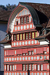
|
Kommandantenhaus | B | 47°24′46″N 9°11′15″E / 47.412661°N 9.187414°E | 14021 | ||
| Flawil | 
|
Kühnishaus | B | 47°24′46″N 9°11′16″E / 47.412685°N 9.18764°E | 8126 | ||
| Flawil | 
|
Reformierte Kirche (1911) | B | 47°24′42″N 9°11′32″E / 47.411687°N 9.192312°E | 8128 | ||
| Flawil | 
|
Reformierte Kirche Oberglatt | B | 47°24′41″N 9°12′26″E / 47.411297°N 9.207328°E | 14023 | ||
| Flawil | 
|
Oberglatt | ISOS | 47°24′44″N 9°12′27″E / 47.4122°N 9.2076°E | |||
| Flawil | 
|
Burgau | ISOS | 47°23′55″N 9°13′10″E / 47.3986°N 9.2194°E | |||
| Flawil | 
|
Raaschberg | ISOS | 47°23′47″N 9°11′59″E / 47.3963°N 9.1998°E | |||
Flums
| Location | Upload | Photo | Object | Cat. | Coordinates | KGS-Nr | |
|---|---|---|---|---|---|---|---|
| Flums | 
|
Burg Gräpplang | A | 47°06′10″N 9°19′56″E / 47.102777777°N 9.332222222°E | 9650 | ||
| Flums | 
|
Kapelle St. Jakob | A | 47°06′00″N 9°19′37″E / 47.099938°N 9.326808°E | 8134 | ||
| Flums | 
|
Katholische Kirche St. Justus | A | 47°05′27″N 9°20′41″E / 47.090888°N 9.344709°E | 8130 | ||
| Flums | 
|
Ehemalige Spinnerei Spoerry | B | 47°05′17″N 9°20′28″E / 47.088014°N 9.341129°E | 14027 | ||
| Flums | 
|
Haus Zink | B | 47°05′30″N 9°20′34″E / 47.091593°N 9.34289°E | 14026 | ||
| Flums | 
|
Kapelle Maria Lourdes | B | 47°04′41″N 9°21′40″E / 47.077921°N 9.360989°E | 14028 | ||
| Flums | 
|
Katholische Kirche St. Laurentius (1861, 1905) | B | 47°05′21″N 9°20′46″E / 47.089256°N 9.346021°E | 8133 | ||
| Flums | 
|
Tschudischer Witwensitz | B | 47°05′26″N 9°20′37″E / 47.090601°N 9.343579°E | 14025 | ||
| Flums | 
|
Flums | ISOS | 47°05′34″N 9°20′38″E / 47.0928°N 9.3439°E | |||
Freienbach
| Location | Upload | Photo | Object | Cat. | Coordinates | KGS-Nr | |
|---|---|---|---|---|---|---|---|
| Freienbach | [[File:|150x150px|Holzbrücke Rapperswil–Hurden]] | Holzbrücke Rapperswil–Hurden | A | 47°13′14″N 8°48′43″E / 47.220558333°N 8.811883333°E | 9669 | ||
Gaiserwald
| Location | Upload | Photo | Object | Cat. | Coordinates | KGS-Nr | |
|---|---|---|---|---|---|---|---|
| Gaiserwald | 
|
Katholische Pfarrkirche St. Josef | A | 47°25′18″N 9°19′27″E / 47.421696°N 9.324074°E | 8135 | ||
| Gaiserwald | 
|
Engelburg, katholische Schutzengelkirche (1768) | B | 47°26′37″N 9°20′28″E / 47.443729°N 9.341087°E | 8136 | ||
| Gaiserwald | 
|
Holzbrücke Spisegg | B | 47°25′31″N 9°20′24″E / 47.425151°N 9.339972°E | 10496 | ||
Gams
| Location | Upload | Photo | Object | Cat. | Coordinates | KGS-Nr | |
|---|---|---|---|---|---|---|---|
| Gams | 
|
Alte Mühle | B | 47°12′15″N 9°26′26″E / 47.204293°N 9.440669°E | 14029 | ||
| Gams | 
|
Katholische Kirche St. Michael (1868) | B | 47°12′13″N 9°26′24″E / 47.203538°N 9.440087°E | 8137 | ||
Goldach
| Location | Upload | Photo | Object | Cat. | Coordinates | KGS-Nr | |
|---|---|---|---|---|---|---|---|
| Goldach | 
|
Katholische Kirche St. Mauritius (1670, 1930) | B | 47°28′24″N 9°27′52″E / 47.473304°N 9.464435°E | 8142 | ||
Gommiswald
| Location | Upload | Photo | Object | Cat. | Coordinates | KGS-Nr | |
|---|---|---|---|---|---|---|---|
| Gommiswald | 
|
Katholische Kirche St. Jakobus d. Ae. (1789) | B | 47°13′52″N 9°01′22″E / 47.231152°N 9.022675°E | 8145 | ||
| Gommiswald | 
|
Katholische Kirche St. Magnus (1912) | B | 47°13′11″N 9°03′02″E / 47.219826°N 9.050505°E | 8257 | ||
| Gommiswald | 
|
Uetliburg | ISOS | 47°14′32″N 9°01′57″E / 47.2421°N 9.0325°E | |||
| Gommiswald | 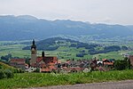
|
Rieden | ISOS | 47°13′00″N 9°03′00″E / 47.216666666°N 9.05°E | |||
| Gommiswald | 
|
Berg Sion | B+ISOS | 47°14′32″N 9°01′00″E / 47.2423°N 9.01663°E | 8144 | ||
Gossau
| Location | Upload | Photo | Object | Cat. | Coordinates | KGS-Nr | |
|---|---|---|---|---|---|---|---|
| Gossau | 
|
Schloss Oberberg | B | 47°24′51″N 9°17′12″E / 47.4142°N 9.28667°E | 8147 | ||
| Gossau | 
|
Ehemalige Gummibandweberei | A | 47°24′44″N 9°15′01″E / 47.412168°N 9.250391°E | 9039 | ||
| Gossau | 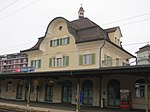
|
Bahnhof | B | 47°24′43″N 9°15′11″E / 47.4119°N 9.253°E | 14107 | ||
| Gossau | 
|
Brauerei Stadtbühl | B | 14031 | |||
| Gossau | 
|
Reformierte Kirche Haldenbühl | B | 47°25′03″N 9°14′55″E / 47.417523°N 9.248558°E | 14030 | ||
| Gossau | 
|
Kulturlandschaft Matten/Wilen/Zinggenhueb | ISOS | 47°25′45″N 9°16′00″E / 47.42911°N 9.26656°E | |||
Grabs
| Location | Upload | Photo | Object | Cat. | Coordinates | KGS-Nr | |
|---|---|---|---|---|---|---|---|
| Grabs | 
|
Schloss Werdenberg | A | 47°10′07″N 9°27′42″E / 47.1685°N 9.4616°E | 8149 | ||
| Grabs | 
|
Mühle, Säge, Wollwäscherei und Hammerschmitte | A | 47°10′49″N 9°26′18″E / 47.180355°N 9.438295°E | 8151 | ||
| Grabs | 
|
Werdenberg, Stadtbefestigung (Stadtmauer, Torturm, «Doktorhaus») | A | 47°10′06″N 9°27′47″E / 47.168315°N 9.463045°E | 10126 | ||
| Grabs | 
|
Werdenberg: «Schlangenhaus» | A | 47°10′03″N 9°27′45″E / 47.16756°N 9.462515°E | 10127 | ||
| Grabs | 
|
Werdenberg: Doppelhaus | A | 47°10′06″N 9°27′46″E / 47.168291°N 9.462899°E | 11773 | ||
| Grabs | 
|
Werdenberg: Haus | A | 47°10′03″N 9°27′44″E / 47.167634°N 9.462347°E | 11771 | ||
| Grabs | 
|
Werdenberg: Haus | A | 47°10′05″N 9°27′46″E / 47.168069°N 9.462706°E | 11772 | ||
| Grabs | 
|
Werdenberg: mittelalterliche Ständerbaureihe, Häuser | A | 47°10′05″N 9°27′47″E / 47.1681°N 9.462998°E | 11760 | ||
| Grabs | 
|
Werdenberg | ISOS | 47°10′06″N 9°46′31″E / 47.168333333°N 9.775277777°E | |||
Häggenschwil
| Location | Upload | Photo | Object | Cat. | Coordinates | KGS-Nr | |
|---|---|---|---|---|---|---|---|
| Häggenschwil | 
|
Burgruine Alt-Ramschwag | B | 47°29′24″N 9°19′20″E / 47.489921°N 9.322245°E | 8153 | ||
| Häggenschwil | 
|
Katholische Kirche St. Notker | B | 47°29′39″N 9°20′37″E / 47.494159°N 9.343647°E | 14032 | ||
Hemberg
| Location | Upload | Photo | Object | Cat. | Coordinates | KGS-Nr | |
|---|---|---|---|---|---|---|---|
| Hemberg | 
|
«Rotes Haus», Bächli | A | 47°17′58″N 9°11′14″E / 47.299315°N 9.187271°E | 10128 | ||
| Hemberg | 
|
Katholische Kirche St. Johannes der Täufer | B | 47°17′53″N 9°10′30″E / 47.297991°N 9.174889°E | 8156 | ||
| Hemberg | 
|
Rotes Haus | B | 8157 | |||
| Hemberg | 
|
Hemberg | ISOS | 47°18′02″N 9°10′31″E / 47.3005°N 9.1754°E | |||
Hombrechtikon
| Location | Upload | Photo | Object | Cat. | Coordinates | KGS-Nr | |
|---|---|---|---|---|---|---|---|
| Hombrechtikon | 
|
Seegubel | B+UNESCO | 47°14′16″N 8°48′31″E / 47.2378°N 8.80849°E | 8164 | ||
Jonschwil
| Location | Upload | Photo | Object | Cat. | Coordinates | KGS-Nr | |
|---|---|---|---|---|---|---|---|
| Jonschwil | Schloss Schwarzenbach | Schloss Schwarzenbach | B | 47°26′33″N 9°04′09″E / 47.4426°N 9.06925°E | 8168 | ||
| Jonschwil | 
|
Kapelle St. Konrad Schwarzenbach (15. Jh.) | B | 47°26′28″N 9°04′35″E / 47.441125°N 9.07626°E | 8167 | ||
Kaltbrunn
| Location | Upload | Photo | Object | Cat. | Coordinates | KGS-Nr | |
|---|---|---|---|---|---|---|---|
| Kaltbrunn | 
|
Burg Bibiton | B | 47°12′32″N 9°00′37″E / 47.208888888°N 9.010277777°E | 8169 | ||
| Kaltbrunn | 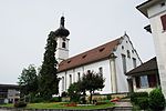
|
Katholische Kirche St. Georg (1821) | B | 47°12′50″N 9°01′28″E / 47.213972°N 9.02441°E | 8170 | ||
| Kaltbrunn | 
|
Oberkirch, ehemaliger Kirchenbezirk St. Georg mit ehemaliger Beinhauskapelle | B | 47°13′11″N 9°00′47″E / 47.219797°N 9.012963°E | 8171 | ||
Kirchberg
| Location | Upload | Photo | Object | Cat. | Coordinates | KGS-Nr | |
|---|---|---|---|---|---|---|---|
| Kirchberg | 
|
Burg Alt-Toggenburg | B | 47°23′18″N 8°58′46″E / 47.3883°N 8.97944°E | 8173 | ||
| Kirchberg | 
|
Heiligkreuzkirche Kirchberg | A | 47°24′42″N 9°02′25″E / 47.411627777°N 9.040375°E | 10129 | ||
| Kirchberg | 
|
Bazenheid, katholische Kirche Herz Jesu (1815) | B | 47°24′53″N 9°04′08″E / 47.414727°N 9.068822°E | 8172 | ||
| Kirchberg | 
|
Villa Roseck | B | 47°24′39″N 9°02′33″E / 47.410796°N 9.042475°E | 14033 | ||
| Kirchberg | 
|
Bäbikon | ISOS | 47°23′12″N 9°04′04″E / 47.3868°N 9.0677°E | |||
Krinau
| Location | Upload | Photo | Object | Cat. | Coordinates | KGS-Nr | |
|---|---|---|---|---|---|---|---|
| Krinau | 
|
Reformierte Kirche | B | 47°19′02″N 9°03′08″E / 47.317288°N 9.052219°E | 14034 | ||
Lichtensteig
| Location | Upload | Photo | Object | Cat. | Coordinates | KGS-Nr | |
|---|---|---|---|---|---|---|---|
| Lichtensteig | 
|
Stadtarchiv Lichtensteig | B | 47°19′25″N 9°05′13″E / 47.323556°N 9.086822°E | 8876 | ||
| Lichtensteig | 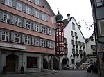
|
Toggenburger Museum | B | 47°19′25″N 9°05′15″E / 47.323629°N 9.08738°E | 8182 | ||
| Lichtensteig | 
|
Altes Rathaus | A | 47°19′22″N 9°05′13″E / 47.322818°N 9.086812°E | 8178 | ||
| Lichtensteig | 
|
Bezirksgebäude | B | 47°19′23″N 9°05′15″E / 47.323069°N 9.087521°E | 14035 | ||
| Lichtensteig | 
|
Haus zur Glocke | B | 47°19′23″N 9°05′15″E / 47.323105°N 9.087522°E | 8179 | ||
| Lichtensteig | 
|
Katholische Kirche St. Gallus | B | 47°19′21″N 9°05′21″E / 47.322408°N 9.089036°E | 14036 | ||
| Lichtensteig | 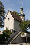
|
Loretokapelle (1680) | B | 47°19′54″N 9°05′04″E / 47.331615°N 9.084411°E | 8180 | ||
| Lichtensteig | 
|
Rathaus (1687) | B | 47°19′25″N 9°05′16″E / 47.323738°N 9.087873°E | 8181 | ||
| Lichtensteig | 
|
Spinnerei Stadtbrücke | B | 47°19′23″N 9°05′06″E / 47.323193°N 9.085104°E | 14037 | ||
| Lichtensteig | Lichtensteig | ISOS | 47°18′59″N 9°04′59″E / 47.316388888°N 9.083055555°E | ||||
Lütisburg
| Location | Upload | Photo | Object | Cat. | Coordinates | KGS-Nr | |
|---|---|---|---|---|---|---|---|
| Lütisburg | 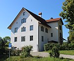
|
Ehemaliger Burgbezirk mit Altem Schulhaus | B | 47°23′37″N 9°04′35″E / 47.393658°N 9.076457°E | 14038 | ||
| Lütisburg | 
|
alte Thurbrücke | B | 47°23′37″N 9°04′26″E / 47.393567°N 9.074004°E | 8184 | ||
| Lütisburg | 
|
Katholische Kirche St. Michael mit Oelbergkapelle | B | 47°23′40″N 9°04′36″E / 47.394339°N 9.076677°E | 8183 | ||
| Lütisburg | 
|
Letzibrücke (Mitte 19. Jh.) | B | 47°23′31″N 9°05′01″E / 47.391975°N 9.083533°E | 8185 | ||
| Lütisburg | 
|
Altes Rathaus | B | 47°23′38″N 9°05′50″E / 47.393784°N 9.097261°E | 14039 | ||
| Lütisburg | 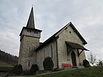
|
St. Bartholomäus | B | 47°23′31″N 9°05′53″E / 47.39201°N 9.09796°E | 14040 | ||
| Lütisburg | 
|
Lütisburg | ISOS | 47°23′41″N 9°04′52″E / 47.3947°N 9.0811°E | |||
Marbach
| Location | Upload | Photo | Object | Cat. | Coordinates | KGS-Nr | |
|---|---|---|---|---|---|---|---|
| Marbach | 
|
Katholische Kirche St. Georg (1852, Turm Ende 13. Jh.) | B | 47°23′30″N 9°34′03″E / 47.391754°N 9.567517°E | 8187 | ||
| Marbach | 
|
Schlösschen Weinstein (1479, 17. Jh.) | B | 47°23′49″N 9°34′16″E / 47.396962°N 9.571025°E | 8188 | ||
| Marbach | 
|
Schlosslandschaft Ober-/Unterrheintal | ISOS | 47°24′07″N 9°34′44″E / 47.4019°N 9.579°E | |||
| Marbach | 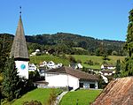
|
Marbach | ISOS | 47°23′30″N 9°34′05″E / 47.3917°N 9.5681°E | |||
Mels
| Location | Upload | Photo | Object | Cat. | Coordinates | KGS-Nr | |
|---|---|---|---|---|---|---|---|
| Mels | 
|
Weisstannen | ISOS | 46°59′21″N 9°20′35″E / 46.9891°N 9.3431°E | |||
| Mels | 
|
Castels, prähistorische-mittelalterliche Höhensiedlung | A | 47°02′58″N 9°24′43″E / 47.049487°N 9.411955°E | 8189 | ||
| Mels | 
|
St. Peter und Paul, frühmittelalterliche Kirchen | A | 47°02′48″N 9°25′20″E / 47.046564°N 9.422313°E | 9651 | ||
| Mels | 
|
Burgruine und Schlösschen Nidberg | B | 47°02′49″N 9°24′59″E / 47.046972°N 9.416444°E | 14108 | ||
| Mels | 
|
Kapuzinerkloster (1651) | B | 47°02′49″N 9°25′28″E / 47.046979°N 9.424369°E | 8193 | ||
| Mels | 
|
Katholische Kirche St. Peter und Paul | B | 47°02′47″N 9°25′21″E / 47.046462427°N 9.422473908°E | 14041 | ||
| Mels | 
|
Oberheiligkreuz, Kapelle Hl. Kreuz (Ende 15. Jh., um 1700) | B | 47°03′20″N 9°25′08″E / 47.055529°N 9.419024°E | 8191 | ||
| Mels | 
|
Mels | ISOS | 47°02′59″N 9°25′00″E / 47.049722222°N 9.416666666°E | |||
Mörschwil
| Location | Upload | Photo | Object | Cat. | Coordinates | KGS-Nr | |
|---|---|---|---|---|---|---|---|
| Mörschwil | 
|
Katholische Kirche St. Johannes der Täufer | B | 47°28′05″N 9°25′28″E / 47.46815°N 9.424434°E | 8199 | ||
| Mörschwil | 
|
Schlosslandschaft Berg/Mörschwil | ISOS | 47°28′42″N 9°25′27″E / 47.4783°N 9.4241°E | |||
Mosnang
| Location | Upload | Photo | Object | Cat. | Coordinates | KGS-Nr | |
|---|---|---|---|---|---|---|---|
| Mosnang | 
|
Bauernhaus Spilhusen | B | 47°23′20″N 9°03′47″E / 47.388954°N 9.063052°E | 8200 | ||
| Mosnang | 
|
Katholische Kirche St. Georg mit Friedhofkapelle | B | 47°21′45″N 9°02′23″E / 47.362379°N 9.039814°E | 8201 | ||
| Mosnang | 
|
Mühlrüti, katholische Kirche St. Josef (1763) | B | 47°22′14″N 8°59′14″E / 47.370591°N 8.987171°E | 8202 | ||
Muolen
| Location | Upload | Photo | Object | Cat. | Coordinates | KGS-Nr | |
|---|---|---|---|---|---|---|---|
| Muolen | 
|
Kulturlandschaft Muolen | ISOS | 47°31′08″N 9°19′20″E / 47.5188°N 9.3222°E | |||