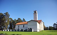
nimi ID
sijaitsee hallinnollisessa alueyksikössä sijainti koordinaatit kuva
Asunnan liikennepaikka (rautatieasema )
4217
. . Keuruu
62°14′38″N 24°53′34″E / 62.244024°N 24.892687°E / 62.244024; 24.892687 Upload an image of this heritage site
Haapamäen rautatieasemanseutu (rautatieympäristö
207
. . Keuruu
Upload an image of this heritage site
Hankasalmen rautatieasema (rautatieasema ratapiha
4215
. Hankasalmen asemanseutu Hankasalmi
62°18′10″N 26°28′42″E / 62.302638888889°N 26.478333333333°E / 62.302638888889; 26.478333333333
Huhkojärven tila (maatalousympäristö
4306
. . Jämsä
62°06′58″N 24°50′42″E / 62.1161025°N 24.84498388888889°E / 62.1161025; 24.84498388888889 Upload an image of this heritage site
Huopanankoski (koski
235
. . Viitasaari
63°02′48″N 25°31′42″E / 63.046666666667°N 25.528333333333°E / 63.046666666667; 25.528333333333
Joutsan Jousitien keskusraitti (historiallinen tie
244
. . Joutsa
Upload an image of this heritage site
Jyväskylän Harju ja Vesilinna (kaupunkimaisema )
4307
. . Jyväskylä
62°14′35″N 25°44′22″E / 62.243072°N 25.739316°E / 62.243072; 25.739316
Jyväskylän Kirkkopuisto ja hallintokeskus (kaupunkimaisema )
186
. . Jyväskylä
62°14′N 25°45′E / 62.24°N 25.75°E / 62.24; 25.75
Jyväskylän rautatieasema (rautatieasema ratapiha maanpäällinen asema risteysasema
4216
. . Jyväskylä
62°14′27″N 25°45′13″E / 62.240833333333°N 25.753611111111°E / 62.240833333333; 25.753611111111
Jyväskylän yliopiston alue (kampus
182
. . Jyväskylä
62°14′12″N 25°43′51″E / 62.236558888889°N 25.730901111111°E / 62.236558888889; 25.730901111111
Jämsänjoen agraarimaisema (maatalousympäristö
193
. . Jämsä
Upload an image of this heritage site
Jämsänkosken teollisuusympäristö (historiallinen teollisuusympäristö
195
. . Jämsä
61°55′02″N 25°09′51″E / 61.917252821°N 25.164118506°E / 61.917252821; 25.164118506
Kannonkosken kirkko (kirkko )
198
. Kannonkosken kirkonkylä Kannonkoski
62°58′23″N 25°15′12″E / 62.97295812°N 25.25333869°E / 62.97295812; 25.25333869 62°58′23″N 25°15′12″E / 62.9729716°N 25.2533219°E / 62.9729716; 25.2533219
Karstulan kirkonkylä (kirkonkylä taajama Suomessa
199
. . Karstula
62°52′40″N 24°48′10″E / 62.87777778°N 24.80277778°E / 62.87777778; 24.80277778
Keiteleen-Iisveden reitin kanavat (vesiliikennepaikka
1077
. . Konnevesi
Upload an image of this heritage site
Keski-Suomen opisto (kansanopisto oppilaitos koulurakennus
228
. . Äänekoski
62°33′36″N 25°52′47″E / 62.560123°N 25.879797°E / 62.560123; 25.879797 62°33′37″N 25°52′48″E / 62.56013982°N 25.87988426°E / 62.56013982; 25.87988426 62°33′37″N 25°52′48″E / 62.5601634°N 25.8798755°E / 62.5601634; 25.8798755
Keuruun vanha keskusta (kylä
202
. . Keuruu
Upload an image of this heritage site
Kinkomaan sairaala (sairaala parantola
219
. Kinkomaa . Muurame
62°09′31″N 25°45′56″E / 62.158585°N 25.765524°E / 62.158585; 25.765524
Kolkanniemen pappila (kirkkomaisema pappila
364
. . Saarijärvi
62°43′33″N 25°09′57″E / 62.72581421°N 25.16594535°E / 62.72581421; 25.16594535 62°43′33″N 25°09′58″E / 62.7257813°N 25.1659746°E / 62.7257813; 25.1659746 Upload an image of this heritage site
Korpilahden kirkkoranta (kirkkomaisema
208
. . Jyväskylä
Kortepohja (Jyväskylän kaupunginosa
197
. . Jyväskylä
62°14′57″N 25°42′27″E / 62.249144444444°N 25.707386111111°E / 62.249144444444; 25.707386111111
Kuhalan talo (kulttuurimaisema
2023
. . Viitasaari
63°14′14″N 25°52′27″E / 63.23721°N 25.87423°E / 63.23721; 25.87423 Upload an image of this heritage site
Lievestuoreen rautatieasema (rautatieasema )
4218
. . Laukaa
62°15′36″N 26°11′46″E / 62.26°N 26.196111°E / 62.26; 26.196111
Luhangan kesäkirkko (kirkko )
1036
. . Luhanka
61°47′55″N 25°42′12″E / 61.798611111111°N 25.703333333333°E / 61.798611111111; 25.703333333333 61°47′55″N 25°42′12″E / 61.7987034°N 25.70333331°E / 61.7987034; 25.70333331 61°47′55″N 25°42′12″E / 61.7986933°N 25.7034156°E / 61.7986933; 25.7034156
Luonetjärven kasarmialue (historiallinen sotilaskohde
1439
. Tikkakoski Jyväskylä
62°23′55″N 25°36′15″E / 62.398746763°N 25.604255656°E / 62.398746763; 25.604255656 Upload an image of this heritage site
Mankolan alue (kulttuurimaisema
1065
. . Jyväskylä
62°16′06″N 25°43′32″E / 62.26823687°N 25.725483142°E / 62.26823687; 25.725483142
Markkamäen omakotialue (kulttuuriperintökohde asuinalue )
254
. . Äänekoski
62°37′13″N 25°43′11″E / 62.620281183°N 25.719645321°E / 62.620281183; 25.719645321 Upload an image of this heritage site
Multian vanha keskusta (kylä
215
. . Multia
Upload an image of this heritage site
Muuramen kirkko (kirkko )
217
. Muuramen kirkonkylä Muurame
62°07′30″N 25°39′52″E / 62.1250682°N 25.66431151°E / 62.1250682; 25.66431151 62°07′30″N 25°39′52″E / 62.1250709°N 25.6643253°E / 62.1250709; 25.6643253
Mönkösmäen talonpoikaistalot (maatalousympäristö
1063
. . Luhanka
Upload an image of this heritage site
Otavan kirjapainokylä (kylä
4303
. . Keuruu
62°15′33″N 24°40′00″E / 62.259158885°N 24.666730528°E / 62.259158885; 24.666730528 Upload an image of this heritage site
Pasala (kylä
392
. . Viitasaari
63°12′14″N 25°54′20″E / 63.203982945°N 25.905600405°E / 63.203982945; 25.905600405 Upload an image of this heritage site
Petäjäveden vanha ja uusi kirkko ympäristöineen (kirkkomaisema
221
. . Petäjävesi
62°15′01″N 25°10′57″E / 62.250242°N 25.182466°E / 62.250242; 25.182466
Pienmäen talomuseo (maatalousympäristö ulkomuseo museo )
181
40 Museotie Hankasalmi
62°17′33″N 26°20′53″E / 62.29257777777778°N 26.347927777777777°E / 62.29257777777778; 26.347927777777777
Pihlajaveden erämaakirkko (kirkko )
4320
. . Keuruu
62°21′49″N 24°21′30″E / 62.3634889°N 24.3583936°E / 62.3634889; 24.3583936
Saarijärven vanha osa (maaseutuympäristö
225
. . Saarijärvi
Upload an image of this heritage site
Seminaarinmäki (kampus
182
. Mattilanpelto Jyväskylä
62°14′12″N 25°43′51″E / 62.236559°N 25.730901°E / 62.236559; 25.730901
Sotatarviketeollisuuden alueet (historiallinen teollisuusympäristö
190
. . Jyväskylä Laukaa
Upload an image of this heritage site
Struven ketju (meridiaanikaari rakennuskompleksi rakennelma
4255
. . Jyväskylä
52°17′22″N 25°38′58″E / 52.28944444444444°N 25.649444444444445°E / 52.28944444444444; 25.649444444444445
Sumiaisten kirkonkylä (kirkonkylä
4330
. Sumiainen Äänekoski
62°39′32″N 26°02′48″E / 62.6589°N 26.0466°E / 62.6589; 26.0466 Upload an image of this heritage site
Suolahden Wanha Asema (rautatieasema asemarakennus
250
. . Äänekoski
62°34′11″N 25°51′08″E / 62.56966667°N 25.85233333°E / 62.56966667; 25.85233333
Suur-Jämsän empiretalot (asuinalue )
1719
. . Jämsä
Upload an image of this heritage site
Säynätsalon teollisuusyhdyskunta (historiallinen teollisuusympäristö
230
. Säynätsalo Jyväskylä
Upload an image of this heritage site
Tammijärven pohjukan asutus (kulttuurimaisema
214
. . Luhanka
Upload an image of this heritage site
Taulumäen kirkko ja Jyväskylän vanha hautausmaa (kirkkomaisema
188
. . Jyväskylä
Upload an image of this heritage site
Uuraisten kirkko ja ympäröivä kulttuurimaisema (kirkkomaisema
4433
. . Uurainen
Upload an image of this heritage site
Vaajakosken tehtaat (historiallinen teollisuusympäristö
191
. . Jyväskylä
Vanha Jämsä (kaupunkimaisema )
1067
. . Jämsä
Upload an image of this heritage site
Viitaniemi (asuinalue )
1035
. . Jyväskylä
62°15′11″N 25°43′48″E / 62.253°N 25.73°E / 62.253; 25.73
museosilta ()
4845
. . Pihtipudas Joutsa
Älylän ja Seminaarinmäen asuinalueet (kaupunkiympäristö
185
. . Jyväskylä
62°14′07″N 25°44′06″E / 62.23534°N 25.735071°E / 62.23534; 25.735071 


