Category:West Hills, Los Angeles
Jump to navigation
Jump to search
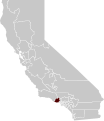
English: The community of West Hills — in the far western San Fernando Valley of Los Angeles, Southern California.
- Formerly known as Owensmouth (1913—1930s) and Canoga Park (1930s—1980s).
Español: West Hills, Los Angeles.
district in Los Angeles, California, United States | |||||
| Upload media | |||||
| Instance of | |||||
|---|---|---|---|---|---|
| Location | Los Angeles County, California, Pacific States Region | ||||
| Inception |
| ||||
| Population |
| ||||
| Area |
| ||||
| Elevation above sea level |
| ||||
| Different from | |||||
 | |||||
Subcategories
This category has the following 5 subcategories, out of 5 total.
Media in category "West Hills, Los Angeles"
The following 28 files are in this category, out of 28 total.
-
Baist's real estate atlas of surveys of Los Angeles, California, 1921 (31382).jpg 4,535 × 6,206; 2.99 MB
-
Canoga Mission Gallery.jpg 3,264 × 2,448; 1.64 MB
-
Castle Peak 1978.jpg 2,095 × 1,572; 2.21 MB
-
Castle Peak San Fernando Valley.jpg 300 × 225; 26 KB
-
Fallbrook Square.jpg 2,132 × 1,600; 3.19 MB
-
Lederer Residence, West Hills.jpg 1,988 × 1,485; 666 KB
-
Map of West Hills neighborhood, Los Angeles, California.png 661 × 477; 374 KB
-
Rancho El Escorpion Hall Map 1880.png 535 × 600; 579 KB
-
Shadow Ranch, West Hills.jpg 3,264 × 2,448; 1.7 MB
-
Ssfl cdc atsdr figure1.gif 701 × 531; 158 KB
-
California SD-27 (2011).svg 1,450 × 1,680; 55 KB
-
Upper-las-virgenes-canyon-open-space-preserve-victory-trailhead.jpg 2,048 × 1,536; 964 KB
-
Victory Gateway at Upper Los Virgenes.JPG 2,185 × 1,668; 840 KB
-
FEMA - 1350 - Photograph by Dave Gatley taken on 03-01-1998 in California.jpg 3,159 × 2,226; 992 KB
-
FEMA - 1351 - Photograph by Dave Gatley taken on 03-03-1998 in California.jpg 3,112 × 2,128; 839 KB
-
WelbyWaySchoolLA.jpg 7,088 × 2,304; 2.9 MB
-
Walmart at 5152 Canoga Park.jpg 3,072 × 2,304; 1.32 MB
-
CA 30 certified.pdf 1,275 × 1,650; 801 KB
-
California US Congressional District 30 (since 2013).tif 2,016 × 998; 3.05 MB


