Category:West Burton, North Yorkshire
Jump to navigation
Jump to search
village in North Yorkshire, UK  | |||||
| Upload media | |||||
| Instance of | |||||
|---|---|---|---|---|---|
| Location | Burton-cum-Walden, Richmondshire, North Yorkshire, Yorkshire and the Humber, England | ||||
 | |||||
Subcategories
This category has the following 4 subcategories, out of 4 total.
C
- Cauldron Force (9 F)
F
- Fox and Hounds, West Burton (6 F)
H
- High Lane, West Burton (1 F)
O
- Obelisk, West Burton (6 F)
Media in category "West Burton, North Yorkshire"
The following 96 files are in this category, out of 96 total.
-
 Aysgarth AA Box 442 - geograph.org.uk - 288622.jpg 480 × 640; 99 KB
-
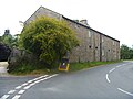
 Barn - geograph.org.uk - 259517.jpg 640 × 479; 98 KB
-
 Barn near West Burton - geograph.org.uk - 2151121.jpg 640 × 480; 63 KB
-
 Behind the waterfall at West Burton - geograph.org.uk - 3035289.jpg 800 × 600; 77 KB
-
 Behind the waterfall, West Burton - geograph.org.uk - 3154321.jpg 800 × 600; 111 KB
-
 Bridge over Walden Beck, West Burton - geograph.org.uk - 3664066.jpg 4,000 × 3,000; 5.16 MB
-
 Burton Bridge - geograph.org.uk - 824831.jpg 640 × 480; 148 KB
-
 Butchers, West Burton, North Yorkshire - geograph.org.uk - 2208300.jpg 1,024 × 705; 213 KB
-
 Cauldron Falls, west burton B 9311.jpg 2,400 × 1,602; 4.45 MB
-
 Cauldron west bourton 9319.jpg 2,400 × 1,600; 4.14 MB
-
 Chapel west bourton 9269.jpg 2,400 × 1,602; 4.01 MB
-
 Chapel west bourton B 9243.jpg 2,400 × 1,602; 4.06 MB
-
 Cheese Press, West Burton, Wensleydale, Yorkshire.jpg 4,896 × 2,752; 4.21 MB
-
 Cultivation terraces at West Burton - geograph.org.uk - 1723593.jpg 3,217 × 1,934; 1.72 MB
-
 Entering West Burton from B6160 - geograph.org.uk - 3081933.jpg 640 × 360; 88 KB
-
 Field barn, West Burton - geograph.org.uk - 3664097.jpg 3,000 × 4,000; 4.17 MB
-
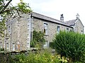
 Field Barn, West Burton - geograph.org.uk - 891346.jpg 640 × 480; 86 KB
-
 Footpath near West Burton - geograph.org.uk - 1924454.jpg 2,048 × 1,536; 1.23 MB
-
 Footpath, West Burton - geograph.org.uk - 2151212.jpg 640 × 480; 86 KB
-
 Grazing, West Burton - geograph.org.uk - 2151223.jpg 480 × 640; 59 KB
-
 Houses in West Burton - geograph.org.uk - 1149716.jpg 640 × 427; 120 KB
-
 Jacobs near West Burton - geograph.org.uk - 2151200.jpg 640 × 480; 101 KB
-
 Market cross and quoits pits, West Burton, Wensleydale, Yorkshire.jpg 4,896 × 2,752; 2.47 MB
-
 Market Cross detail, West Burton, Wensleydale, Yorkshire.jpg 4,192 × 2,743; 1.68 MB
-
 Market cross, West Burton, Wensleydale, Yorkshire.jpg 4,896 × 2,752; 2.26 MB
-
 Morpeth Gate Lane, Wensleydale - geograph.org.uk - 124306.jpg 459 × 309; 23 KB
-
 New House, Bishopdale - geograph.org.uk - 159753.jpg 640 × 480; 65 KB
-
 Old Mounting Block, West Burton, Wensleydale, Yorkshire.jpg 4,896 × 2,752; 4.44 MB
-
 Pastures near West Burton - geograph.org.uk - 1962500.jpg 640 × 480; 73 KB
-
 Path to West Burton - geograph.org.uk - 891336.jpg 640 × 480; 87 KB
-
 Quoits pits, West Burton, Wensleydale, Yorkshire.jpg 4,257 × 2,267; 2.66 MB
-
 Rapids on the Ure below Aysgarth - geograph.org.uk - 123513.jpg 398 × 603; 71 KB
-
 Ryder's Farmhouse, West Burton.jpg 4,320 × 3,240; 3.17 MB
-
 School, West Burton - geograph.org.uk - 3111135.jpg 640 × 480; 79 KB
-
 Sheep near West Burton - geograph.org.uk - 2151130.jpg 640 × 480; 66 KB
-
 South Side of Harland Hill (2) - geograph.org.uk - 641679.jpg 640 × 427; 280 KB
-
 South Side of Harland Hill - geograph.org.uk - 641678.jpg 427 × 640; 262 KB
-
 Stepped pathway, West Burton - geograph.org.uk - 1016822.jpg 480 × 640; 158 KB
-
 Stocks, West Burton, Wensleydale, Yorkshire.jpg 4,896 × 2,752; 3.69 MB
-
 Stocks, West Burton.jpg 4,320 × 3,240; 4.77 MB
-

-
 Stone footbridge over Walden Beck - geograph.org.uk - 698167.jpg 640 × 480; 134 KB
-
 The Grange, West Burton - geograph.org.uk - 891395.jpg 640 × 423; 76 KB
-
 The Market Cross detail, West Burton, Wensleydale, Yorkshire.jpg 4,896 × 2,752; 2.06 MB
-
 Trees in field near West Burton - geograph.org.uk - 4207059.jpg 1,500 × 862; 1.38 MB
-
 View from Black Scar. - geograph.org.uk - 149150.jpg 640 × 480; 78 KB
-
 Viewing the falls, West Burton - geograph.org.uk - 1606602.jpg 640 × 480; 123 KB
-

-
 Walden Beck, West Burton - geograph.org.uk - 383868.jpg 525 × 394; 98 KB
-
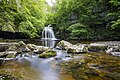
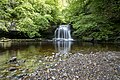
 Waterfall at West Burton - geograph.org.uk - 2534517.jpg 1,799 × 1,199; 824 KB
-
 Waterfall, West Burton - geograph.org.uk - 1541633.jpg 640 × 425; 93 KB
-
 West bourton row 9278.jpg 2,400 × 1,602; 4.73 MB
-
 West Burton - geograph.org.uk - 103664.jpg 640 × 480; 108 KB
-
 West Burton and Forelands Rigg - geograph.org.uk - 891364.jpg 640 × 356; 52 KB
-
 West Burton Fall - geograph.org.uk - 4172044.jpg 600 × 800; 130 KB
-
 West Burton Falls 21 May 2022 01.jpg 2,400 × 3,000; 5.76 MB
-
 West Burton Falls 21 May 2022 02.jpg 3,600 × 2,400; 8.04 MB
-
 West Burton Falls 21 May 2022 03.jpg 3,600 × 2,400; 7.69 MB
-
 West Burton Falls 21 May 2022 04.jpg 3,600 × 2,400; 7.02 MB
-
 West Burton Falls 21 May 2022 05.jpg 3,600 × 2,400; 9.28 MB
-
 West Burton features (3) (geograph 7338713).jpg 4,267 × 2,400; 1.97 MB
-
 West Burton from Brant Lea - geograph.org.uk - 3439412.jpg 4,000 × 3,000; 4.08 MB
-
 West Burton from Tomgill Bank - geograph.org.uk - 883201.jpg 640 × 480; 73 KB
-
 West Burton from Town Head - geograph.org.uk - 2969251.jpg 3,072 × 2,304; 1.32 MB
-
 West Burton houses (1) (geograph 7338694).jpg 4,320 × 3,240; 2.61 MB
-
 West Burton houses (10) (geograph 7338709).jpg 4,213 × 3,160; 2.06 MB
-
 West Burton houses (11) (geograph 7338711).jpg 4,320 × 3,240; 3.07 MB
-
 West Burton houses (12) (geograph 7338712).jpg 4,320 × 3,240; 3.29 MB
-
 West Burton houses (2) (geograph 7338698).jpg 4,320 × 3,240; 3.03 MB
-
 West Burton houses (3) (geograph 7338700).jpg 4,231 × 2,380; 2.45 MB
-
 West Burton houses (5) (geograph 7338702).jpg 4,320 × 3,240; 3.94 MB
-
 West Burton houses (6) (geograph 7338703).jpg 4,320 × 3,240; 2.48 MB
-
 West Burton Mill - geograph.org.uk - 1016790.jpg 640 × 523; 80 KB
-
 West Burton village green.jpg 2,272 × 1,504; 848 KB
-
 Ashby Gill - geograph.org.uk - 349512.jpg 640 × 487; 90 KB
-
 Bishopdale Beck - geograph.org.uk - 824809.jpg 480 × 640; 150 KB
-
 Buckstones - geograph.org.uk - 349494.jpg 640 × 482; 123 KB
-
 Crooksby Barn - geograph.org.uk - 159718.jpg 640 × 480; 98 KB
-
 Dove Scar - geograph.org.uk - 349531.jpg 640 × 479; 157 KB
-
 Foot bridge - geograph.org.uk - 259622.jpg 640 × 480; 109 KB
-
 Hay Garth Barn - geograph.org.uk - 158999.jpg 640 × 480; 94 KB
-
 Howesyke Farm, Bishopdale - geograph.org.uk - 159733.jpg 640 × 480; 98 KB
-
 Knarlton Knot - geograph.org.uk - 349471.jpg 640 × 479; 122 KB
-

-
 Low Dove Scar - geograph.org.uk - 349503.jpg 640 × 476; 72 KB
-
 Morpeth Road - geograph.org.uk - 349523.jpg 640 × 479; 209 KB
-
 Morpeth Road North - geograph.org.uk - 349618.jpg 479 × 640; 133 KB
-
 Road Junction near West Burton - geograph.org.uk - 70368.jpg 640 × 480; 135 KB
-
 Ruined Barn - geograph.org.uk - 349635.jpg 640 × 479; 135 KB
-
 Stone Barn below Odlin Holes Wood - geograph.org.uk - 158965.jpg 640 × 480; 103 KB
-
 Stone Circles - geograph.org.uk - 349483.jpg 640 × 479; 171 KB
-
 The Barn - geograph.org.uk - 349606.jpg 640 × 479; 230 KB
-
 The Larches - geograph.org.uk - 349517.jpg 640 × 483; 103 KB
-
 The Turnoff - geograph.org.uk - 349603.jpg 640 × 479; 205 KB
-
 Thupton Gill, Waldendale - geograph.org.uk - 53113.jpg 640 × 480; 124 KB
-
 W S Hartle butchers - geograph.org.uk - 194040.jpg 640 × 480; 58 KB


_-_geograph.org.uk_-_641679.jpg)


_(geograph_7338713).jpg)


_(geograph_7338694).jpg)
_(geograph_7338709).jpg)
_(geograph_7338711).jpg)
_(geograph_7338712).jpg)
_(geograph_7338698).jpg)
_(geograph_7338700).jpg)
_(geograph_7338702).jpg)
_(geograph_7338703).jpg)


