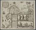
Category:Walruses on maps
Jump to navigation
Jump to search
Subcategories
This category has only the following subcategory.
I
Media in category "Walruses on maps"
The following 8 files are in this category, out of 8 total.
-
1850 Tallis Map of the Western Hemisphere - Geographicus - HemiWest-tallis-1850.jpg 4,000 × 2,940; 2.05 MB
-
Carta Marina AB stitched.jpg 3,340 × 1,268; 990 KB
-
Flickr - USCapitol - Alaskan Purchase, 1867.jpg 2,832 × 2,268; 4.5 MB
-
Linschoten Map of Scandinavia.jpg 1,536 × 1,316; 540 KB
-
Linschotens nordenkart, 1601 (12067624705) (2).jpg 4,400 × 3,609; 22.96 MB
-
Linschotens nordenkart, 1601 (12067624705).jpg 4,037 × 3,455; 22.29 MB
-
Walrus on Carta Marina.jpeg 322 × 248; 34 KB


