Category:Animals on maps
Jump to navigation
Jump to search
Subcategories
This category has the following 14 subcategories, out of 14 total.
Media in category "Animals on maps"
The following 105 files are in this category, out of 105 total.
-
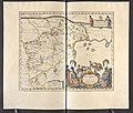
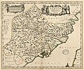
"Fokien Imperii Sinarum provincia undecima." (22066426729).jpg 3,503 × 2,972; 2.05 MB
-
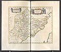
"Iunnan Imperii Sinarum provincia decimaquinta." (21630475324).jpg 3,563 × 2,992; 2.18 MB
-
"Pecheli, sive Peking, imperii Sinarum provincia prima." (22263939511).jpg 3,615 × 3,020; 1.9 MB
-
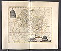
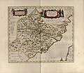
"Xensi, Imperii Sinarum provincia Tertia. " (22240618482).jpg 3,656 × 3,036; 2.45 MB
-
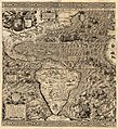
1562 Americæ Gutiérrez.JPG 10,490 × 11,500; 91.89 MB
-
1570 map of Asia Minor by Giacomo Gastaldi.jpg 1,609 × 1,200; 569 KB
-
Atlas Ortelius KB PPN369376781-085av-085br.jpg 3,000 × 2,194; 4.6 MB
-
Cartouche in a Tartary map by Ortelius.jpg 1,006 × 634; 597 KB
-
1592 4 Nova Doetecum mr.jpg 2,000 × 1,418; 3.49 MB
-
1598 map of the Polar Regions by Willem Barentsz.jpg 13,719 × 10,160; 30.66 MB
-
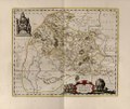
1657 Jansson Map of Germany (Germania) - Geographicus - Germaniae-jansson-1657.jpg 3,500 × 2,811; 3.38 MB
-
Xensi… - Atlas Maior, vol 11, map 15 - Joan Blaeu, 1667 - BL 114.h(star).11.(15).jpg 4,000 × 3,428; 2.17 MB
-
Fokien - Atlas Maior, vol 11, map 23 - Joan Blaeu, 1667 - BL 114.h(star).11.(23).jpg 4,000 × 3,422; 1.99 MB
-
Ivnnan - Atlas Maior, vol 11, map 27 - Joan Blaeu, 1667 - BL 114.h(star).11.(27).jpg 4,000 × 3,363; 2.03 MB
-
Jan Janssonius - Japan.jpg 6,726 × 5,561; 8.04 MB
-
1847 Levasseur Map of Sarthe, France - Geographicus - Sarthe-levasseur-1847.jpg 5,177 × 3,631; 4.68 MB
-
1847 Levasseur Map of the Dept. Du Lot, France - Geographicus - Lot-levasseur-1847.jpg 3,000 × 2,139; 2.09 MB
-
1852 Levasseur Map of Asia - Geographicus - Asia-levasseur-1852.jpg 4,000 × 2,780; 3.92 MB
-
1882 satirical map - L'Europe animale - physiologie comique.jpg 9,883 × 7,135; 19.62 MB
-
A map of New England and New York - F. Lamb sculp. NYPL434826.tiff 5,248 × 6,075; 91.22 MB
-
A New Depiction of the Whole of Hungary WDL6761.png 1,657 × 1,024; 3.59 MB
-
A peculiar map drawn by the Turkish admiral Piri Reis around 1513.jpg 3,293 × 1,508; 2.58 MB
-
Afr. II tab. - btv1b531968799 (2 of 3).jpg 8,672 × 6,396; 8.51 MB
-
America Septentrionalis. NYPL434086.tiff 4,728 × 5,283; 71.47 MB
-
Asia XII ceylon.jpg 1,600 × 1,200; 387 KB
-
Atlas Van der Hagen-KW1049B13 034-PECHELI SIVE PEKING IMPERII SINARVM PROVINCIA PRIMA.jpeg 5,500 × 4,584; 4.32 MB
-
Atlas Van der Hagen-KW1049B13 038-XENSI. IMPERII SINARVM PROVINCIA TERTIA.jpeg 5,500 × 4,608; 3.66 MB
-
Atlas Van der Hagen-KW1049B13 046-FOKIEN IMPERII SINARVM PROVINCIA VNDECIMA.jpeg 5,500 × 4,638; 4.5 MB
-
Barbary Coast on 1644 Europa Recens by Blaeu (cropped).jpg 4,123 × 987; 3.79 MB
-
Barentskartet, 1598 (12068020364).jpg 2,842 × 2,091; 3.85 MB
-
Barentsz Full Map.jpg 1,000 × 742; 258 KB
-
Belgii novi, angliæ novæ, et partis Virginiæ - novissima delineatio. LOC 96686642.jpg 6,494 × 5,379; 6.03 MB
-
Blaeu - Nova Belgica et Anglia Nova (Detail Hudson Area).png 798 × 465; 685 KB
-
Blaeu - Nova Belgica et Anglia Nova.png 5,976 × 4,472; 39.75 MB
-
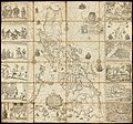
Carta Hydrographica y Chorographica de la Yslas Filipinas MANILA, 1734.jpg 2,000 × 1,870; 2.09 MB
-
Carta Marina AB stitched.jpg 3,340 × 1,268; 990 KB
-
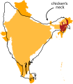
Chickens neck.svg 447 × 512; 46 KB
-
Deliniantur in hac tabula.E.jpg 1,245 × 811; 986 KB
-
Detail (south) ebstorf world map.jpg 1,684 × 2,232; 3.7 MB
-
Figures on a 1644 Blaeu map of Europe.jpg 1,660 × 1,742; 1.01 MB
-
Forminsket utgave av Barentskartet - no-nb krt 00487.jpg 4,418 × 3,449; 3.45 MB
-
Gerard Mercator's 1569 map of the world - Sheet 05.tif 10,938 × 8,333; 260.79 MB
-
Gerard Mercator's 1569 map of the world - Sheet 07.tif 11,392 × 8,689; 283.2 MB
-
Het Aards Paradijs (2901353681).jpg 3,264 × 2,176; 3.06 MB
-
Java indo 1595 map 01 gnangarra.jpg 2,576 × 1,932; 2.05 MB
-
Kaart van Nova Zembla, 1594, NG-1979-564-2.jpg 3,502 × 4,144; 2.66 MB
-
Kaartje van Kaap de Goede Hoop, 1595, RP-P-OB-80.230.jpg 6,052 × 4,434; 5.11 MB
-
Leguat Settlement.jpg 2,325 × 1,702; 3.81 MB
-
Luke Foxe voyage account (North-West Fox, 1635) - 4 foldout map - 3 fox.png 1,216 × 684; 1.27 MB
-
Map - American Folk Art Museum, NYC - IMG 5867.JPG 3,264 × 2,448; 2.95 MB
-
New Map of the Wonderful, Large and Rich Land of Guiana... WDL165.png 1,520 × 1,024; 2.89 MB
-
Nova Belgica Et Anglia Nova (New Netherland and New England) Blaeu Map c1634.jpg 9,000 × 7,644; 25.45 MB
-
Nova Belgica Et Anglia Nova - btv1b8595999k (1 of 2).jpg 8,240 × 6,332; 8.66 MB
-
Novvs atlas Sinensis. LOC 2002625249-2.jpg 7,498 × 6,059; 5.66 MB
-
Novvs atlas Sinensis. LOC 2002625249-2.tif 7,498 × 6,059; 129.98 MB
-
Novvs atlas Sinensis. LOC 2002625249-5.jpg 7,376 × 6,366; 5.18 MB
-
Novvs atlas Sinensis. LOC 2002625249-5.tif 7,376 × 6,366; 134.34 MB
-
Novvs atlas Sinensis. LOC 2002625249-6.jpg 7,284 × 6,156; 5.32 MB
-
Novvs atlas Sinensis. LOC 2002625249-6.tif 7,284 × 6,156; 128.29 MB
-
Olaus Magnus - On Rocks Decorated with Helmets.jpg 1,300 × 600; 274 KB
-
Orcades Carta Marina.JPG 939 × 1,322; 310 KB
-
Pascatway River New England.jpg 3,440 × 2,448; 749 KB
-
Piri Reis en proyección acimutal de Lambert con centro en el norte Mar Rojo.svg 1,004 × 1,004; 35 KB
-
Piri reis world map 01.jpg 1,964 × 2,619; 7.08 MB
-
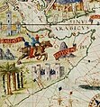
Portuguese map of the Indian Ocean, Africa and Arabia (cropped).jpg 223 × 240; 20 KB
-
Portuguese map of the Indian Ocean, Africa and Arabia.jpg 1,024 × 717; 356 KB
-
Rodrigues.jpg 3,162 × 2,283; 5.87 MB
-
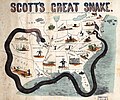
Scott-anaconda.jpg 5,248 × 4,382; 4.16 MB
-
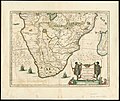
Southern Africa 1640, Jan Jansson (4265384-recto).jpg 7,103 × 5,982; 7.52 MB
-
Tab. XI Asiae, comprehendens Indiam extra Gangem.jpg 9,111 × 9,660; 15 MB
-
Tabula Asiae III by Gerardus Mercator.jpg 11,968 × 9,365; 23.23 MB
-
Typus orbis terrarum - Arnoldus F. ab Langren, auth. et scalp. - btv1b8490572r.jpg 7,426 × 5,028; 7.64 MB
-
Venezuela with the Southern Part of New Andalusia WDL11337.jpg 5,780 × 4,642; 9.44 MB
-
Venezuela with the Southern Part of New Andalusia WDL11337.png 1,238 × 1,024; 2.6 MB
-
Zee Custen tusschen Dovere ende.jpg 1,920 × 1,303; 2.73 MB
-
Карта мира с древними животными.jpg 1,023 × 1,024; 865 KB


