
Category:Volcanology of the United States
 | |||
|---|---|---|---|
| United States | |||
| |||
Subcategories
This category has the following 23 subcategories, out of 23 total.
Media in category "Volcanology of the United States"
The following 29 files are in this category, out of 29 total.
-
 Ashsem small.jpg 175 × 120; 8 KB
-
 Bathymetry image of the Hawaiian archipelago.png 3,681 × 2,844; 14.38 MB
-
 Battle Mountain countour map based on NASA ASTER data.jpg 520 × 393; 150 KB
-
 BattleMountain PaleaogeographicReconstruction 704Mya.jpg 923 × 942; 138 KB
-
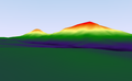
 Cascade Volcanic Arc.jpg 461 × 686; 84 KB
-
 Cascadia earthquake sources.png 580 × 575; 25 KB
-
 Close Encounters of the Lava Kind (13926724270).jpg 4,752 × 3,168; 11.09 MB
-
 Digital terrain model of Battle Mountain based on ASTER data.png 1,217 × 752; 217 KB
-
 Geologists Seamounts.png 821 × 787; 1.01 MB
-
 Harmonic-tremor.jpg 768 × 560; 247 KB
-
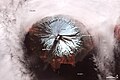
 Hornito (24150729389).jpg 3,648 × 2,736; 4.18 MB
-
Image of the Week - Volcan de Fuego, Guatemala.ogv 54 s, 1,280 × 720; 23.27 MB
-
 Kilauea - Landsat mosaic.jpg 2,563 × 1,898; 1.48 MB
-
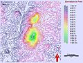
 MedicineLakeBathymetricMeters20080926.png 992 × 663; 123 KB
-
 Mount Cleveland 2010-06-01.jpg 720 × 480; 82 KB
-
 MSH80 Seismographic Activity March 1980.png 401 × 281; 8 KB
-
 NOAA Asuncion Island Benthic Map.png 922 × 908; 790 KB
-
 Old Faithful Geyser KDE with plugin bandwidth.png 1,800 × 1,800; 31 KB
-
 Sampling lava with hammer and bucket.jpg 1,200 × 800; 198 KB
-
 SAR Kilauea topo interferogram.jpg 577 × 577; 152 KB
-
 Sierran Arc Subduction.gif 863 × 344; 61 KB
-
 Sierran Arc Subduction.png 437 × 178; 40 KB
-
 SIR-C X-SAR Long Valley, California.jpg 1,383 × 1,540; 553 KB
-
 Sisters07 TheHusband gps station 05-10-07.jpg 2,560 × 1,920; 3.06 MB
-

-
 Tiltmeter on Mauna Loa.jpg 500 × 632; 47 KB
-
-
 USGSLavaDeltaCartoon.JPG 400 × 300; 22 KB
-
Volcano Lava Sample.webm 2 min 45 s, 1,280 × 720; 50.6 MB


.jpg)


.jpg)


