Category:Volcano monitoring in the United States
Jump to navigation
Jump to search
Subcategories
This category has the following 8 subcategories, out of 8 total.
H
S
U
Media in category "Volcano monitoring in the United States"
The following 18 files are in this category, out of 18 total.
-
017 warning siesmograph resize (22027451672).jpg 1,176 × 800; 192 KB
-
100 Years at Kilauea - NASA Earth Observatory.jpg 720 × 964; 293 KB
-
2016-366-259 Clearing the Volcano (29711633025).jpg 4,032 × 3,024; 1.82 MB
-
Crater Peak vent of Mount Spurr.jpg 1,024 × 698; 270 KB
-
From Johnston Ridge Observatory October 2004 24.JPG 2,272 × 1,704; 950 KB
-
Harmonic-tremor.jpg 768 × 560; 247 KB
-
Hawaiian Volcano Observatory tower.jpg 2,592 × 1,944; 998 KB
-
Mauna Loa Summit Inflation InSAR.jpg 404 × 410; 69 KB
-
Mount Cleveland 2010-06-01 lrg.jpg 2,701 × 2,701; 931 KB
-
Mount Cleveland 2010-06-01.jpg 720 × 480; 82 KB
-
MSH80 Diagram earthquakes April 20th to Mai 18th.gif 401 × 301; 7 KB
-
MSH80 Seismographic Activity March 1980.png 401 × 281; 8 KB
-
Our group with Scientific Instruments - Flickr - brewbooks.jpg 2,812 × 2,284; 2.29 MB
-
Salton Buttes - Obsidian Butte - monitoring devices.JPG 3,294 × 2,526; 3.88 MB
-
Seismographs HVNP visitor centre.jpg 1,245 × 1,875; 321 KB
-
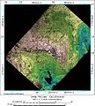
SIR-C X-SAR Long Valley, California.jpg 1,383 × 1,540; 553 KB
-
Sisters07 TheHusband gps station 05-10-07.jpg 2,560 × 1,920; 3.06 MB
-
Ssis InSAR may2001.jpg 1,081 × 878; 197 KB


