Category:Utah State Route 44
Jump to navigation
Jump to search
 | number: | (forty-four) |
|---|---|---|
| State highways in Utah: | 24 · 25 · 26 · 27 · 28 · 29 · 30 · 31 · 32 · 33 · 34 · 35 · 36 · 37 · 38 · 39 · 40 · 41 · 42 · 43 · 44 · 45 · 46 · 47 · 48 · 49 · 50 · 51 · 52 · 53 · 54 · 55 · 56 · 57 · 58 · 59 · 60 · 61 · 62 · 63 · 64 |
state highway in Daggett County, Utah, United States | |||||
| Upload media | |||||
| Instance of | |||||
|---|---|---|---|---|---|
| Part of | |||||
| Located in protected area |
| ||||
| Location | Daggett County, Utah | ||||
| Transport network | |||||
| Owned by | |||||
| Maintained by | |||||
| Inception |
| ||||
| Length |
| ||||
| Terminus | |||||
| |||||
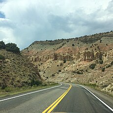
English: Media related to Utah State Route 44, a 27.995-mile (45.054 km) state highway entirely within Daggett County in northeastern Utah, United States, the connects U.S. Route 191 in the Flaming Gorge National Recreation Area (at Greendale Junction) with Utah State Route 43 in Manila. The entire route is part of the Flaming Gorge-Uintas Scenic Byway.
Subcategories
This category has the following 2 subcategories, out of 2 total.
F
Media in category "Utah State Route 44"
The following 6 files are in this category, out of 6 total.
-
Flaming Gorge 1831.jpg 3,000 × 2,003; 5.84 MB
-
Flaming Gorge National Recreation Area 4171.jpg 2,448 × 2,448; 1.43 MB
-
Flaming Gorge NP 4172.jpg 3,264 × 2,448; 2.33 MB
-
Manila, Utah map.svg 800 × 600; 462 KB
-
Utah 44.svg 600 × 600; 10 KB
-
Utah SR 44.svg 385 × 385; 5 KB


