Category:Utah State Route 30
Jump to navigation
Jump to search
 | number: | (thirty-) |
|---|---|---|
| State highways in Utah: | 10 · 11 · 12 · 13 · 14 · 15 · 16 · 17 · 18 · 19 · 20 · 21 · 22 · 23 · 24 · 25 · 26 · 27 · 28 · 29 · 30 · 31 · 32 · 33 · 34 · 35 · 36 · 37 · 38 · 39 · 40 · 41 · 42 · 43 · 44 · 45 · 46 · 47 · 48 · 49 · 50 |
state highway in Box Elder, Cache, and Rich counties in Utah, United States | |||||
| Upload media | |||||
| Instance of | |||||
|---|---|---|---|---|---|
| Location |
| ||||
| Transport network | |||||
| Connects with | |||||
| Owned by |
| ||||
| Maintained by |
| ||||
| Inception |
| ||||
| Length |
| ||||
| Terminus | |||||
| Partially coincident with | |||||
| |||||
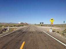
English: Media related to Utah State Route 30, a 135.62-mile (218.26 km) state highway in Box Elder, Cache, and Rich counties in northern Utah, United States, that has three sections. The western 90.615-mile (145.831 km) section connects Nevada State Route 233 at the Nevada state line (about 7.25 miles [11.67 km] west of Lucin) with Interstate 84, just west of Snowville. The middle 19.315-mile (31.084 km) section connects Interstate 15, just southwest of Riverside, with U.S. Route 89/U.S. Route 91 in Logan. The eastern 25.689-mile (41.342 km) section connects U.S. Route 89 in Garden City with Wyoming Highway 89 at the Wyoming state line (about 10.5 miles [16.9 km] northeast of Randolph).
Subcategories
This category has the following 5 subcategories, out of 5 total.
*
Media in category "Utah State Route 30"
The following 4 files are in this category, out of 4 total.
-
SR-30 guide number 69.jpg 185 × 428; 14 KB
-
Utah 30.svg 600 × 600; 12 KB
-
Utah SR 30 map.svg 1,475 × 860; 575 KB
-
Utah SR 30.svg 385 × 385; 9 KB


