Category:Utah State Route 147
Jump to navigation
Jump to search
 | number: | (one hundred fourty-seven) |
|---|---|---|
| State highways in Utah: | 127 · 128 · 129 · 130 · 131 · 132 · 133 · 134 · 135 · 136 · 137 · 138 · 139 · 140 · 141 · 142 · 143 · 144 · 145 · 146 · 147 · 148 · 149 · 150 · 151 · 152 · 153 · 154 · 155 · 156 · 157 · 158 · 159 · 160 · 161 · 162 · 163 · 164 · 165 · 166 · 167 |
state highway in Utah County, Utah, United States .jpg) | |||||
| Upload media | |||||
| Instance of | |||||
|---|---|---|---|---|---|
| Location | Utah County, Utah | ||||
| Transport network | |||||
| Connects with | |||||
| Owned by | |||||
| Maintained by | |||||
| Inception |
| ||||
| Length |
| ||||
| Terminus | |||||
| |||||
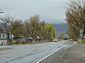
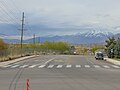
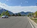
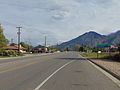
English: Media related to Utah State Route 147, a 18.175-mile (29.250 km) state highway in southern Utah County, Utah, United States, that connects the northern terminus of Utah State Route 141 at McBeth Corner in West Mountain with U.S. Route 89 (1600 West) in Mapleton, by way of northern Spanish Fork and Mapleton Main Street (with another connection with U.S. Route 89 in southern Mapleton).
Subcategories
This category has the following 3 subcategories, out of 3 total.
S
Media in category "Utah State Route 147"
The following 51 files are in this category, out of 51 total.
-
 "SR-89" & SR-147 shields in Mapleton, Utah, Feb 17.jpg 2,592 × 1,944; 2.24 MB
-
 147 1600 south (30275854547).jpg 4,032 × 3,024; 1.53 MB
-
 147 ahead (31340807918).jpg 4,032 × 3,024; 1.94 MB
-
 89 1600 west (30275854827).jpg 4,032 × 3,024; 1.2 MB
-
 BenjaminUtah.jpg 1,200 × 577; 157 KB
-
 East 147 (30275855427).jpg 4,032 × 3,024; 1.54 MB
-
 East across Benjamim at Spanish Fork Peak, Jun 17.jpg 2,592 × 1,944; 2.33 MB
-
 East along SR-147 from SR-51, Apr 16.jpg 2,592 × 1,944; 2.35 MB
-
 East at Main Street & 1600 South in Mapleton, Utah, Apr 16.jpg 2,592 × 1,944; 2.4 MB
-
 East at Main Street & Maple Street in Mapleton, Utah, Apr 16.jpg 2,592 × 1,944; 2.4 MB
-
 East at SR-147 overpass over I-15, Apr 16.jpg 2,592 × 1,944; 2.42 MB
-
 East at US-89 & SR 147 (W Maple St) junction, Apr 16.jpg 2,592 × 1,944; 2.43 MB
-
 East at US-89 & SR-147 (W 1600 South) in Mapleton, Utah, Apr 16.jpg 2,592 × 1,944; 2.39 MB
-
 East on SR-147 under US-6,.jpg 2,592 × 1,944; 2.38 MB
-
 East toward junction of SR-115 and SR-147, Apr 16.jpg 2,592 × 1,944; 2.33 MB
-
 East toward SR-147 & SR 156 junction, Apr 16.jpg 2,592 × 1,944; 2.43 MB
-
 Mapleton Elementary School (Utah).JPG 2,816 × 2,112; 2.59 MB
-
 North across junction of SR-147 & SR-51 in Spanish Fork, Utah, Apr 16.jpg 2,592 × 1,944; 2.33 MB
-
 North along SR-147 in West Mountain, Utah, Jun 16.jpg 2,592 × 1,944; 2.19 MB
-
 North at Main Street & 1600 South in Mapleton, Utah, Apr 16.jpg 2,592 × 1,944; 2.28 MB
-
 North at Main Street & Maple Street in Mapleton, Utah, Apr 16.jpg 2,592 × 1,944; 2.4 MB
-
 North at SR-147 & SR-141 junction, Apr 16.jpg 2,592 × 1,944; 2.33 MB
-
 North at US-89 & SR 147 (W Maple St) junction, Apr 16.jpg 2,592 × 1,944; 2.37 MB
-
 North at US-89 & SR-147 (W 1600 South) in Mapleton, Utah, Apr 16.jpg 2,592 × 1,944; 2.39 MB
-
 North toward junction of SR-115 and SR-147, Apr 16.jpg 2,592 × 1,944; 2.4 MB
-
 North toward junction of SR-77 and SR-147, Apr 16.jpg 2,592 × 1,944; 2.28 MB
-
 North toward SR-147 & SR 156 junction, Apr 16.jpg 2,592 × 1,944; 2.4 MB
-
 North UT-147 Beginning where UT-141 Ends - panoramio.jpg 1,600 × 1,200; 538 KB
-
 South at junction of SR-51 & SR-147 in Spanish Fork, Utah, Apr 16.jpg 2,592 × 1,944; 2.36 MB
-
 South at Main Street & 1600 South in Mapleton, Utah, Apr 16.jpg 2,592 × 1,944; 2.24 MB
-
 South at Main Street & Maple Street in Mapleton, Utah, Apr 16.jpg 2,592 × 1,944; 2.41 MB
-
 South at SR-147 & SR-141 junction, Apr 16.jpg 2,592 × 1,944; 2.42 MB
-
 South at US-89 & SR 147 (W Maple St) junction, Apr 16.jpg 2,592 × 1,944; 2.36 MB
-
 South at US-89 & SR-147 (W 1600 South) in Mapleton, Utah, Apr 16.jpg 2,592 × 1,944; 2.42 MB
-
 South toward junction of SR-115 and SR-147, Apr 16.jpg 2,592 × 1,944; 2.41 MB
-
 South toward junction of SR-77 and SR-147, Apr 16.jpg 2,592 × 1,944; 2.24 MB
-
 South toward SR-147 & SR 156 junction, Apr 16.jpg 2,592 × 1,944; 2.43 MB
-
 Spanish Fork City Police vehicle, Utah.JPG 2,816 × 2,112; 2.67 MB
-
 SR 147 77 (45253941781).jpg 4,032 × 3,024; 1.86 MB
-
 SR 147, 51 (30275854947).jpg 4,032 × 3,024; 2.07 MB
-
 SR 77 147 (43440165090).jpg 4,032 × 3,024; 2.57 MB
-
 Utah 147.svg 750 × 600; 72 KB
-
 Utah SR 147.svg 385 × 385; 6 KB
-
 West along SR-147 passing under US-6, Apr 16.jpg 2,592 × 1,944; 2.4 MB
-
 West at Main Street & 1600 South in Mapleton, Utah, Apr 16.jpg 2,592 × 1,944; 2.38 MB
-
 West at Main Street & Maple Street in Mapleton, Utah, Apr 2016.jpg 2,592 × 1,944; 2.42 MB
-
 West at SR-147 overpass over I-15, Apr 16.jpg 2,592 × 1,944; 2.42 MB
-
 West at US-89 & SR 147 (W Maple St) junction, Apr 16.jpg 2,592 × 1,944; 2.42 MB
-
 West at US-89 & SR-147 (W 1600 South) in Mapleton, Utah, Apr 16.jpg 2,592 × 1,944; 2.35 MB
-
 West toward junction of SR-77 and SR-147, Apr 16.jpg 2,592 × 1,944; 2.23 MB
-
 West toward SR-147 & SR 156 junction, Apr 16.jpg 2,592 × 1,944; 2.38 MB

.jpg)
.jpg)
.jpg)


_junction,_Apr_16.jpg)
_in_Mapleton,_Utah,_Apr_16.jpg)


.JPG)


_junction,_Apr_16.jpg)
_in_Mapleton,_Utah,_Apr_16.jpg)


_junction,_Apr_16.jpg)
_in_Mapleton,_Utah,_Apr_16.jpg)


.jpg)
.jpg)
.jpg)


_junction,_Apr_16.jpg)
_in_Mapleton,_Utah,_Apr_16.jpg)

