Category:Utah State Route 128
Jump to navigation
Jump to search
 | number: | (one twenty-eight) |
|---|---|---|
| State highways in Utah: | 108 · 109 · 110 · 111 · 112 · 113 · 114 · 115 · 116 · 117 · 118 · 119 · 120 · 121 · 122 · 123 · 124 · 125 · 126 · 127 · 128 · 129 · 130 · 131 · 132 · 133 · 134 · 135 · 136 · 137 · 138 · 139 · 140 · 141 · 142 · 143 · 144 · 145 · 146 · 147 · 148 |
state highway in Grand County, Utah, United States .jpg)   | |||||
| Upload media | |||||
| Instance of | |||||
|---|---|---|---|---|---|
| Part of | |||||
| Location | Grand County, Utah | ||||
| Located in or next to body of water | |||||
| Transport network | |||||
| Owned by | |||||
| Maintained by | |||||
| Inception |
| ||||
| Length |
| ||||
| Terminus | |||||
| |||||
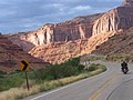
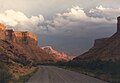
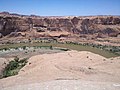
English: Media related to Utah State Route 128, a 44.564-mile (71.719 km) highway in southeastern Grand County, Utah, United States, that connects U.S. Route 191 immediately north of Moab with Interstate 70 (about 5 miles [8.0 km] northeast of Cisco, running south and east of Arches National Park. The entire route has been designated the Upper Colorado River Scenic Byway by the Utah Scenic Byways program and is part of the "Dinosaur Diamond Prehistoric Highway" in the National Scenic Byway program.
Subcategories
This category has the following 3 subcategories, out of 3 total.
Media in category "Utah State Route 128"
The following 45 files are in this category, out of 45 total.
-
 128and191jct.jpg 1,600 × 1,200; 330 KB
-

-
 Castlerock.jpg 641 × 275; 166 KB
-
 Colorado River Scenic Byway (3767946786).jpg 2,336 × 3,504; 2.6 MB
-
-
 DinosaurDiamond map.svg 1,475 × 860; 769 KB
-
 East UT-128 Shield - panoramio.jpg 1,600 × 1,200; 519 KB
-
 Fishertowers2.jpg 2,906 × 2,022; 695 KB
-
 Going southwest on Highway 128.jpg 4,032 × 3,024; 3.65 MB
-
 Junction of UT-128 and US-191 near Moab 20110816 1.jpg 3,781 × 2,127; 3.29 MB
-
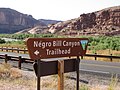 N-word Bill Canyon sign.JPG 1,024 × 768; 329 KB
-
 On US 128 near Moab, Utah (15874358579).jpg 5,616 × 3,744; 23.63 MB
-
 On US 128 near Moab, Utah (16060432615).jpg 4,782 × 3,188; 11.92 MB
-
 River Road 8-16 (15367073589).jpg 5,760 × 3,840; 6.17 MB
-
 River Road 8-16 (15367074909).jpg 5,760 × 3,840; 4.88 MB
-
 River Road 8-16 (15368068740).jpg 3,840 × 5,760; 7.09 MB
-
 River Road 8-16 (15529980956).jpg 5,760 × 3,840; 4.35 MB
-
 River Road 8-16 (15529985336).jpg 5,760 × 3,840; 6.18 MB
-
 River Road 8-16 (15553699795).jpg 3,840 × 5,760; 6.91 MB
-
 River Road 8-16 (15554542832).jpg 5,760 × 3,840; 4.5 MB
-
 River Road 8-16 (15554544222).jpg 5,760 × 3,840; 5.85 MB
-
 River Road 8-16 (15554545942).jpg 5,760 × 3,840; 5.2 MB
-
 Slickrock - panoramio (1).jpg 3,264 × 2,448; 3.36 MB
-
 Slickrock - panoramio (4).jpg 3,264 × 2,448; 3.25 MB
-
 Slickrock-Colorado.jpg 2,398 × 1,350; 632 KB
-
 SR128coloradoriver.JPG 3,008 × 2,000; 2.01 MB
-
 Turn west to continue on UT-128 East - panoramio.jpg 1,600 × 1,200; 442 KB
-
 US Highway 191 - Utah - 7688651108.jpg 3,072 × 2,304; 441 KB
-
 US Highway 191 - Utah - 7688651724.jpg 3,072 × 2,304; 569 KB
-
 Ut128.JPG 640 × 480; 117 KB
-
 UT128wterminus.jpg 3,264 × 2,448; 3.57 MB
-
 Utah 128.svg 750 × 600; 73 KB
-
 Utah SR 128 map.svg 1,475 × 860; 60 KB
-
 Utah SR 128.svg 385 × 385; 10 KB
-
 Utah state highway 128 (2539537752).jpg 4,219 × 2,741; 7.83 MB
-
 Utah State Route 128 (6352000838).jpg 4,320 × 3,240; 9.89 MB
-
 Utah State Route 128 Along Colorado River Near Moab, Utah (2407539109).jpg 2,048 × 1,536; 456 KB
-
 Utah State Route 128 Along Colorado River Near Moab, Utah (2407541849).jpg 2,048 × 1,536; 493 KB
-
 Utah State Route 128 Along Colorado River Near Moab, Utah (2408363636).jpg 2,048 × 1,536; 461 KB
-
 Utah State Route 128 Along Colorado River Near Moab, Utah (2408373398).jpg 2,048 × 1,536; 464 KB
-
 Utah State Route 128 Along Colorado River Near Moab, Utah (2408378826).jpg 2,048 × 1,536; 467 KB
-
 Utah State Route 128 Along Colorado River Near Moab.jpg 2,048 × 1,536; 449 KB
-
 UTSR128.JPG 3,008 × 2,000; 1.86 MB
-
 UTSR128Blindcurve.JPG 3,008 × 2,000; 3.02 MB
-
 WarningsignonSR128.jpg 1,600 × 1,200; 438 KB


.jpg)


.jpg)
.jpg)
.jpg)
.jpg)
.jpg)
.jpg)
.jpg)
.jpg)
.jpg)
.jpg)
.jpg)
.jpg)


.jpg)
.jpg)
.jpg)
.jpg)
.jpg)
.jpg)
.jpg)


