Category:Tsunami evacuation route signs in the United States
Jump to navigation
Jump to search
Media in category "Tsunami evacuation route signs in the United States"
The following 19 files are in this category, out of 19 total.
-

-
-

-

-

-
 Bastendorff Beach 2 (8884978380).jpg 4,960 × 3,048; 7.48 MB
-
 Kalani entrance, entering tsunami evacuation area (a0004909) - panoramio.jpg 4,928 × 3,264; 7.2 MB
-
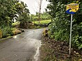
 Kalani entrance, leaving tsunami evacuation area (a0004885) - panoramio.jpg 3,264 × 4,928; 5 MB
-
 Leaving Tsunami Hazard Zone Sign.jpg 3,074 × 2,283; 6.41 MB
-
 MUTCD EM1-2.svg 198 × 198; 10 KB
-
 Sign Saliendo Zona de Peligro Tsunami.jpg 1,656 × 2,208; 499 KB
-
 Tsunami evac sign Seaside Oregon.JPG 3,872 × 2,592; 3.83 MB
-
 Tsunami Evacuation Map Depoe Bay Oregon.jpg 4,752 × 3,168; 7.82 MB
-
 Tsunami evacuation route sign (2066817391).jpg 3,264 × 2,448; 3.46 MB
-
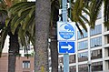 Tsunami evacuation route sign San Francisco 2019.jpg 4,928 × 3,264; 6.74 MB
-
 Tsunami Evacuation Route Sign Southern California 8176008396 o.jpg 2,400 × 1,600; 2.72 MB
-
 Tsunami Evacuation Route signage south of Aberdeen Washington.jpg 550 × 549; 59 KB
-
 Tsunami Evacuationroute sign.JPG 2,048 × 1,360; 528 KB
-
 U.S. Virgin Island — Tsunami evacuation route (sign).JPG 3,672 × 4,896; 6.7 MB


.jpg)
_-_panoramio.jpg)
_-_panoramio.jpg)


.jpg)


.JPG)