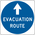
Category:Evacuation route signs in the United States
Jump to navigation
Jump to search
Subcategories
This category has the following 3 subcategories, out of 3 total.
Media in category "Evacuation route signs in the United States"
The following 20 files are in this category, out of 20 total.
-
2020.06.06 DC People and Places, Washington, DC USA 158 82241.jpg 5,884 × 3,923; 15.2 MB
-
A1A North at FL 816 (39022774990).jpg 2,400 × 1,600; 1.79 MB
-
Constitution Avenue Sign.jpg 2,134 × 1,681; 818 KB
-
DC Street Sign - K Street NW.jpg 2,800 × 2,100; 863 KB
-
East End US 41-FL 44 Multiplex (Sidewalk).JPG 4,000 × 3,000; 2.47 MB
-
Evacuation route sign - Hawaii.jpg 1,600 × 1,200; 209 KB
-
Evacuation Route sign, Carrollton Avenue, New Orleans.jpg 3,888 × 5,184; 21.4 MB
-
Evacuation sign.jpg 2,448 × 3,264; 1.59 MB
-
F Capodanno Bl Sand Ln td (2022-03-26) 05.jpg 5,472 × 3,648; 4.49 MB
-
GA Tsunami evac route.jpg 3,024 × 4,032; 5.42 MB
-
Lefferts Bl Qns td (2020-10-17) 132.jpg 5,472 × 3,648; 5.31 MB
-
MUTCD EM1-1.svg 73 × 73; 13 KB
-
NB FL 441 @ Rosalyn Avenue & Evacuation Route.jpg 3,648 × 2,736; 2.05 MB
-
NB FL 441; Evacuation Route @ 90-point-7 FM-1.jpg 3,648 × 2,736; 2.11 MB
-
NB FL 441; Evacuation Route @ 90-point-7 FM-2.jpg 3,648 × 2,736; 2.04 MB
-
NB FL 441; Evacuation Route @ Mobile Avenue.jpg 3,648 × 2,736; 2.02 MB
-
NY 395 nb past NY 7, 2023.jpg 2,832 × 2,145; 1.13 MB


