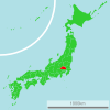
Category:Transport maps of Saitama prefecture
Jump to navigation
Jump to search
日本語: 埼玉県の交通に関する地図
| Prefectures of Japan 交通に関する地図 | |||
|---|---|---|---|
|

| ||
Media in category "Transport maps of Saitama prefecture"
The following 3 files are in this category, out of 3 total.
-
KoutsuSeisakuShigikai198 Tokyo.png 3,937 × 3,325; 726 KB
-
Saitama prefectural road No.3 Route map.svg 628 × 360; 17 KB
-
UnyuSeisakuShingikai18 Tokyo.png 3,175 × 3,212; 639 KB


