Category:Transport maps of Aichi prefecture
Jump to navigation
Jump to search
日本語: 愛知県の交通に関する地図
| Prefectures of Japan 交通に関する地図 | |||
|---|---|---|---|
|

| ||
Subcategories
This category has the following 3 subcategories, out of 3 total.
R
- Railway maps of Nagoya Railroad (137 F)
Media in category "Transport maps of Aichi prefecture"
The following 5 files are in this category, out of 5 total.
-
Hirai Junction Railway track.svg 800 × 452; 189 KB
-
Hirai Junction wiring diagram.png 800 × 452; 63 KB
-
Hirai s g penpen.PNG 978 × 553; 16 KB
-
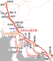
LineMap JRandMeitetsu.png 470 × 550; 102 KB
-
Linemap of JRC and Meitetsu.svg 2,056 × 2,377; 397 KB


