Category:Topographic maps of the Czech Republic
Jump to navigation
Jump to search
Subcategories
This category has only the following subcategory.
Media in category "Topographic maps of the Czech Republic"
The following 26 files are in this category, out of 26 total.
-
After Action Report - Kladno - NARA - 100384951.jpg 10,800 × 7,755; 9.7 MB
-
After Action Report - Teplitz-Schönau - NARA - 100384490 (page 1).jpg 10,800 × 7,673; 10.57 MB
-
After Action Report - Vodňany - NARA - 100384947.jpg 10,800 × 7,843; 9.91 MB
-
After Action Report - Znojmo - NARA - 100384945.jpg 10,800 × 7,837; 9.85 MB
-
Bohemian Massif relief location map.jpg 1,400 × 1,085; 1.02 MB
-
Czech Republic-Poland border (topographic).JPG 680 × 510; 532 KB
-
Czechia - merged map.png 2,684 × 1,568; 2.05 MB
-
Czechia demis.png 2,684 × 1,568; 2.14 MB
-
Dolnoslaskie topo.png 2,942 × 2,254; 8.74 MB
-
Eastern Moravia relief map.png 929 × 829; 1.21 MB
-
Erzgebirge phys map de.png 1,797 × 1,134; 2.33 MB
-
Map of Germany(GN03358).jpg 3,264 × 2,448; 1.22 MB
-
Naturraumkarte Fichtelgebirge Hufeisen.png 949 × 920; 1.07 MB
-
Naturraumkarte Fichtelgebirge.png 949 × 920; 1.15 MB
-
Naturraumkarte Thueringisch-Fraenkisches Mittelgebirge mit Vogtland.png 2,111 × 1,693; 4.63 MB
-
Oberpfälzer Wald - Deutsche Mittelgebirge, Serie A-de.png 1,800 × 2,050; 6.55 MB
-
Przedgórze Sudeckie relief.png 4,170 × 3,173; 10.21 MB
-
Relief Map of Czech Republic.png 1,000 × 608; 866 KB
-
Reliefkarte Tschechien.png 3,289 × 2,065; 10.91 MB
-
Sachsen topo.png 2,598 × 2,098; 7.67 MB
-
Slovakia topo.jpg 1,400 × 962; 582 KB
-
Teschen Silesia and Moravian Gate.jpg 620 × 498; 477 KB
-
Topo boehmerwald engleder.jpg 730 × 501; 396 KB
-
Tschechien topo.png 1,000 × 773; 1.39 MB
-
Vienna Basin physical.png 926 × 1,066; 1.81 MB
-
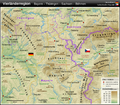
Vierländerregion Bayern - Thüringen - Sachsen - Böhmen DE.png 1,033 × 908; 1.62 MB


