Category:Topographic maps of Saxony-Anhalt
Jump to navigation
Jump to search
Federal states of Germany:
Subcategories
This category has the following 2 subcategories, out of 2 total.
T
Media in category "Topographic maps of Saxony-Anhalt"
The following 20 files are in this category, out of 20 total.
-
Altmark Jerichow topo.png 2,608 × 1,626; 3.59 MB
-
Einzugs- und Flussgebietskarte Bode.png 1,422 × 1,043; 1.49 MB
-
Einzugs- und Flussgebietskarte Saale.png 2,103 × 3,002; 7.24 MB
-
Einzugs- und Flussgebietskarte Weisse Elster.png 1,276 × 1,998; 2.86 MB
-
Fichkona map.png 1,200 × 1,490; 1.19 MB
-
Gotischer Backstein um Nord- & südliche Ostsee.png 5,248 × 2,250; 11.33 MB
-
Harz - Deutsche Mittelgebirge, Serie A-de.png 2,450 × 1,300; 4.46 MB
-
Karte des Deutschen Reiches (5820362).jpg 11,376 × 13,969; 67.5 MB
-
Karte des Deutschen Reiches (5820388c).jpg 11,387 × 9,213; 42.27 MB
-
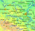
Magdeburger Boerde.png 681 × 602; 139 KB
-
Sachsen-Anhalt 1665x2047 Kreise.png 1,665 × 2,047; 4.19 MB
-
Sachsen-Anhalt.gif 1,163 × 1,373; 512 KB
-
Saxony-Anhalt in Germany (relief) (shade) (special marker).svg 1,073 × 1,272; 6.54 MB
-
Saxony-Anhalt in Germany (relief) (shade).svg 1,073 × 1,272; 6.52 MB
-
Saxony-Anhalt in Germany (relief).svg 1,073 × 1,272; 6.53 MB
-
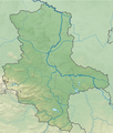
Saxony-Anhalt relief location map.jpg 1,273 × 1,500; 691 KB
-
Saxony-Anhalt relief location map.png 1,272 × 1,499; 2.75 MB
-
Topographische Karte Altmark - Mittelmark, Elbe - Magdeburg.jpg 10,201 × 6,994; 23.19 MB
-
Minerva atlas 1926 (142708883).jpg 5,362 × 8,313; 61.96 MB
-
Minerva atlas 1926 (142708884).jpg 10,349 × 8,316; 119.5 MB


