Category:Topographic maps of Saxony
Jump to navigation
Jump to search
Federal states of Germany:
Media in category "Topographic maps of Saxony"
The following 46 files are in this category, out of 46 total.
-
Ehemalige Muskauer Heide - südlich Weißwasser 3D.png 1,384 × 699; 2.07 MB
-
Einzugs- und Flussgebietskarte Pleisse.png 777 × 1,233; 1.03 MB
-
Einzugs- und Flussgebietskarte Saale.png 2,103 × 3,002; 7.24 MB
-
Einzugs- und Flussgebietskarte Weida.png 553 × 713; 408 KB
-
Einzugs- und Flussgebietskarte Weisse Elster.png 1,276 × 1,998; 2.86 MB
-
Erzgebirge phys map de.png 1,797 × 1,134; 2.33 MB
-
Fichkona map.png 1,200 × 1,490; 1.19 MB
-
Gotischer Backstein um Nord- & südliche Ostsee.png 5,248 × 2,250; 11.33 MB
-
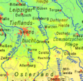
Leipzig Lowlands.png 515 × 501; 330 KB
-
Map of Germany(GN03358).jpg 3,264 × 2,448; 1.22 MB
-
Mittelsachsen.gif 439 × 350; 76 KB
-
Mittelsachsen.png 438 × 314; 185 KB
-
Naturraumkarte Fichtelgebirge Hufeisen.png 949 × 920; 1.07 MB
-
Naturraumkarte Fichtelgebirge.png 949 × 920; 1.15 MB
-
Naturraumkarte Thueringisch-Fraenkisch-Vogtlaendisches Schiefergebirge.png 1,541 × 938; 2.04 MB
-
Naturraumkarte Thueringisch-Fraenkisches Mittelgebirge mit Vogtland.png 2,111 × 1,693; 4.63 MB
-
Naturraumkarte Thueringisch-Fraenkisches Schiefergebirge.png 1,033 × 936; 1.38 MB
-
Naturraumkarte Vogtland.png 1,103 × 938; 1.42 MB
-
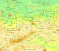
Naturregion Sächsisch-Niederlausitzer Heideland.jpg 1,838 × 1,340; 1.18 MB
-
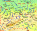
Naturregion Sächsisches Bergland und Mittelgebirge.jpg 1,838 × 1,340; 1.19 MB
-
Naturregion Sächsisches Lössgefilde.jpg 1,838 × 1,340; 1.22 MB
-
Riesa und Umgebung.jpg 5,717 × 5,036; 12.92 MB
-
Sachsen Kreise Namen.png 2,254 × 1,644; 6.82 MB
-
Sachsen topo 2.PNG 742 × 599; 605 KB
-
Sachsen topo.png 2,598 × 2,098; 7.67 MB
-
Sachsen.gif 1,249 × 1,068; 657 KB
-
Sachsen2.gif 1,249 × 1,068; 657 KB
-
Sachsen3.png 1,249 × 1,068; 594 KB
-
Sax0tx2.gif 1,249 × 1,068; 414 KB
-
Saxony in Germany (relief) (shade) (special marker).svg 1,073 × 1,272; 6.55 MB
-
Saxony in Germany (relief) (shade).svg 1,073 × 1,272; 6.52 MB
-
Saxony in Germany (relief).svg 1,073 × 1,272; 6.53 MB
-
Saxony relief location map.jpg 1,838 × 1,340; 901 KB
-
Section Zwickau.jpg 6,801 × 5,931; 12.69 MB
-
Topo.Erzgebirge.jpg 2,621 × 1,716; 575 KB
-
Topo.Osterzgebirge.jpg 2,621 × 1,716; 577 KB
-
Topo.SaechsSchweiz.jpg 2,621 × 1,716; 577 KB
-
Topo.Westerzgebirge.jpg 2,621 × 1,716; 576 KB
-
Topographische Karte 1868 Section 2 Leipzig.jpg 8,668 × 7,433; 20.99 MB
-
Topographische Karte der Umgegend von Leipzig (1863).jpg 10,508 × 12,397; 26.9 MB
-
Topographische Karte von dem Kreisamte Leipzig.jpg 3,630 × 3,307; 4.56 MB
-
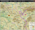
Vierländerregion Bayern - Thüringen - Sachsen - Böhmen DE.png 1,033 × 908; 1.62 MB
-
Der Brockhaus Atlas - die Welt Bild und Karte 1937 (136214209).jpg 6,016 × 3,922; 29.1 MB
-
Minerva atlas 1926 (142708872).jpg 5,324 × 8,304; 61.44 MB
-
Minerva atlas 1926 (142708873).jpg 5,164 × 8,286; 58.64 MB
-
Minerva atlas 1926 (142708874).jpg 10,376 × 8,303; 117.58 MB


