Category:Topographic maps of Japan
Jump to navigation
Jump to search
Subcategories
This category has the following 4 subcategories, out of 4 total.
S
T
Media in category "Topographic maps of Japan"
The following 113 files are in this category, out of 113 total.
-
Amami archaeology-en.png 1,500 × 1,540; 418 KB
-
Amami Islands-de.png 1,500 × 1,540; 391 KB
-
Amami Islands-de2.png 1,500 × 1,540; 392 KB
-
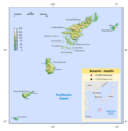
Amami Islands-en.png 1,500 × 1,540; 392 KB
-
Amami Islands-ja.png 1,500 × 1,540; 376 KB
-
Ariake sea coastline.png 180 × 200; 22 KB
-
Awashima (Niigata prefecture) map.jpg 374 × 300; 41 KB
-
Battle of Yamazaki.png 642 × 463; 274 KB
-
Capital cities Japan-fr.png 2,380 × 1,686; 2.24 MB
-
Capital cities Japan.png 2,380 × 1,686; 2.34 MB
-
Carte topographique du Japon-fr.jpg 2,580 × 2,341; 1.13 MB
-
Chichijima-retto.png 457 × 559; 651 KB
-
East Seas in East Asia.png 1,104 × 728; 850 KB
-
Empire-of-Japan-Topographic-Map-大日本帝国の地形図-1918.jpg 8,922 × 6,522; 23.47 MB
-
Ertuğrul'un battığı konum.png 774 × 580; 417 KB
-
Hahajima-retto.png 619 × 605; 977 KB
-
Hajikino1map.jpg 239 × 340; 35 KB
-
Hokkaido map small.png 300 × 152; 14 KB
-
Hory.png 2,000 × 1,625; 3.77 MB
-
Iki-no-shima map.jpg 662 × 677; 144 KB
-
Island arc of Japan.jpg 737 × 615; 228 KB
-
Iwo Jima.png 505 × 383; 431 KB
-
Japan - 1st Edition - DPLA - 474da52ab6d9150b4c557f293630a8cd.jpg 12,528 × 15,004; 22.74 MB
-
Japan bluemarble location map with side map of the Ryukyu Islands.jpg 2,497 × 2,256; 1.38 MB
-
Japan location map zoom south-topographic.png 548 × 548; 73 KB
-
Japan location map-topographic.png 1,482 × 1,477; 1.24 MB
-
Japan Map Chikei.gif 700 × 530; 142 KB
-
Japan Map Chikei.png 700 × 530; 121 KB
-
Japan Nansei-Shoto Map Chikei.gif 710 × 485; 58 KB
-
Japan natural location map with side map of the Ryukyu Islands.jpg 2,497 × 2,256; 830 KB
-
Japan relief location map with side map of the Ryukyu Islands.jpg 2,497 × 2,256; 2.25 MB
-
Japan relief location map.jpg 1,482 × 1,477; 1.02 MB
-
Japan Relief Map of Land and Seabed.png 2,117 × 1,745; 7.47 MB
-
Japan satellite view with Kii Peninsula marked.png 1,557 × 1,419; 1.26 MB
-
Japan topo en.jpg 1,400 × 1,498; 559 KB
-
Japan topo.jpg 1,400 × 1,498; 564 KB
-
Japan-Archipelago-Outlined-Islands-Map.png 2,012 × 1,644; 3.2 MB
-
Japan-location-zh.jpg 777 × 544; 120 KB
-
JapanTanakaContours.jpg 500 × 336; 257 KB
-
Japon topo.jpg 1,400 × 1,498; 564 KB
-
JustJapan.png 1,251 × 941; 408 KB
-
Kanto plain.png 931 × 755; 926 KB
-
KANTO-SMALL.png 450 × 573; 448 KB
-
Kantomap-jp.png 585 × 554; 307 KB
-
Keise-shima map.jpg 330 × 169; 24 KB
-
Kinki-en.png 642 × 463; 269 KB
-
Kinki-fa.png 642 × 463; 283 KB
-
Kinki-jp.png 642 × 463; 268 KB
-
Kitaiojima.png 305 × 243; 169 KB
-
Korea Strait.png 681 × 479; 220 KB
-
Korea Tsushima Strait descr.jpg 3,334 × 2,500; 1.54 MB
-
Koreastrasse without labels.png 1,149 × 715; 169 KB
-
Koreastrasse.png 1,149 × 715; 177 KB
-
Koreasundet.png 1,149 × 715; 132 KB
-
Koshikijima-rettō map.jpg 1,122 × 955; 428 KB
-
Kyushu map.png 598 × 672; 101 KB
-
Kyushu-jp.png 631 × 1,120; 385 KB
-
Kyushumap-en.png 631 × 1,120; 389 KB
-
Location AtsumiPeninsulaJp.jpg 647 × 702; 61 KB
-
Location BosoPeninsulaJp.jpg 647 × 702; 62 KB
-
Location ChitaPeninsulaJp.jpg 647 × 702; 61 KB
-
Location ChuoExpwayJp.jpg 647 × 702; 97 KB
-
Location KyotoJapan.jpg 647 × 702; 54 KB
-
Location MeishinExpwayJp.jpg 647 × 702; 61 KB
-
Location MiuraPeninsulaJp.jpg 647 × 702; 61 KB
-
Location NagasakiPeninJp.jpg 647 × 702; 61 KB
-
Location NemuroPeninJp.jpg 647 × 702; 61 KB
-
Location NotsukePeninsulaJp.jpg 647 × 702; 61 KB
-
Location OgaPeninsulaJp.jpg 647 × 702; 61 KB
-
Location SatsumaPeninsulaJp.jpg 647 × 702; 61 KB
-
Location ShiretokoPeninJp.jpg 647 × 702; 61 KB
-
Location TohokuExpwayJp.jpg 647 × 702; 61 KB
-
Location TsugaruPeninsulaJp.jpg 647 × 702; 195 KB
-
Location-of-Awaji-island-ja.png 640 × 480; 96 KB
-
Map of Izu Islands-de.png 1,257 × 1,409; 693 KB
-
MapISO3166-2=JP.jpg 788 × 784; 92 KB
-
MapNankaiTrough.jpg 300 × 240; 35 KB
-
Mapofkanto.png 585 × 554; 306 KB
-
Mikuni Ridge map 01.gif 800 × 526; 282 KB
-
Minamiiojima.png 397 × 291; 254 KB
-
Miyake-jima-map.jpg 824 × 636; 410 KB
-
Mukojima-retto.png 589 × 837; 1.14 MB
-
Ogasawara Islands.jpg 856 × 541; 69 KB
-
Okinawakenchizu.png 1,250 × 773; 916 KB
-
Ryukyu map.jpg 400 × 400; 85 KB
-
Sea of Japan Map en.png 800 × 524; 685 KB
-
Sea of Japan Map-ar.png 1,166 × 764; 477 KB
-
Sea of Japan Map.png 1,170 × 766; 526 KB
-
Sea of Japan-eo.png 868 × 558; 464 KB
-
Sea of Japan-es.png 868 × 558; 463 KB
-
Sea of Japan-fi.png 868 × 558; 457 KB
-
Sea of Japan-it.png 868 × 558; 464 KB
-
Sea of Japan-nds.png 868 × 558; 459 KB
-
Sea of Japan-nl.png 868 × 558; 462 KB
-
Sea of Japan-pl.png 868 × 558; 467 KB
-
Sea of Japan-pt.png 868 × 558; 466 KB
-
Sea of Japan-th.png 868 × 558; 463 KB
-
Sea of Japan-vi.png 868 × 558; 461 KB
-
Sea-of-Japan-Map-Japanese-日本海の地図.png 744 × 908; 681 KB
-
Seikantunnel - Tsugaru street detail.PNG 595 × 417; 74 KB
-
Senkaku Diaoyu Tiaoyu Islands-zh.png 900 × 900; 366 KB
-
Situation of Ishima.png 1,792 × 1,244; 294 KB
-
South Korea and 4 neighbours.png 1,423 × 1,143; 2.33 MB
-
Southwest Japan Physiographic Diagram - DPLA - f727427f214cc1972a67463371ed899c.jpg 13,274 × 11,172; 14.88 MB
-
Topographic Map of Japan.png 1,800 × 1,400; 564 KB
-
Topographic map of Mount Fuji and Tokyo-2.jpg 3,000 × 1,500; 431 KB
-
Location of Japanese Alps.png 420 × 401; 157 KB
-
Topographic15deg N20E120.png 900 × 900; 145 KB
-
Topographic30deg N20E120.png 1,800 × 1,800; 865 KB
-
Topographic30deg N30E120.png 1,800 × 1,800; 1.16 MB
-
Ushirotateyama-map 01.png 341 × 738; 546 KB


