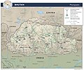
Category:Topographic maps of Bhutan
Jump to navigation
Jump to search
Subcategories
This category has only the following subcategory.
S
Media in category "Topographic maps of Bhutan"
The following 11 files are in this category, out of 11 total.
-
107.35149E 34.75769N.png 1,028 × 726; 1.03 MB
-
2015 map detail, Bhutan Physiography (cropped).jpg 2,500 × 1,440; 699 KB
-
Bhutan Physiography.jpg 2,632 × 2,215; 948 KB
-
Bhutan topo en.jpg 1,200 × 909; 321 KB
-
Bhutan topo.jpg 1,200 × 909; 321 KB
-
Brahmaputra-verlaufsgebiet.jpg 1,280 × 836; 296 KB
-
China edcp relief location map Sichuan.png 1,968 × 1,567; 6.62 MB
-
Manasrivermap.png 1,000 × 1,000; 924 KB
-
Map India and Pakistan 1-250,000 Tile NG 45-4 Phari Dzong.jpg 5,000 × 3,815; 6.06 MB
-
Txu-oclc-10552568-nh46-13.jpg 5,000 × 3,798; 4.31 MB


